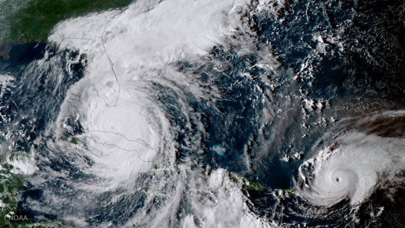
This geocolor image from GOES-16 shows Hurricane Katia (l) Hurricane Irma (m) and Hurricane Jose (r) in the Atlantic Ocean on September 7, 2017.
The most-advanced weather satellite ever developed by the U.S. National Oceanic and Atmospheric Administration has given scientists and the general public an unprecedented birds-eye-view of the major hurricanes hitting the United States in recent weeks.
Launched in November 2016, the GOES-16 is NOAA’s next-generation weather satellite equipped with Advanced Baseline Imager (ABI) instrument that provides four times greater resolution than NOAA’s existing GOES imagers.
Now in its testing phase, GOES-16 will be declared fully operational in November and will be moved to the GOES-East position approximately 22,000 miles above the earth.
But even though the new satellite is still in its test phase, GOES-16 has already been sending back some incredible images, like the one below taken January 15, 2017. The image was actually part of the first set of images taken by the GOES-16 satellite and released by NOAA in January.
This composite color full-disk visible image is from 1:07 p.m. EDT on January 15, 2017 and was created using several of the 16 spectral channels available on the GOES-16 Advanced Baseline Imager (ABI) instrument. Photo: NOAA
In May, when NOAA forecasters began predicting an above-average Atlantic Hurricane Season in 2017, officials made the decision to move the GOES-16 into its east orbit so it could observe the entire continental United States and monitor areas most vulnerable to major weather events like hurricanes, floods, and tornadoes.
The decision paid off when Hurricanes Harvey and Irma, two record-setting storms, set their sights on the United States.
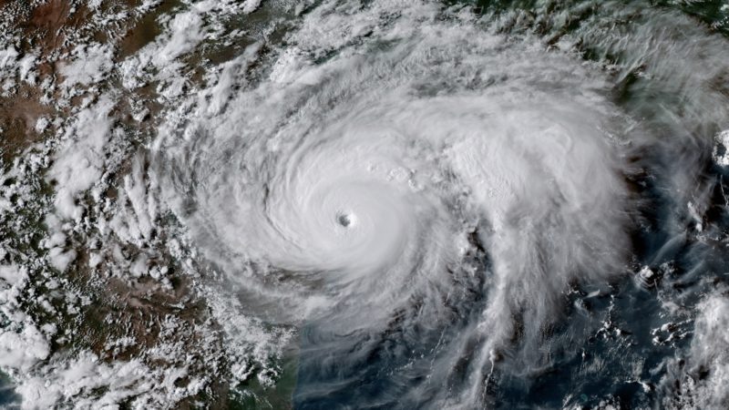
Below is a picture captured by the GOES-16 satellite on August 25, 2017 at 23:00 UTC showing Hurricane Harvey as it reaches peak intensity of Category 4 with maximum sustained winds of 130 mph.
Photo credit: NOAA
Not only are the images impressive, but the 30-second visible images have been equally as stunning. The video below shows the eye of Hurricane Harvey as it approaches the coast of Texas on August 25, 2017.
The next images were captured by GOES 16 as Hurricane Irma strengthened to Category 5 strength over the Atlantic Ocean.
NOAA worked with its partners at the Cooperative Institute for Research in the Atmosphere to experiment with geocolor image enhancements that use geostationary satellite data in different ways depending on whether it is day or night.
During nighttime, liquid water clouds appear in shades of blue, ice clouds are grayish-white, water looks black, and land appears gray. During daytime, land and shallow-water features appear as they do in true-color imagery.
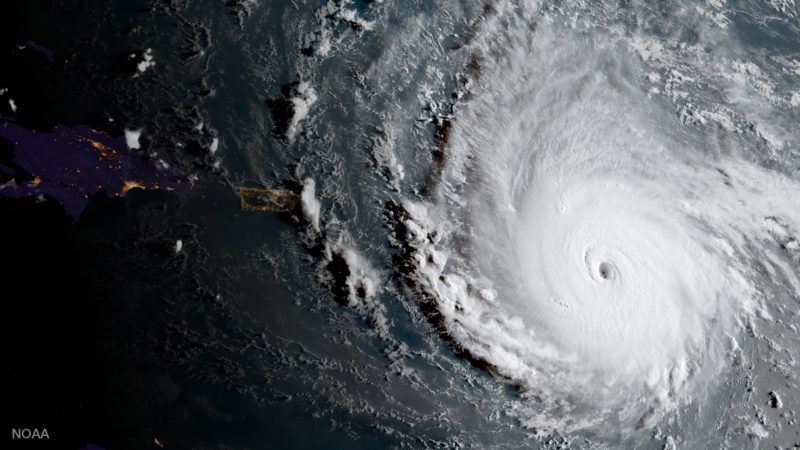
GOES-16 captured this geocolor image of Hurricane Irma the morning of September 5, 2017.
The image below was captured during sunrise over the Caribbean on September 8, with nighttime features on the far left side of the image and daytime in the rest.
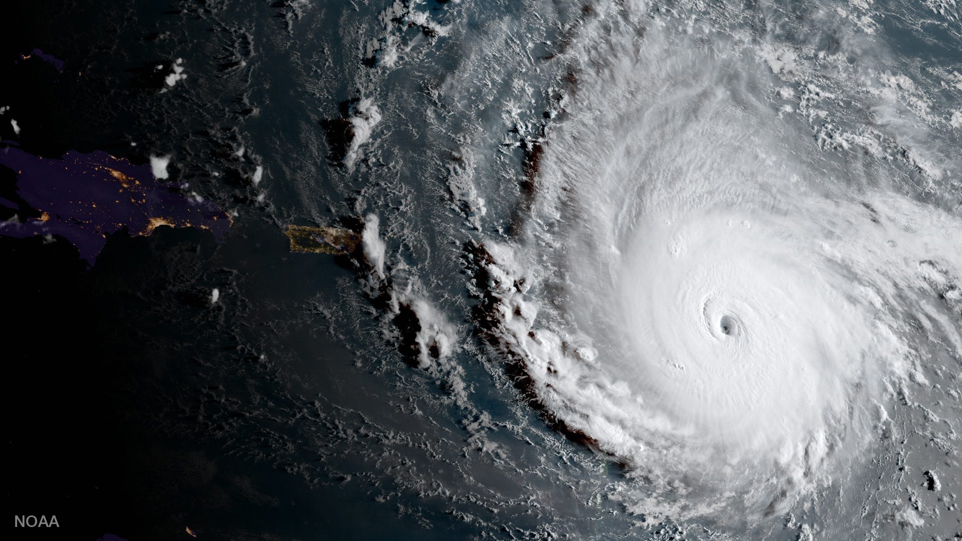
GOES-16 captured this geocolor image of Hurricane Irma passing the eastern end of Cuba at about 8:00 am (eastern) on September 8, 2017.
Below is another example showing daytime (left) and nighttime.
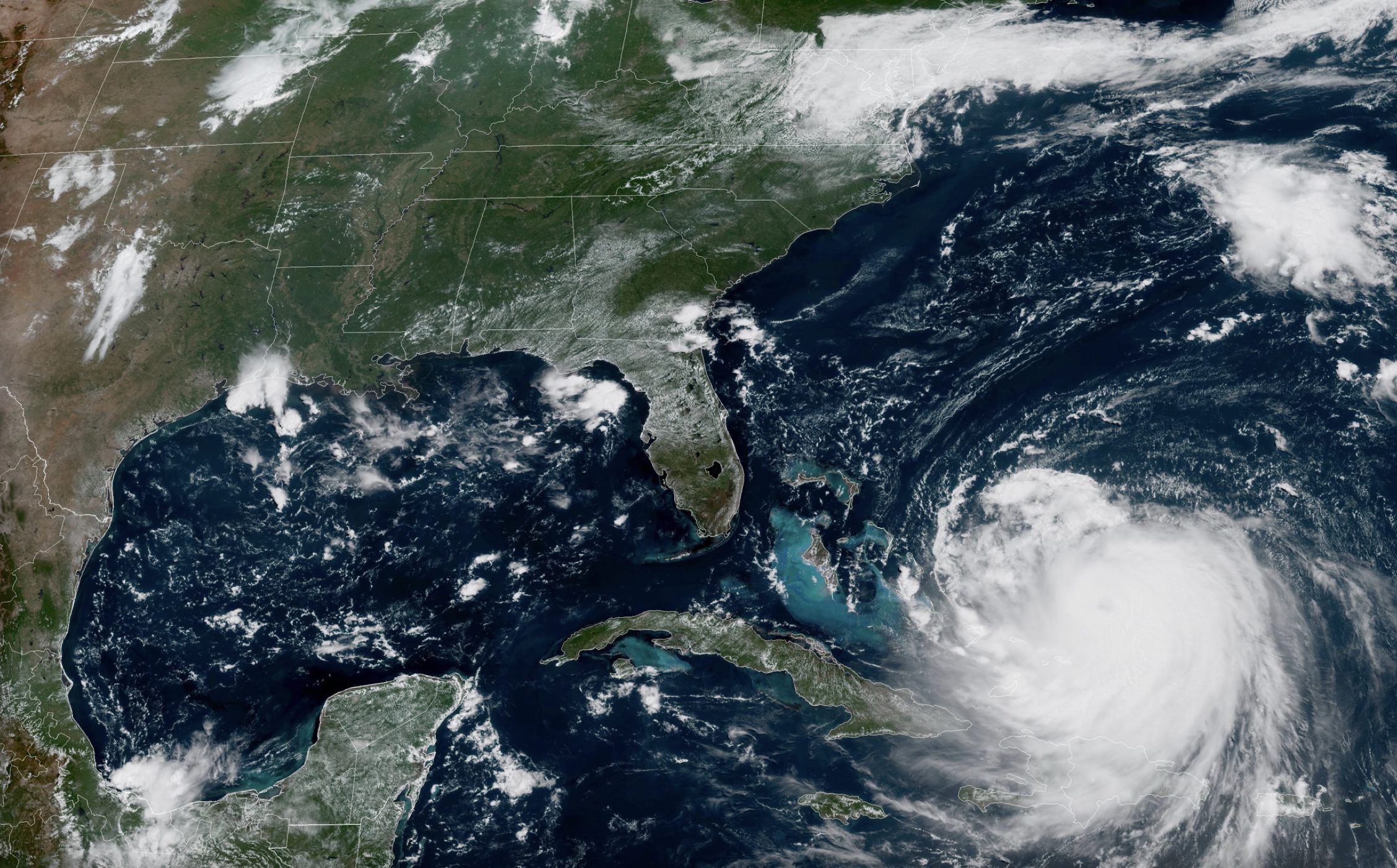
GOES-16 captured this geocolor image of Hurricanes Irma and Jose in the Atlantic Ocean on the evening of September 9, 2017.
GOES-16 is also equipped with a Geostationary Lightning Mapper (or GLM), marking the first time that this sort of instrument has put into geostationary orbit.
Below is the lightning from storms associated with Hurricane Irma over a period of more than 80 hours beginning at noon on September 4, 2017, to 9:30 pm (eastern) on September 9. NOAA noted that hurricanes don’t often exhibit a great deal of lightning, particularly around the eye, due their winds. Irma of course is an exception.
Here’s where things get really interesting.
The 30-second visible imagery from GOES-16 below offers a close-up on Hurricane Irma on September 7, 2017.
One of the more striking differences between the GOES-16 and GOES-13 imagers is represented by the video below:
One more look at the eye, this time a 60-second visible image taken over an approximately 6.5-hour period beginning at about 9:00 am (eastern) to 3:30 pm today, September 5, 2017.
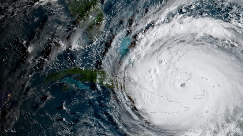
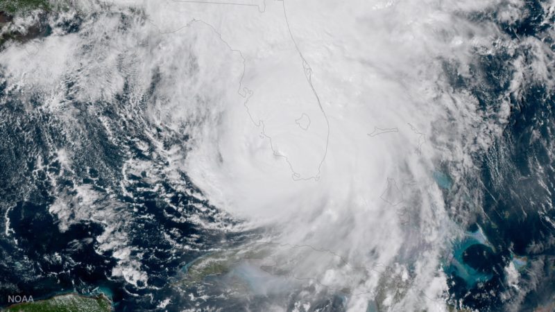
GOES-16 captured the geocolor image below of Hurricane Irma making a second landfall near Marco Island, Florida, on the afternoon of September 10, 2017. After making landfall at Cudjoe Key at 9:10 am EDT, Irma made a second landfall on Marco Island at 3:35 p.m.
Photo: NOAA
Not only does GOES-16 capture weather data, but it is also equipped with a Solar Ultraviolet Imager (SUVI). The instrument captured the large solar flare seen below on September 10, 2017:
Now if all these images are considered just tests, we can’t wait to see what NOAA’s GOES-16 satellite has in store for us once it becomes fully operational. But until then, here are some more GOES-16 satellite resources for you to check out.
The United States is ramping up efforts to secure domestic sources of critical minerals with a major new seabed mapping initiative in the Pacific, part of a broader push to...
NOAA Ocean Exploration and Fugro have signed a cooperative research and development agreement (CRADA) focused on advancing uncrewed systems for deep ocean mapping and characterization. The partnership aims to enhance...
Hurricane Erin has once again strengthened into a dangerous Category 4 storm with maximum sustained winds of 140 mph as it moves through the western Atlantic, prompting warnings for maritime...
August 18, 2025
Total Views: 1124
Get The Industry’s Go-To News
Subscribe to gCaptain Daily and stay informed with the latest global maritime and offshore news
— just like 107,147 professionals
Secure Your Spot
on the gCaptain Crew
Stay informed with the latest maritime and offshore news, delivered daily straight to your inbox
— trusted by our 107,147 members
Your Gateway to the Maritime World!
Essential news coupled with the finest maritime content sourced from across the globe.

 Join The Club