In August of 2008 gCaptain forum member New3M made a brilliant suggestion for gCaptain to develop software for the iPhone. We loved the idea but wanted to make sure any software carrying the gCaptain name was of high quality and of use to mariners.
Fast forward to the summer of this year and the crew here at gCaptain decided that the best way to move forward on a high quality application was to make the development of the app a team effort. With this in mind we teamed up with the professional maritime data providers at MIS Development and the programing team at Refresh Media to create gTrax, Vessel Tracking For The iPhone.
What is gTrax?
gTrax harnesses MIS’s network of redundant secure, Automatic Information System (AIS), antennas to gather information directly from commercial ships and boats underway in the harbor. Once processed through MIS’s server the information is pushed out to your iPhone and the location of each ship is plotted on the app’s built in google map.
The vessel’s location is just the start. Each ship is color coded according to it’s speed and oriented by course giving you an accurate “heads-up” view of the marine traffic around you. Clicking on the vessel brings additional information including the ship’s destination, job function, navigational status and more.
Advanced sorting capabilities allow you to sort by the vessel’s name and function. For example, if you want to find the exact location of a ferry, you can select to view only “Passenger” vessels. If you know the name of a specific ferry simply type it in and the map will automatically center on the boat’s current location.
You can sort ships by type including:
- Cargo of Tanker (Large Commercials Ships)
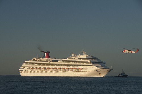
- Passenger (Ferry’s & Cruise Ships)
- Law Enforcement (Coast Guard & Police)
- Oil Spill Response
- Fishing Boats
- Plus 14 other categories.In addition the app tracks Super-yachts, Sailing Ships and Pleasure Boats equipped with AIS-B transmitters.
We are really excited about this application and I personally want to thank the myriad of people who made this possible including Steve Gordon, Moses Calouro, Doug Pine, the MAREX team, our forum members and, of course, Mike Schuler. It would not have been possible without the gCaptain community’s support.
So without any further delay please visit the iTunes store and download gTrax. then be sure to rate it 5 stars to personally thank all who where involved! To help kick-start the app… every forum member that writes a review of the application (good or bad but this week only) on the iTunes store will be sent a FREE gCaptain t-shirt and $5 Starbucks card as our thanks for supporting gCaptain. Just copy and past your review of the app in the comments below and Mike will contact you for your address.
CLICK HERE TO GET STARTED
Related Posts:
This blog is sponsored by:


Great idea guys!

The info is promising and the screenshots look good and I really wanted to buy this app but unfortunately it's no good for me.
Paying for it, then also a subscription fee and then only getting the info for the main ports in the US of A....no sorry.
If it had the whole world covered I would have jumped on the bandwagon, now I'll keep my current AIS-app which is subscription-free and covers a hugh chunk of the world.
Yes the app is simple but that is intentional. But I do promise that if you were to download it the difference between AIS apps would be clear. Also, this is just version 1.0 of our broader plans for accessing maritime information on the iPhone.
Thanks for taking the time to comment Bart and.... Merry Christmas!
The other point is understanding the limitations of the systems you are using. For example many voyage plans are done using Microsoft Excel or shareware programs like Waypoint for Windows. Both have bugs that can cause serious navigational errors so should these programs both stamp "Not For Navigational Use" on them? Should they be banned from use on the bridge altogether?
The advantage of an iPhone app over a bridge system is speed. On the bridge we are all being overwhelmed by technology and communication but, in fact, it's not the information that's overwhelming us, it's the lost time it takes to organize and process this data that's causing the problem.
Also what about non-critical tasks? Say you want to DSC a nearby ship. It's much more efficient to bring gTrax to the GMDSS console than it is to walk over to the AIS... scroll through the MKD of an AIS display.... try to figure out which ship is the right one (this is easier on ships that have ecdis.... but not all do) write down the MMSI number.... walk over to the GMDSS console and retype it. Using this program you can perform this duty in 30 seconds but without it making this dsc call would take 2-5 minutes (assuming you wrote down the correct numbers).
The extra 1.5-4.5 minutes you saved by using gTrax can now be used on a more important task.
Like anything you need to know the limitations of the system and verify the data. I would not trust an excel voyage plan without verifying the results manually just as I would not use gTrax without verifying the data on a class approved ship systems.
Whenever we get new equipment or software on the bridge I always ignore it during my first few watches and test it when there is free time available on someone else's watch (with their permission, of course). Personally I will certainly be testing the app out on the bridge while I'm off duty.
Last it's simple to use. ECDIS and AIS systems approval does not care about user interface design and it was the complexity of the ecdis system contributed to the Cosco Busan hitting a bridge. Even earlier in the error chain of that incident the complexity led to the pilot's reluctance to learn the system. Now what if the pilot (or an 17 year old cadet!) had gTrax on his iphone (say to monitor his next job from the car)? Within 30 seconds of launching the app it would have been clear he was not lined up on the proper heading.
So while I still agree fully, it would be foolish to use this for navigational purposes, I do not think it should be banned from use on the bridge because, like anything, it has it's uses and limitations and it is up to the watchkeeper to understand these and only use the program for non-critical tasks.... then verify his findings.
Circling around to my initial point... gCaptain was built on trusting our forum members. I don't think we need to provide a big pop-up box saying "The ideas presented in the forum are not verified and should not be used in the navigation of a vessel" just like I'm not going to build a big pop-up in gTrax saying "This app has not been verified by class and, therefore, should not be used for navigational purposes". The members of gCaptain are smart enough to know when a forum poster is giving dangerous advice and they are also smart enough to know not to ignore their class approved ECDIS.
investigators found that bar pilot John Cota was intoxicated from his use of prescription pharmaceuticals while piloting the ship, which rendered him unable to use the onboard radar and electronic maps correctly, and that the Coast Guard's Vessel Traffic Service did not warn Cota that he was sailing into the bridge. I don't think an i-phone would have helped him much. You stated that you do not condone or advise it's use in navigation but just gave an example of how to use it in a navigational setting. I can see some problems if an incident occurs and an i-phone is involved, in regards to the investigation. I wish you the best of luck in the sales of your product, John, but please do not advocate it's use in the wheelhouse where only CFR designated equipment is to be used by law. I really am not trying to be a downer here, it's just that as U.S. licensed merchant mariner's, we have an obligation to hold to the standards of the given laws and regulations that govern us and our conduct on the bridge. We have to be very careful in this environment of CYA!
I don't want to make this a long drawn out disscussion. I won't say anymore about it. Good luck with the app. Merry Christmas, John
Don't ban me for disagreeing with you!
investigators found that bar pilot John Cota was intoxicated from his use of prescription pharmaceuticals while piloting the ship, which rendered him unable to use the onboard radar and electronic maps correctly, and that the Coast Guard's Vessel Traffic Service did not warn Cota that he was sailing into the bridge. I don't think an i-phone would have helped him much. You stated that you do not condone or advise it's use in navigation but just gave an example of how to use it in a navigational setting. I can see some problems if an incident occurs and an i-phone is involved, in regards to the investigation. I wish you the best of luck in the sales of your product, John, but please do not advocate it's use in the wheelhouse where only CFR designated equipment is to be used by law. I really am not trying to be a downer here, it's just that as U.S. licensed merchant mariner's, we have an obligation to hold to the standards of the given laws and regulations that govern us and our conduct on the bridge. We have to be very careful in this environment of CYA! Maybe some day you can get it approved for navigation purposes......
I don't want to make this a long drawn out discussion. I won't say anymore about it. Good luck with the app. Merry Christmas, John
Don't ban me for disagreeing with you!
Being old school (as opposed to "old salt"), I wonder if the instruction manual is available for review separately, or does it only come with the app?
Merry Christmas to you to John, and to all other reading this.
I'll deffo keep an eye out for when the services are indeed going global. The app I use now uses hobbiest AIS-feeds, there is nothing wrong with that but they can be a bit unreliable.
To get to your point of using the app on the bridge: I don't think I would ever do that. and for the following reasons:
A) The ships I sail on nowadays got an ECDIS with an integrated AIS-function, so a big screen with all the rcvd AIS-info in real time and on scale around you. Nothing can beat that.
B) And then there is the dedicated AIS-equipment: some is just rubbish to use, some is easy to use but it is there and ready for it.
C) The bad example: seeing the Chief or the Old man navigating while holding and monitoring his phone might give a wrong impression to the younger mates o/b. There already is enough distractions going on to keep them from proper navigating.
Nevertheless: I can see the advantage for yachties and other users on the water (canoe, sailing boat, everything without electricity).
I use my app quit a bit when I'm not on the ship to see where my colleagues on other ships are.
So when the app has a good global coverage I'll be the first in line to start using it. And I'm looking forward to that time.
"can't wait to use at sea". by super cadet
you should add a calculator for all the sailings in a massive update
Just joking... actually I enjoy it most when people disagree with me. It helps keep me on track... something I am in real need of sometimes.
stby
I'll deffo keep an eye out for when the services are indeed going global. The app I use now uses hobbiest AIS-feeds, there is nothing wrong with that but they can be a bit unreliable..........
Global coverage will be slowly pushed out starting in the coming months. Any ports high on your wish list?
you should add a calculator for all the sailings in a massive update
Just joking... actually I enjoy it most when people disagree with me. It helps keep me on track... something I am in real need of sometimes.
So, since it was my "brilliant suggestion," does that mean that I get it for free???
Global coverage will be slowly pushed out starting in the coming months. Any ports high on your wish list?
While not really wanting to wade into this I am curious as to just which law it is that you believe only allows CFR designated equipment in the wheelhouse. I find that claim a bit of a stretch.
Regardless of what you all think about the usefulness of this app for professionals, I hope every weekend warrior with a boat and an iPhone in Puget Sound downloads this thing and learns how to use it. Maybe gTrax should come with a free copy of the COLREGS app for every person who downloads it! (http://doubledogstudios.com/apps/navrules/index.html).
Here is my review of gTrax...where is my T-shirt and coffee card?
"A quality app at a Reasonable Price"
Those of us who follow gCaptain have been waiting for this app for a long time, and I have to say that it was worth the wait. This app is easy to use, even for persons not familiar with the AIS system. If you have a view of the harbor from your home (lucky you), this app will tell you the name and nationality of that ship at the dock. Or maybe you walk the dog along the waterfront and you were wondering where that ship at anchor is from? If you ride the ferry or sail on a cruise ship, this app will tell you were your ship is, real time. Professional mariners will appreciate the functionality. If you work on boats, your friends and family can now see where your vessel is from the iPhone. Pleasure boaters might finally realize that ship in the traffic lanes is making 25 kts and headed right towards them!
-captfish
Global coverage will be slowly pushed out starting in the coming months. Any ports high on your wish list?
Basically the whole world then
AIS- Best tool we ever gave pirates!! They know where we are, where were headed, when we will be there....20th century before AIS pirate attacks-few, after AIS whoohoo PIRATE city. GO FIGURE??
is available in the ipod touch??
Both Class A and Class B AIS devices must be certified by both the Federal Communications Commission (FCC) and the Coast Guard before being marketed or sold in the U.S. FCC rules require that certification first be obtained from the Coast Guard. The FCC Laboratory will coordinate review of applications for certification of AIS equipment with the United States Coast Guard to ensure that the equipment meets all applicable international standards and requirements.
While I have worked as a pilot with a laptop (using the neat little pilot plug that is required for vessels over 1600t), it was equipment that met technical requirements for shipboard use by the US. Coast Guard (for the FCC), as spelled out in part in the CFR's stated above and links below. Maybe gTrax can get approval, or maybe the software that it is working with is already approved. It would be worth checking into.
Any equipment that is placed in the wheelhouse, has to be Coast Guard approved. It may be a last resort to bring you own equipment with you. But regardless of how great it works, if it is not approved, it may cause problems in court. I don't agree with it, necessarily, but it is one of the "legal" problems in our profession. Regulations, regulations, regulations...
Coast Guard Certification Requirements
Certification requirements for Class A AIS are described in 47 CFR 80.275, 47 CFR 80.1101(c)12 and in the Coast Guard's Navigational and Vessel Inspection Circular (NVIC) 8-01, as amended by Change 01, Approval of Navigation Equipment for Ships. NVIC 8-01 describes the certification process for AIS and other navigation equipment described under SOLAS V. Note that applications should be submitted to Commandant (CG521), the new routing code replacing G-MSE and G-PSE.
Certification requirements for Class B AIS equipment are described in 47 CFR 80.231(c) as well as 47 CFR 1101(c)12.
I realize (NVIC's are not the law), but cfr's are.
Ok I get it now, I did not realize you were referring specifically to AIS equipment. Gotcha.
Yea, but only if your iTouch is on wifi....not so good entering port!