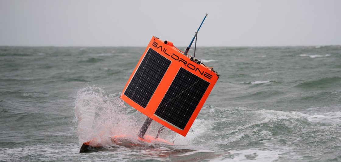
Photo courtesy NOAA
An unmanned “saildrone” has completed a 13,670-nautical-mile journey around Antarctica after successfully collecting oceanic and atmospheric carbon dioxide measurements to benefit climate change science.
The U.S. National Oceanic and Atmospheric Administration (NOAA) reports that the drone, named Saildrone 1020, completed its mission on August 3 following the 196-day voyage, marking the world’s first autonomous circumnavigation of Antarctica.
The drone was equipped with a instrument developed by NOAA’s Pacific Marine Environmental Laboratory and designed to collect oceanic and atmospheric carbon dioxide measurements.
“The assumption was the Southern Ocean would eat the saildrone … and that would be that,” said NOAA oceanographer Adrienne Sutton. “But we were willing to try, given the large role the ocean plays in the trajectory of climate change. Getting the Southern Ocean’s carbon balance right is urgently important.”
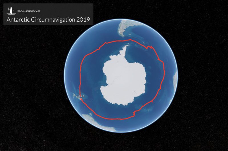
The Saildrone 1020, along with two counterparts, launched from Point Bluff, New Zealand on January 19, 2019, on a mission funded by the Li Ka Shing Foundation. The three drones collected and transmitted a range of data on weather, seal and krill populations, and levels of carbon dioxide, CO2, in the air and water.
The two other saildrones are currently still making their way around Antarctica.
“Until recently, scientists assumed that the Southern Ocean steadily absorbed large volumes of CO2 from the atmosphere — a big contributor to the entire ocean’s uptake of up to 40 percent of the greenhouse gases driving global warming,” NOAA said in a post. “However, scientists also knew shifts in winds and circulation around Antarctica could alter CO2 uptake from the atmosphere, and recent measurements from instrumented Argo floats showed that under certain conditions the Southern Ocean could emit CO2 instead of absorbing it.”
Researchers were yet to sample vast areas, however, especially during stormy autumn and winter seasons.
According to NOAA, preliminary results suggest that parts of the ocean identified by the floats as potential CO2 sources were indeed emitting the greenhouse gas during winter months. Saildrone 1020 also got close enough to one of the floats to allow scientists to compare their CO2 measurements, a valuable cross-check of different robots and observing techniques, NOAA said.
“On four previous voyages in the Southern Ocean, the wings on our saildrones broke after just a few days, so we went back and built something we thought was indestructible,” said Saildrone founder and CEO Richard Jenkins. “It was a long shot, but it worked out exactly as we hoped.”
“It was a high-risk, high reward kind of deployment,” Sutton said. “We weren’t sure it was going to make it.
Editorial Standards · Corrections · About gCaptain

 Join The Club