New ADMIRALTY EasyTide website to provide seamless access to UK tidal prediction services
PRess Release – The UK Hydrographic Office (UKHO) has successfully launched its new ADMIRALTY EasyTide platform following extensive research on enhancing its tidal product portfolio.
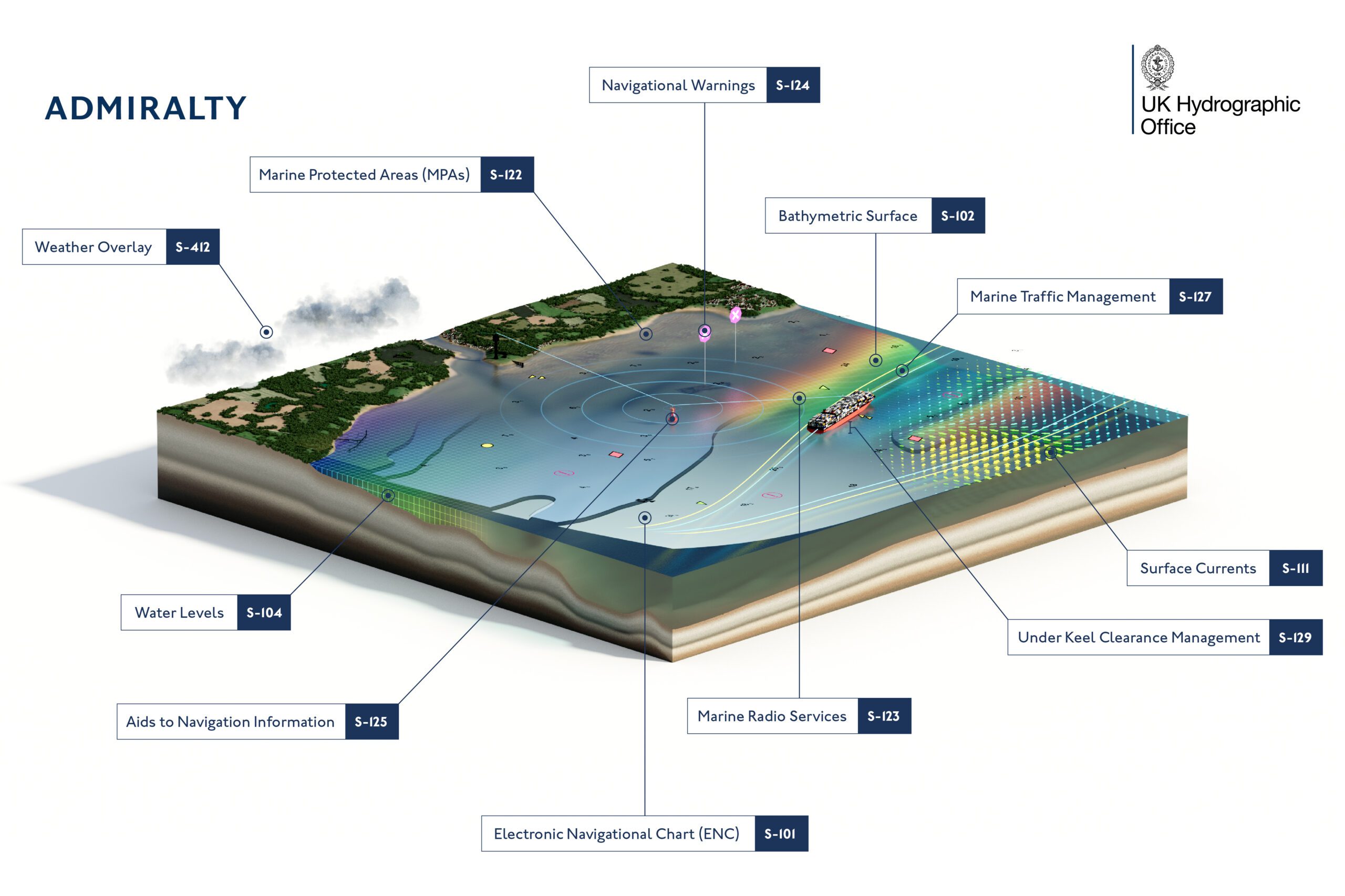
The new ADMIRALTY EasyTide service provides free access to 7-days’ tidal predictions for over 600 UK port locations, displayed as a tide table and tidal curve. The newly launched website has been redesigned to improve usability and built to ensure responsiveness across desktop, mobile and tablet devices whilst users have access to UKHO’s considerable UK tidal database.
The announcement follows the news in April 2021 that EasyTide would become a free-to-use service for the current day plus subsequent six days’ tidal predictions for UK port locations from September 2021.
The design and usability improvements of the new website will support leisure users and enable safer activities at sea, such as watersports, beach going, coastal walking and sailing.
As part of the new transition, Enhanced Predictions will no longer be available. Instead, UKHO is encouraging customers to explore their wider tidal product portfolio, including its ADMIRALTY Tidal Prediction Service, UK Tidal APIs, ADMIRALTY TotalTide and stock of Leisure Charts.
To learn more about ADMIRALTY EasyTide, please visit the new website: https://easytide.admiralty.co.uk
About the UK Hydrographic Office (UKHO)
The UK Hydrographic Office is a leading centre for hydrography, providing marine geospatial data to inform maritime decisions. We work with a wide range of data suppliers and partners to support maritime navigation, safety, security and marine development around the UK and worldwide.
We make location-based information available through ADMIRALTY Maritime Data Solutions, our world-leading range of charts, publications and custom data sets. Our use of marine data and technology, combined with our expertise, ensures we continue to innovate and provide a wider range of solutions.
We source, process and provide access to location-based information, ranging from seabed to surface. This enables our partner organisations to make critical maritime decisions – informing the sustainable use and management of the marine environment and supporting the development of the blue economy.
Editorial Standards · Corrections · About gCaptain

 Join The Club