(Ocean Weather Service) – Each year there are, on average, about 6 hurricanes in the North Atlantic, 8 in the Eastern North Pacific and 17 Typhoons in the western North Pacific. Few people (outside of Mariners) realize that there is another season of hurricane winds that occurs over both the North Atlantic and the North Pacific Ocean and runs from September to May. These storms do not track through the tropics, but instead are associated with the extratropical cyclones of the mid-latitudes.
Extratropical Storms
An extratropical cyclone, also called a mid-latitude cyclone, is a storm system that gets its energy from horizontal temperature gradients and is most often associated with frontal zones. Tropical cyclones, in contrast, are generated by the energy released as clouds and rain form in warm, moist, tropical air masses. Extratropical cyclones occur throughout the year and can vary widely in size from under 100 NM to over 2,500 NM. On average, extra-tropical cyclones last about 5 days, however, hurricane-force wind events when associated with these systems typically last 24hr or less.
Hurricane Force Storms
It had been long known that extratropical cyclones can sometimes produce hurricane force winds but not until the deployment of modern satellite technology did meteorologists discover that hurricane wind events were much more frequent than previously thought. The risk for a winter hurricane wind event begins to increase in September and October, peaks in December and January, then tapers off sharply in April and May, although quite infrequently we have observed them in each month of the year in the North Atlantic.
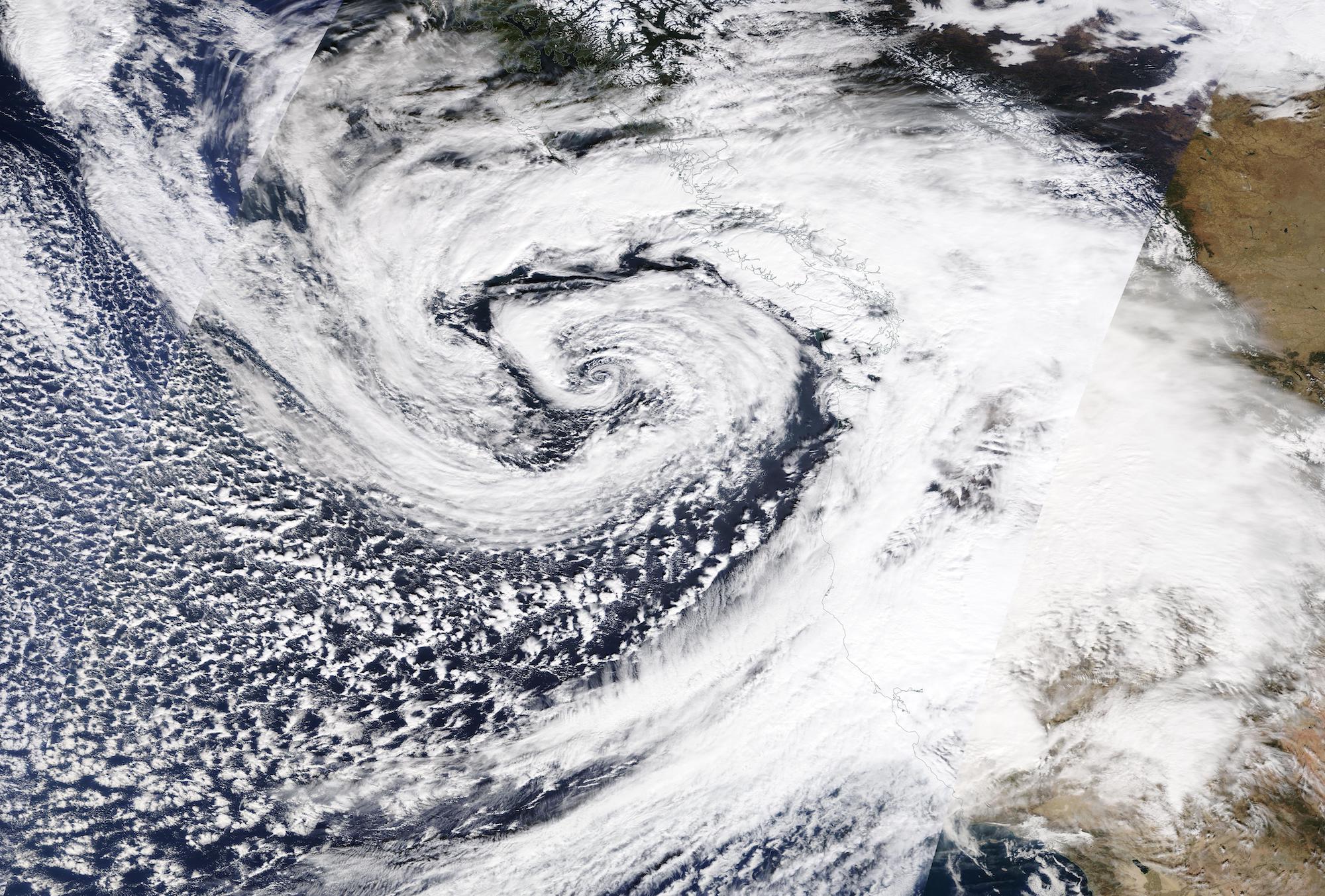
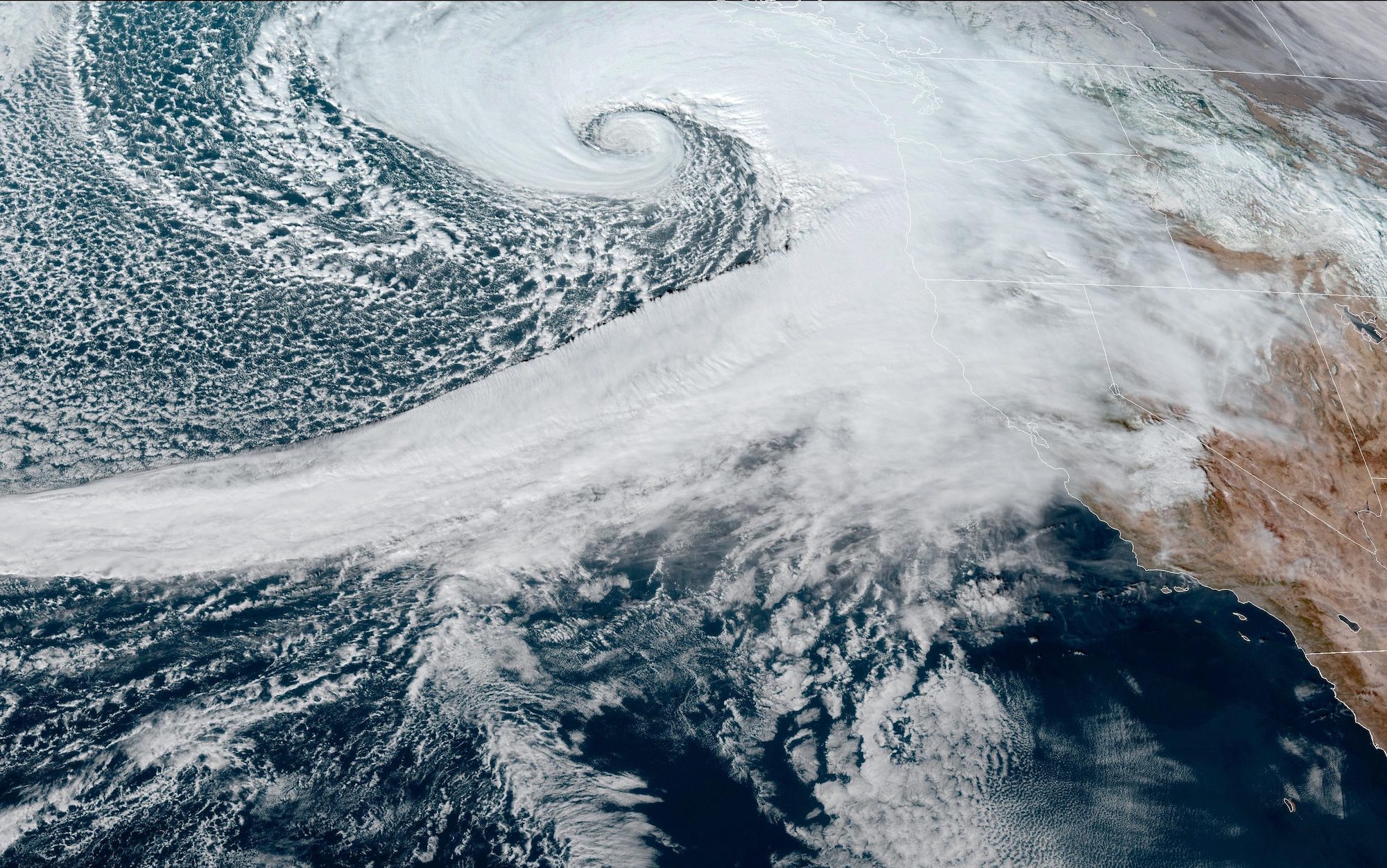
A hurricane-force extratropical cyclone in January 2016 with a distinct eye-like feature, caused by a warm seclusion. Image credit NOAA
Each winter season has, on average, about 37 non-tropical hurricane force wind events occur over the North Pacific and about 45 events over the North Atlantic. NOAA Ocean Prediction Center issues a “Hurricane Force Wind Warning”(1) when sustained winds, or frequent gusts, of 64 knots (74 mph) or greater, either predicted or occurring, and not directly associated with a tropical cyclone.”
Hurricane force wind events occur mainly during the warm seclusion or mature stage of the extratropical cyclone lifecycle as described by Shapiro & Keyser in a paper in 1990(2). During this stage there can be an eye-like feature of relatively calm wind and clear skies.
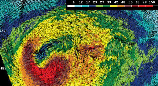
During the mature stage of the extratropical cyclone lifecycle, many of these cyclones deepen very rapidly with a core of hurricane force winds developing along the cold side of the bent-back portion of the warm front. Generally, these conditions are short lived, on average, lasting less than 24 hours in duration.
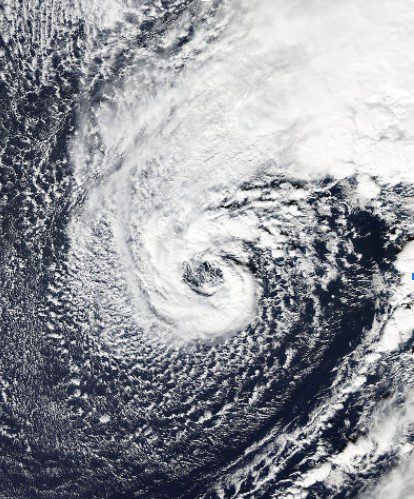
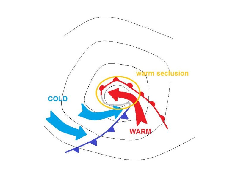
Schematic of the surface fronts involved in a Shapiro-Keyser cyclone in the Mature stage (courtesy European Organization for the Exploitation of Meteorological Satellites (EUMETSAT)
QuikSCAT image of a mature North Atlantic extratropical cyclone from December 1, 2004. The color bar in the upper right indicates wind speed in knots. The storm’s hurricane-force winds, located to the south of the center of the low pressure system, are depicted as red wind barbs. Image courtesy of NOAA OPC.
Impact
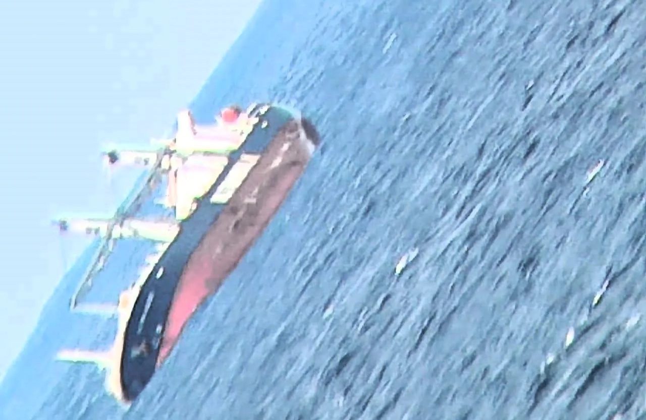
When these hurricane force storms occur along shipping routes they pose a significant threat to life and property due to high winds and waves. The 1991 Halloween Storm of “Perfect Storm” fame produced hurricane force winds with verified waves to 100 feet! (8).In 1998 the containership APL China lost 388 containers with another 400 damaged when it encountered hurricane force winds and a 70 ft wave in the North Pacific from an extra-tropical cyclone that was infused with energy from what was once “Typhoon Babs”. When these intense storms make landfall they also can cause widespread damage along the coast from high winds and flooding, not to mention heavy snowfalls.
Fred Pickhardt is a marine meteorologist and founder of Ocean Weather Service, providing optimum ship routing services and forensic marine weather reports to the maritime industry.
Shapiro, M. A., and D. Keyser, 1990: Fronts, jet streams and the tropopause. Extratropical Cyclones, The Erik Palmén Memorial Volume, C. W. Newton and E. O. Holopainen, Eds., Amer. Meteor. Soc., 167-191.
A look at hurricane force extratropical cyclones. Joseph M. Sienkiewicz, NOAA/NWS/NCEP Ocean Prediction Center: Cyclone Workshop, Sainte-Adele, Quebec, Canada Sep 21-26, 2008 ttps://slideplayer.com/slide/12860098/
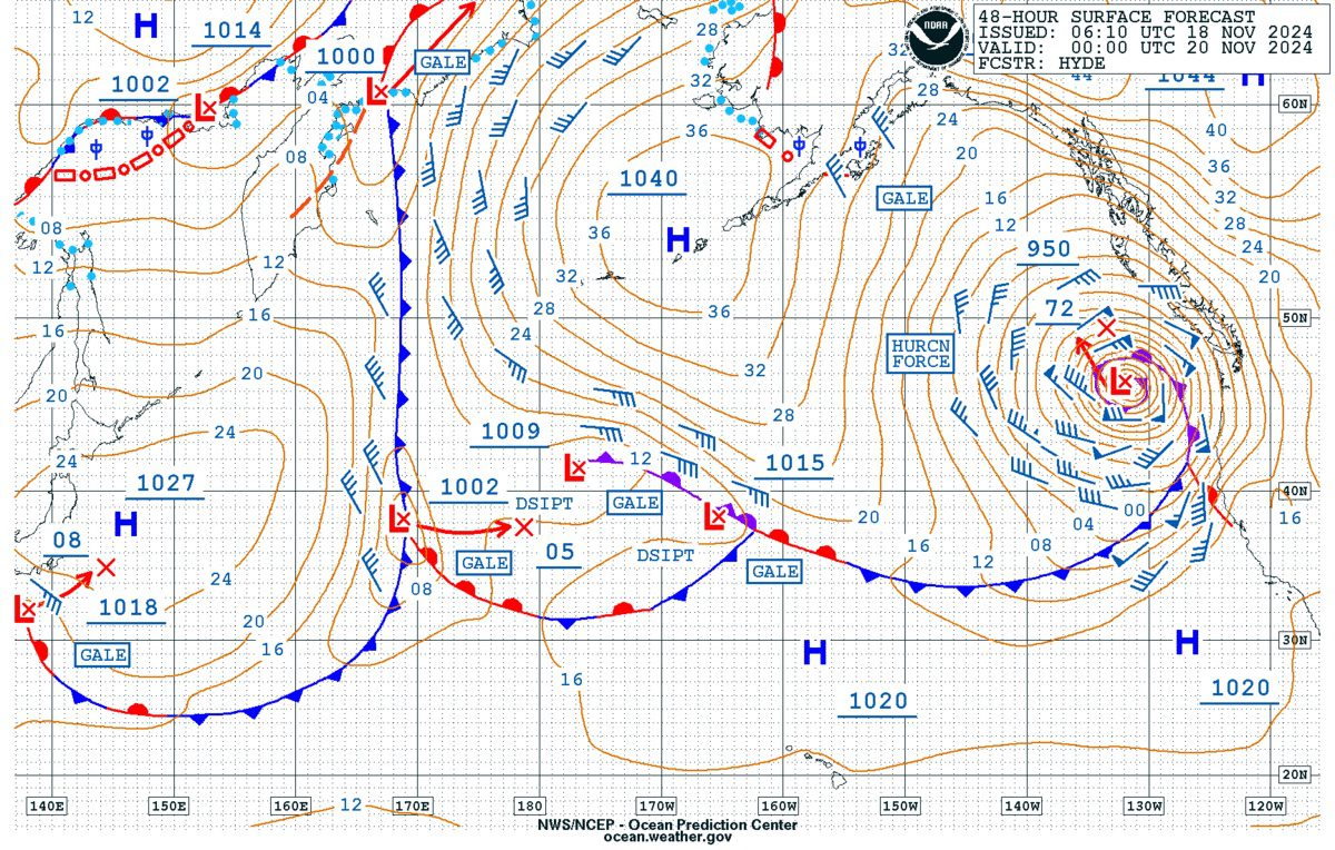
A rapidly intensifying weather system, known as a “bomb cyclone,” has developed off the U.S. West Coast, creating perilous conditions for mariners and coastal communities in the Pacific Northwest. The...
A powerful weather system is set to explode off the U.S. West Coast, bringing with it hurricane-force winds and massive wave heights. The rapidly intensifying low-pressure system is expected to...
(Bloomberg) — Storms pounded South Africa’s coastline for a fourth day on Wednesday, disrupting shipping operations, with massive swells forcing the evacuation of a cargo ship. State-owned port operator...
July 10, 2024
Total Views: 3926
Get The Industry’s Go-To News
Subscribe to gCaptain Daily and stay informed with the latest global maritime and offshore news
— just like 105,552 professionals
Secure Your Spot
on the gCaptain Crew
Stay informed with the latest maritime and offshore news, delivered daily straight to your inbox
— trusted by our 105,552 members
Your Gateway to the Maritime World!
Essential news coupled with the finest maritime content sourced from across the globe.

 Join The Club