Image Credit: National Centers for Environmental Information (NCEI)
Scientists with the National Centers for Environmental Information (NCEI) have made an early update to World Magnetic Model (WMM), which helps navigation systems used by ships, planes, and submarines in the Arctic region.
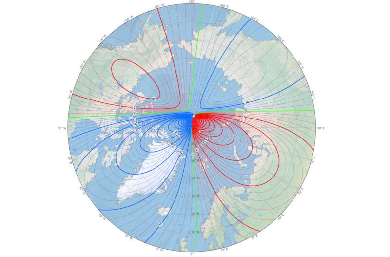
Scientists say the unplanned update of the WMM comes as the Earth’s northern magnetic pole unpredictably moves quickly away from the Canadian Arctic towards Siberia.
Typically, a new and updated version of the WMM is released every five years, with the next scheduled release planned for the end of 2019. However, due to what has been described as “erratic changes” in the north polar region, scientists on Tuesday released a mid-cycle update to more accurately represent the change of the magnetic field between last update in 2015 and now.
The WMM is run by the British Geological Survey together with NCEI, which is part of the U.S. National Ocean and Atmospheric Administration.
“This out-of-cycle update before next year’s official release of WMM2020 will ensure safe navigation for military applications, commercial airlines, search and rescue operations, and others operating around the North Pole,” NCEI said in a release.
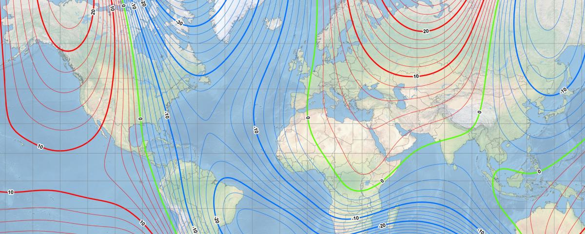
This map shows the location of the north magnetic pole (white star) and the magnetic declination (contour interval 2 degrees) at the beginning of 2019. Courtesy of NOAA NCEI/CIRES
In addition to commercial uses, the military also heavily relies on the WMM for accurate undersea and aircraft navigation, parachute deployment, and more. Other governmental organizations, such as NASA, the Federal Aviation Administration, and U.S. Forest Service, also use the technology for surveying and mapping, satellite/antenna tracking, and air traffic management.
Smartphone and consumer electronics companies also rely on the module to provide consumers with accurate compass apps, maps, and GPS services, although impacts are most noticeable in the Arctic.
“Compasses use declination (the difference between true north and where your compass points) to help correct navigation systems for a wide variety of uses,” NCEI explains. “As Earth’s magnetic field evolves between the 5-year release schedule of the WMM, these predicted values can become off as the rate of change in Earth’s magnetic field evolves due to unpredictable flows in Earth’s core. The north polar region is experiencing one of these erratic changes.”
By Jonathan Saul LONDON, June 21 (Reuters) – Plans to map the entire ocean floor by 2030 are going ahead despite the challenges of the coronavirus crisis, officials leading the...
By Andrew R.C. Marshall OXFORD, England, Dec 11 (Reuters) – On November 14, 1881, an American called George Melville limped across a frozen delta in Siberia and pulled a pole...
German research icebreaker Polarstern is now parked Arctic Ocean ice floe where researchers will set up camp for a one-year-long drift around the North Pole in the name of climate...
October 8, 2019
Total Views: 57
Get The Industry’s Go-To News
Subscribe to gCaptain Daily and stay informed with the latest global maritime and offshore news
— just like 104,535 professionals
Secure Your Spot
on the gCaptain Crew
Stay informed with the latest maritime and offshore news, delivered daily straight to your inbox
— trusted by our 104,535 members
Your Gateway to the Maritime World!
Essential news coupled with the finest maritime content sourced from across the globe.

 Join The Club