Like everyone else, I was blown away to hear about the 8.9 magnitude earthquake that struck Japan, spawning a massive and deadly tsunami. I was even more blown away to hear that the U.S. west coast was going to be effected by it, forcing authorities to issue a Tsunami Warning, closing schools and causing evacuations up and down the west coast.
Being in San Francisco, I grabbed my camera and went to Lands End to see what was going on. I arrived 09:00 PST, approximately 50 minutes after the initial waves hit. The police had Point Lobos Ave. blocked off from the intersection of 48th going south. From the parking lot of the Lands End Trail looking west it was hard to see what exactly was going on, but you could tell the water was extremely turbulent.
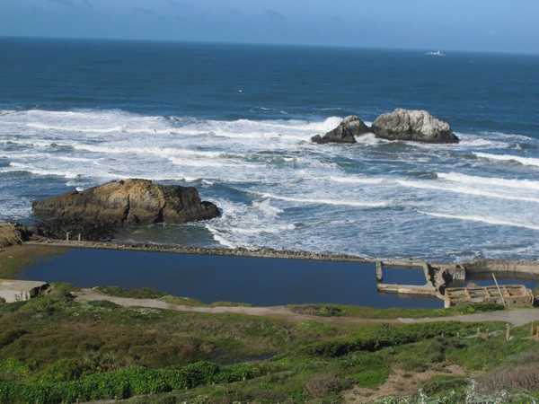
Police however weren’t restricting anyone from walking down the trails to the Sutro Baths. In the photo below, you can see a pedestrian at the top left corner of the bath. Having seen video from this morning’s tsunami in Japan, I wasn’t about to venture down there.

My vantage point for these next shots was directly under the Cliff House, looking south down Great Highway. I arrived just as what appeared to be the second strongest set of waves hitting the beach at approximately 09:30. You can see the line in the sand from what was presumably the first set at 08:08 PST, according to reports.
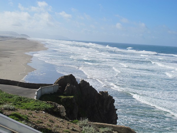
The water level remained at this height for a good couple of minutes. Having arrived at the peak of a set it was difficult to tell what was happening, although you knew something different was going on. It wasn’t until the water began to recede that you could really grasp the situation.
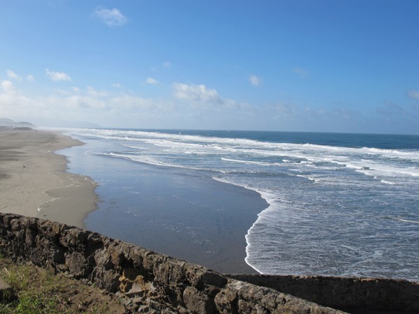
Low tide was at 9:51 am, right around when these shots were taken.

At it’s lowest point, the tide was approximately 100 yards from what it was its peak, and the water a lot less choppy.

There were not many people on the beach and relatively few on the cruising path. This person thought it was a good idea to bring their kid down and there was no one stopping them.

Every 10 or 15 minutes, the water would again rise about midway before heading back out.

When the water did rise, the waves were not as to be expected and hard to judge. They came in small but frequent doses of white water about 2-3 feet max in height. They weren’t the clean barrel waves you’d associate with surfing. There were definitely no surfers out there.

Below, is the peak of the third strongest set at approximately 10:15 PST. You can see it was about 30 yards or so from where the first strongest set reached, and just a few yards away from the second, shown in the above pictures.


It truly is remarkable that we can see the physical effects of a natural disaster that happened several thousand miles away, and many hours prior, in Japan. While it was exciting to see (safely) the strength of nature up close and personal, lucky for us here on the west coast it was not too dramatic of a scene.
Our thoughts and prayers go out to those affected by this tragedy.
Word and photos by Mike Schuler © gCaptain.com

 Join The Club


![San Francisco Tsunami – March 11, 2011 [Photos]](https://gcaptain.com/wp-content/uploads/2011/03/IMG_4057.jpg)


