By Sarah Morland
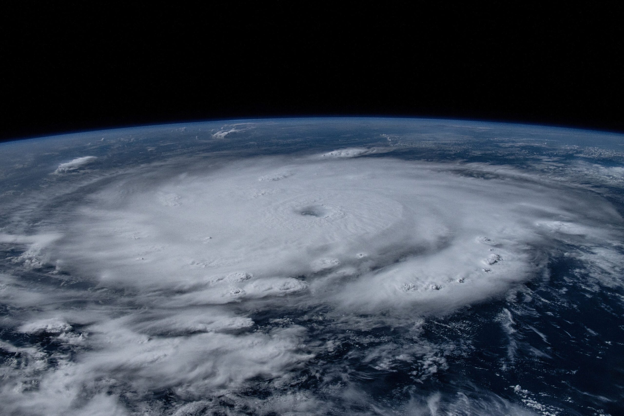
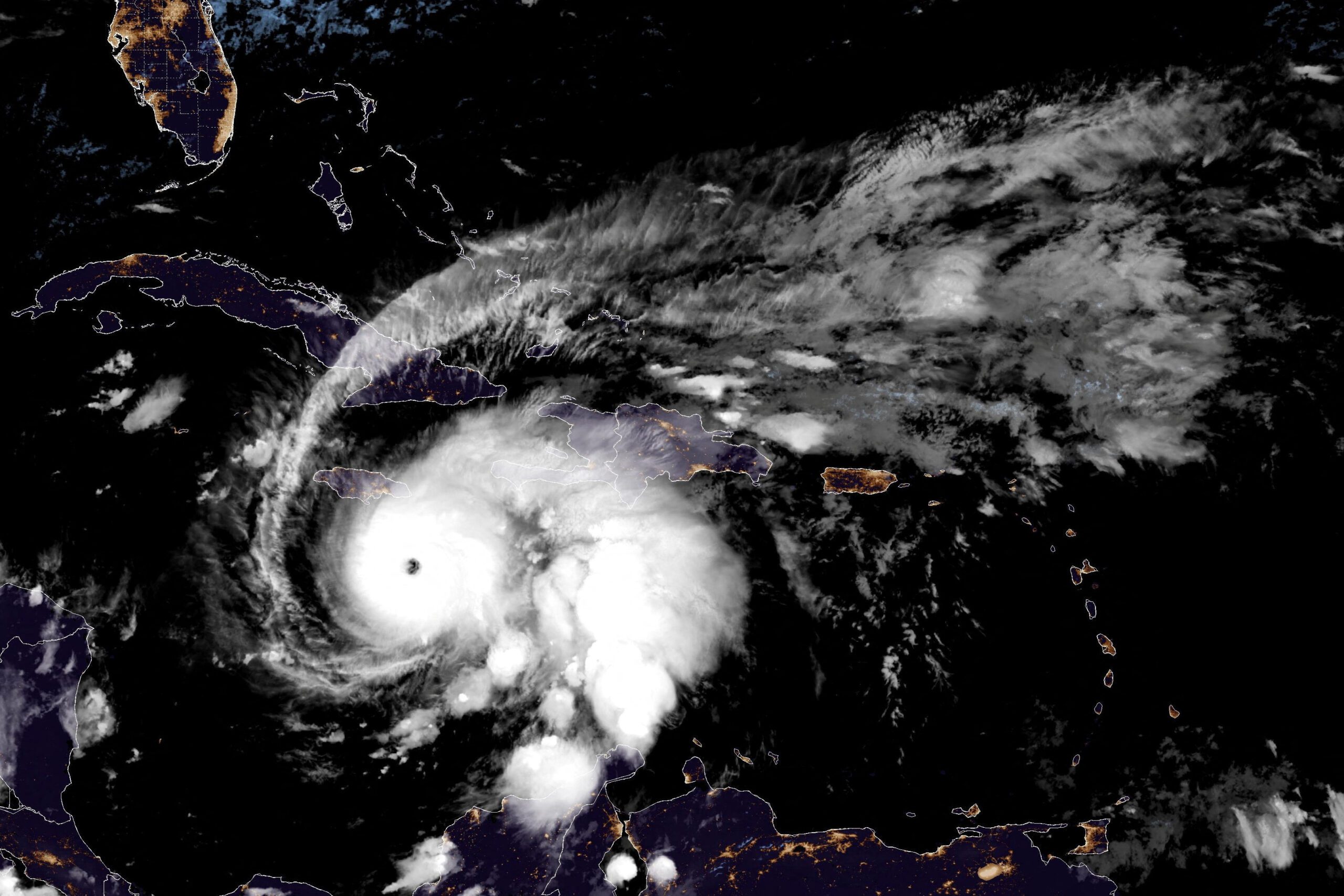
July 3 (Reuters) – Powerful Hurricane Beryl was the 2024 Atlantic season’s first hurricane and the earliest storm on record to reach the strongest possible ranking of Category 5, before weakening to Category 4 as it barrelled towards Jamaica on Wednesday.
Record-breaking sea temperatures that allow tropical storms to get stronger faster, driven by human-caused climate change and cyclical weather patterns, are fueling what scientists say is shaping up to be a very dangerous hurricane season.
WHAT IS CATEGORY 5?
A Category 5 is the strongest hurricane on the Saffir-Simpson Scale, bringing winds of 157 mph (252 kph) or higher, capable of causing catastrophic damage including the destruction of homes and infrastructure.
Since 1960, only 30 Atlantic hurricanes have reached Category 5, with 2005 – the year deadly Hurricane Katrina devastated New Orleans – setting the record for the most recorded in a single season, at four.
WHY IS BERYL SO EARLY?
Hurricane Beryl is the earliest Category 5 hurricane on record in the Atlantic, according to the United Nations’ World Meteorological Organization.
Anne-Claire Fontaine, a scientific officer for the agency, said a reason Beryl had developed so early on in the season was because the MDR is hitting its warmest ever temperatures.
Scientists say a streak of record temperatures in the North Atlantic since early last year would be extremely unlikely without climate change, driven by man-made fossil fuel emissions.
Higher water temperatures allow storms to intensify quicker, and ocean temperatures of at least 26.5°C (79.7°F) are needed to maintain a tropical cyclone. According to NOAA, north Caribbean coastal water temperatures are hovering around 29.4°C (85°F).
WHERE IS BERYL GOING?
Beryl is currently forecast to barrel over the Caribbean island of Jamaica on Wednesday, where it could dump as much as 12 inches (30 cm) of rain, skimming the Dominican Republic and Haiti along the southern coast of the island of Hispaniola.
Jamaican Prime Minister Andrew Holness has urged residents to bolster their roofs and windows and to stock up on candles and batteries, drinking water and canned foods. In Haiti, many people displaced by a gang conflict are particularly vulnerable.
The Cayman Islands, to the north-west of Jamaica, are also in Beryl’s current path, and further to the west, Belize and Mexico’s Yucatan peninsula and Gulf coast. Hurricanes typically weaken as they move over land.
HOW DANGEROUS IS BERYL?
Beryl is the strongest storm to hit the south-eastern Caribbean in 20 years, when 2004’s Ivan smashed into Grenada as a Category 3, damaging most of its buildings, wreaked havoc over Jamaica as a Category 4 and strengthened to Category 5 over western Cuba.
Ivan weakened before hitting the United States but spawned over a hundred tornadoes. It killed around 90 people and left more than $20 billion in damages.
On Monday, Beryl made landfall on small islands in the eastern Caribbean, smashing fishing boats in Barbados, knocking out drinking water in St. Lucia, downing power lines and reportedly killing two people in Grenada and St Vincent.
It was heading towards Jamaica as a Category 4 storm on Wednesday.
WHAT HELP IS ON THE TABLE?
As the Caribbean prepares to bear the brunt of a highly destructive hurricane season, regional leaders have pushed for better financing options so governments can invest more in protecting their populations from worsening climate change.
Highly-indebted and tourism-dependent Caribbean states have long called on wealthy nations and top global polluters to do more to honor their pledges to meet emissions goals, provide climate adaption funds and consider debt relief.
However, a Reuters investigation found that billions in funds sent to help developing nations battle climate change have been funneled back to rich nations.
WHAT IS A HURRICANE SEASON?
Hurricane seasons are annual periods during which tropical storms are most likely to form, fueled by strong ocean breezes, warm seas and humidity. In the Atlantic Ocean this typically lasts from June through November, peaking in the late summer.
The Atlantic is also home to the so-called Hurricane Alley, or Main Development Region (MDR), a stretch of warmer water spanning from West Africa to much of the Caribbean, Central America, Mexico and the southern United States.
On average, a hurricane season produces 14 named storms (winds of at least 39 miles per hour or 63 kilometers per hour), of which seven become hurricanes (winds over 74 mph or 119 kph) and three become “major,” with wind speeds over 111 mph (178 kph). But as ocean temperatures break new records, the U.S. National Oceanic and Atmospheric Administration (NOAA) has warned of an “extraordinary” 2024 Atlantic season and forecast 17 to 25 named tropical storms, eight to 13 hurricanes and between four and seven major hurricanes.
(Reporting by Sarah Morland in Mexico City; Editing by Aurora Ellis)
(c) Copyright Thomson Reuters 2024.
Updated: July 7, 2024 (Originally published July 3, 2024)
Editorial Standards · Corrections · About gCaptain
This article contains reporting from Reuters, published under license.

 Join The Club


