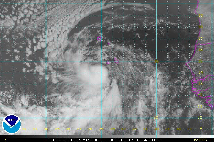
TS Erin formed late Wednesday over the eastern North Atlantic and was moving west-northwestward at about 13 knots with max winds of about 35 knots. Conditions are favorable during the next 48 to 72 hours for some slow development , however, after that drier air may tend to weaken this system. Time will tell if Erin survives the dry air or not.
TS Erin 1145Z 15 Aug 2013 Visible Satellite image via NOAA
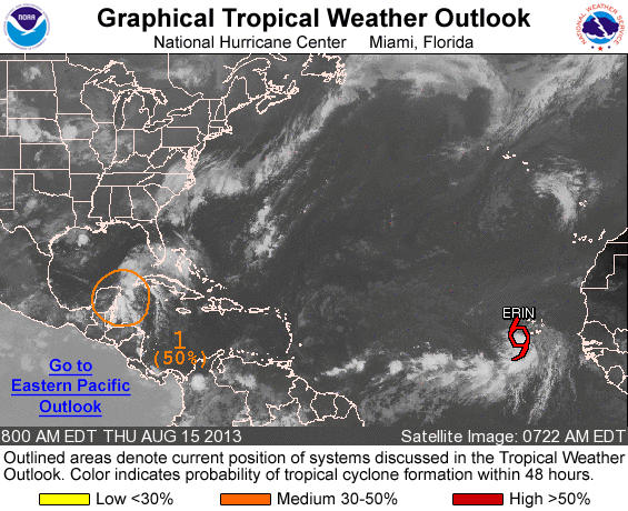
Farther to the west, another disturbance (Invest 92L) over the Northwest Caribbean was approaching the Yucatan Peninsula but much of the shower activity is already overland so development is not likely in the short term, but development may be possible once it moves over the southern Gulf of Mexico.
An update Thursday from the U.S. National Hurricane Center said that the area of low pressure still has a 50 percent chance of becoming a tropical cyclone during the next 48 hours
Invest 92L 1345Z 15 Aug 2013 NOAA Visual Satellite image
By Sheela Tobben (Bloomberg) –It’s the year of the unprecedented and the hurricane season has been no exception. A record-breaking hurricane season shut in an OPEC-nation amount of oil during...
Oct 29 (Reuters) – As crews began returning to U.S. Gulf of Mexico offshore facilities on Thursday, this year’s repeated oil and gas production halts were already hitting energy firms’...
Editor’s NOTE: With Hurricane Sandy currently over Cuba and threatening Florida and the U.S. East Coast, here is a look at some of the top websites for tracking hurricanes as picked...
October 25, 2015
Total Views: 2815
Get The Industry’s Go-To News
Subscribe to gCaptain Daily and stay informed with the latest global maritime and offshore news
— just like 104,486 professionals
Secure Your Spot
on the gCaptain Crew
Stay informed with the latest maritime and offshore news, delivered daily straight to your inbox
— trusted by our 104,486 members
Your Gateway to the Maritime World!
Essential news coupled with the finest maritime content sourced from across the globe.

 Join The Club


![Top Hurricane Tracking Sites [Ranked]](https://gcaptain.com/wp-content/uploads/2012/08/699900main_sandy_360.jpeg)


