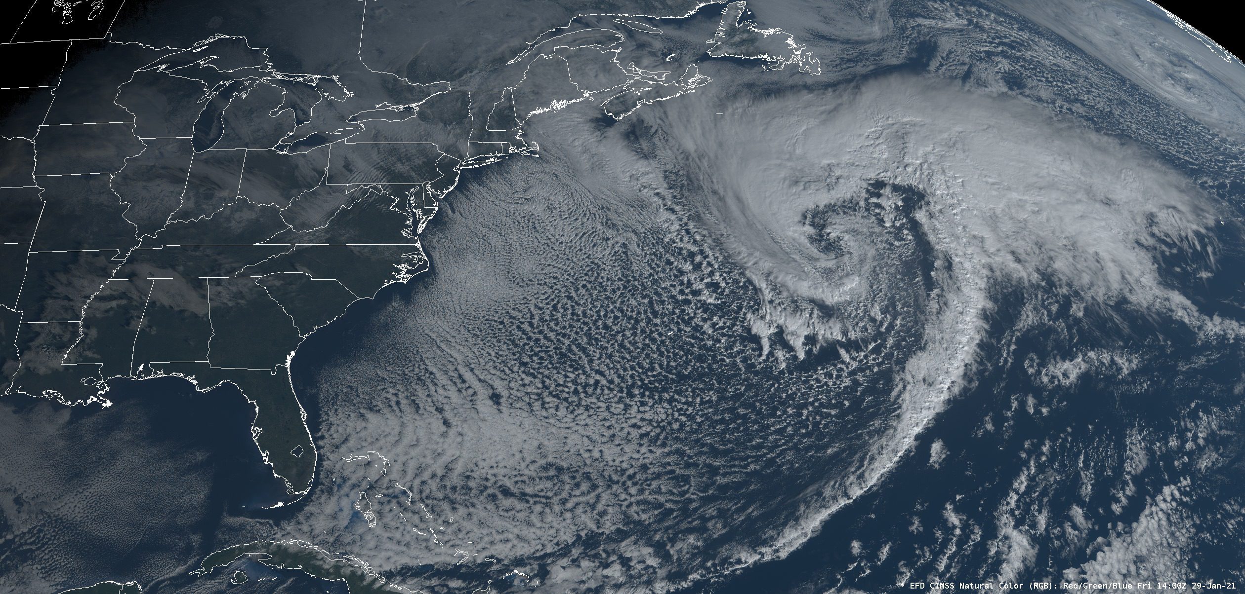
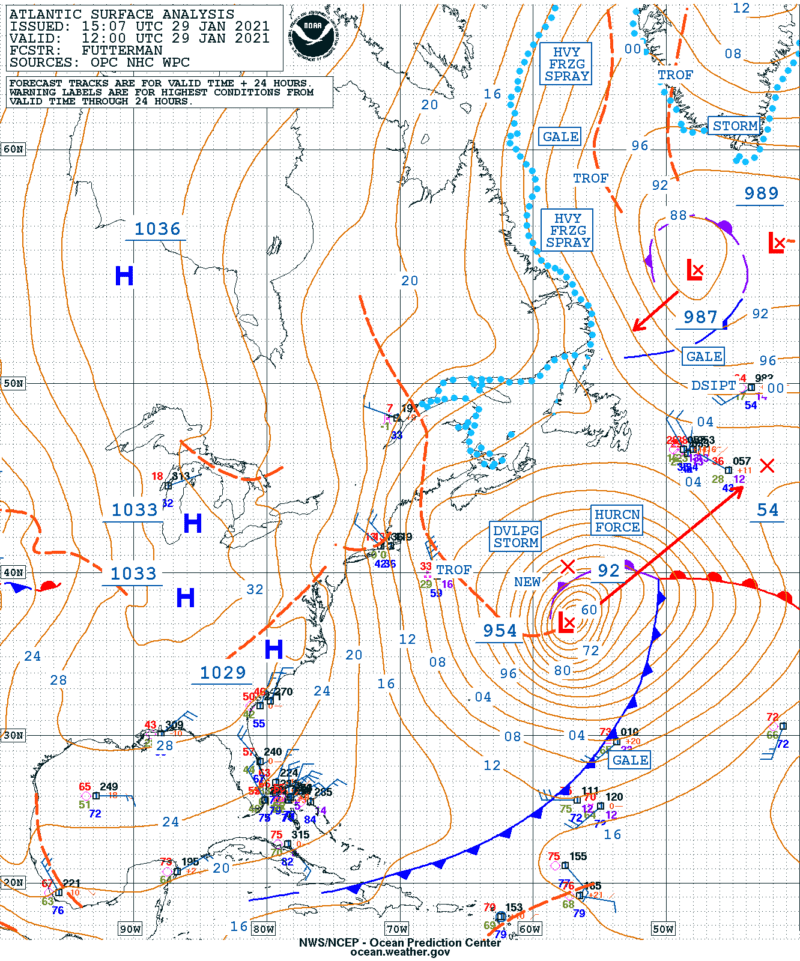
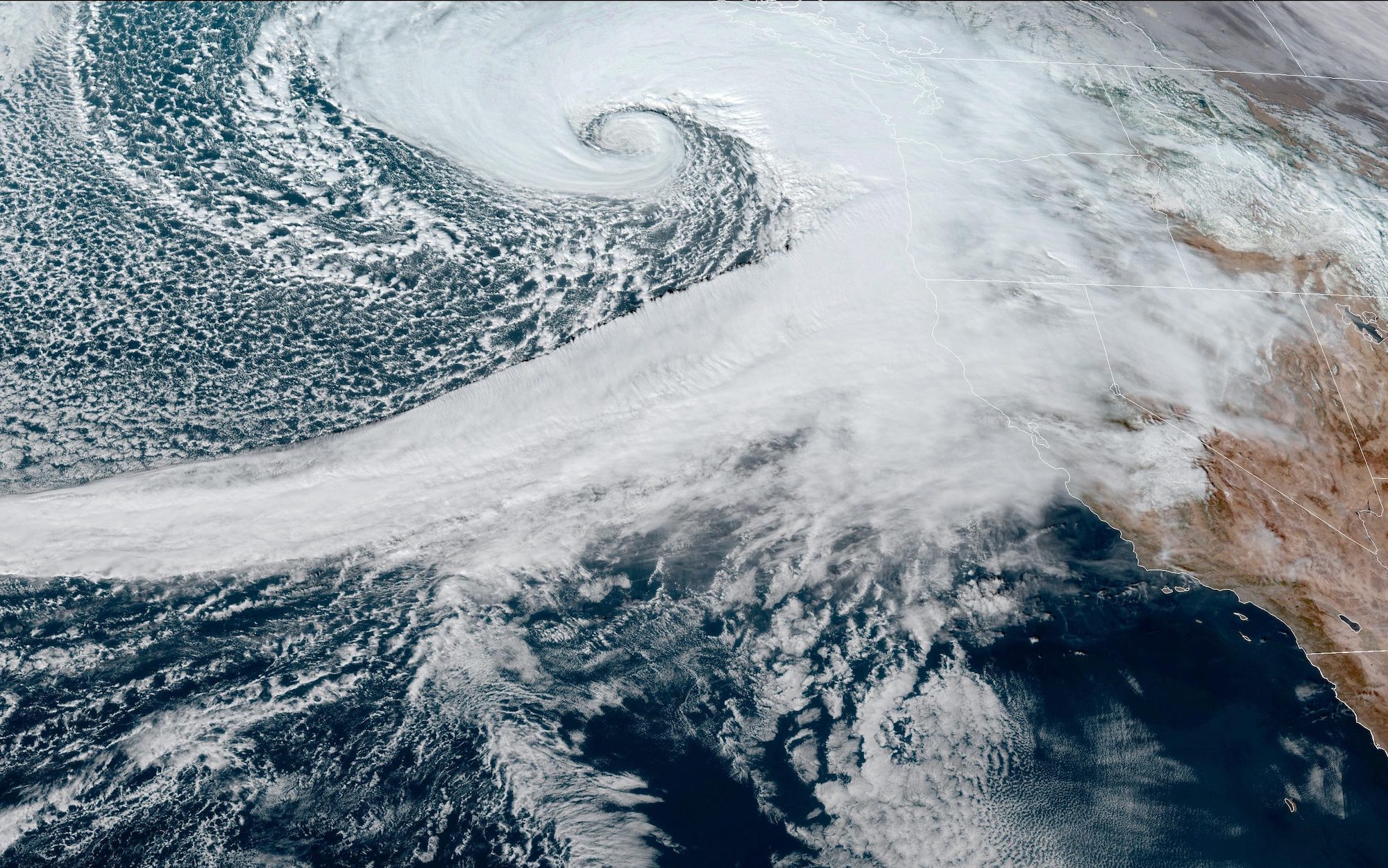
The NOAA Ocean Prediction Center is predicting seas in excess of 60 feet associated with a low pressure system that has rapidly intensified in the North Atlantic off the northeast coast of the U.S.
“Low pressure rapidly intensified yesterday and overnight, and continues to produce #hurricaneforce winds to 75 kt today,” the Ocean Prediction Center said in an update posted to Facebook.
At 12:00 UTC, National Weather Serviced meteorologists analyzed significant wave heights of 52 feet, or 16 meters, associated with the storm. The latest NWS North Atlantic High Seas Forecast showed a Hurricane Force Wind Warning is in effect for the area with seas forecasted to build to 60 feet, or more than 18 meters, over the next 24 hours!
Remember, significant wave height is the average height of the tallest 1/3 of waves, so individual waves can be much larger and may be more than twice the significant wave height.
Atlantic Surface Analysis for 1200 UTC 29 Jan 2021
According to the World Meteorological Organization, the world record for the tallest significant wave height was recorded by North Atlantic buoy located between Iceland and the United Kingdom in February 2013. The wave height: a whopping 62.3 feet, or 19 meters!
The previous record of 18.275 meters (59.96 feet) was measured on 8 December 2007, also in the North Atlantic.
While today’s forecast is calling for seas that could approach previous records, verifying wave heights with a high degree of certainty is a different ball game, as you need to rely on either buoy data (most accurate but fixed locations), ship observations (first you need a ship in area), or satellite altimeter data that has a history of being finicky.
In one instance in 2018, the National Hurricane Center’s Tropical Analysis and Forecast Branch reported that satellite radar picked up a significant wave height of 83 feet associated with Hurricane Florence. Although forecasters at first believed the data to be accurate, they admitted that the reading could have also been the result of extremely heavy rain, which may have produced bad data.
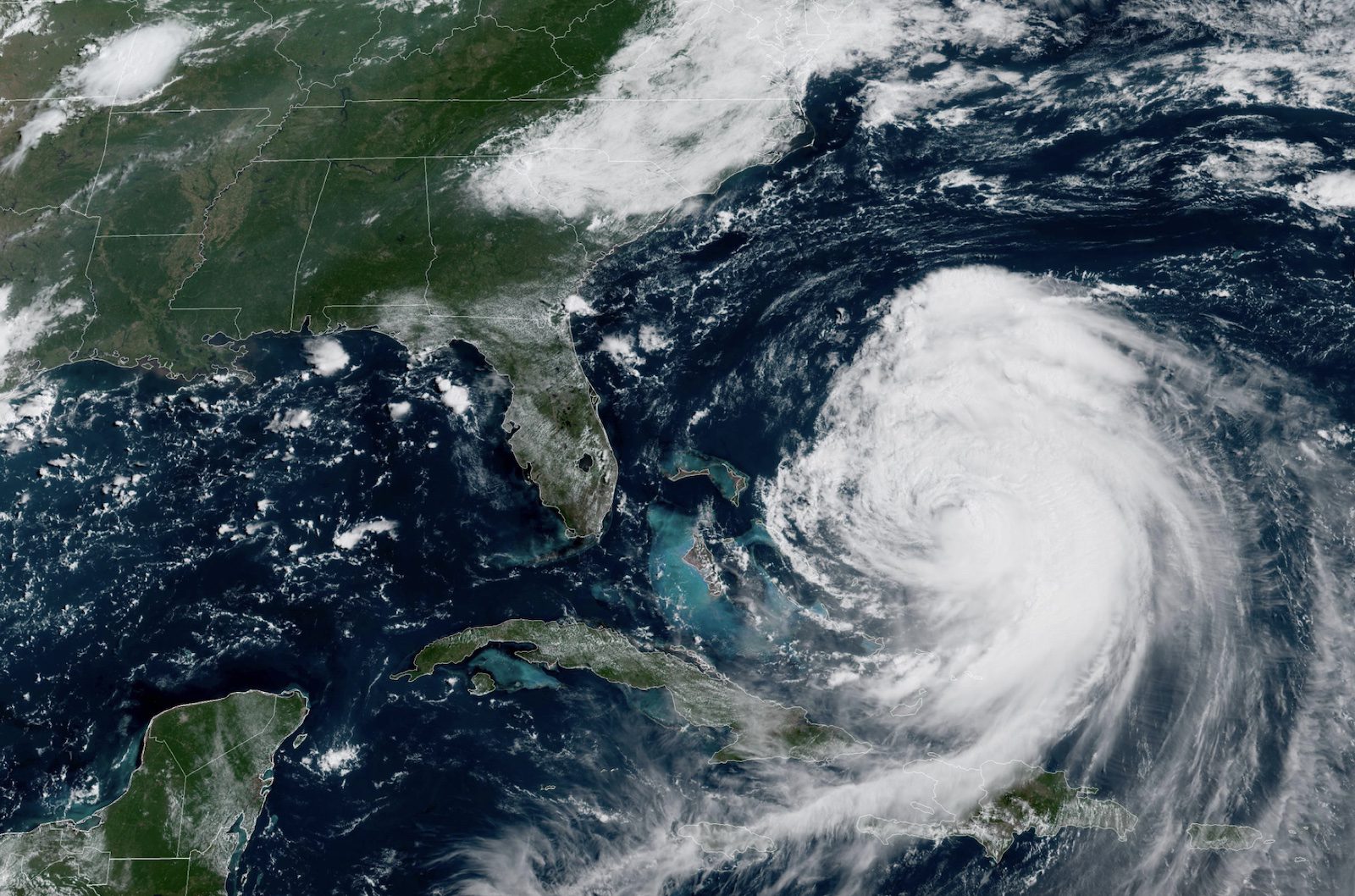
Hurricane Erin is generating dangerous sea conditions across the western Atlantic with forecasted significant wave heights reaching extreme levels as the storm moves between the U.S. East Coast and Bermuda....
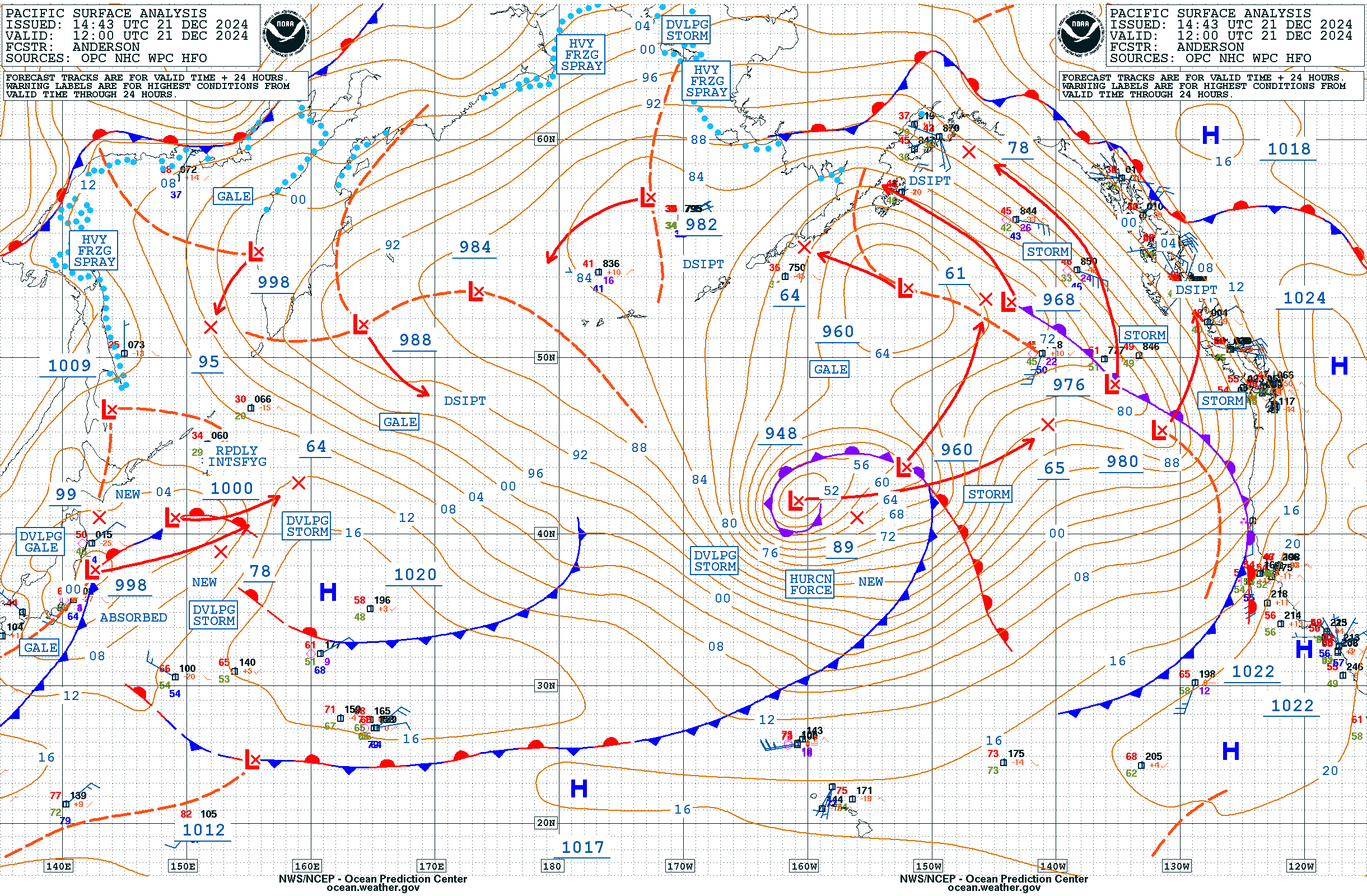
A powerful hurricane-force low pressure system in the North Pacific Ocean is generating extraordinary sea conditions, with significant wave heights reaching 65.77 feet (20 meters), according to the National Weather...
A rapidly intensifying weather system, known as a “bomb cyclone,” has developed off the U.S. West Coast, creating perilous conditions for mariners and coastal communities in the Pacific Northwest. The...
November 19, 2024
Total Views: 3773
Get The Industry’s Go-To News
Subscribe to gCaptain Daily and stay informed with the latest global maritime and offshore news
— just like 105,985 professionals
Secure Your Spot
on the gCaptain Crew
Stay informed with the latest maritime and offshore news, delivered daily straight to your inbox
— trusted by our 105,985 members
Your Gateway to the Maritime World!
Essential news coupled with the finest maritime content sourced from across the globe.

 Join The Club