How Are Shipwrecks Found And Protected In United States Waters?
By NOAA – Shipwrecks are the stuff of epic tales and imagination. Some sank in battle, some in transit. They were war machines, whalers and luxury cruise liners. Their doomed...

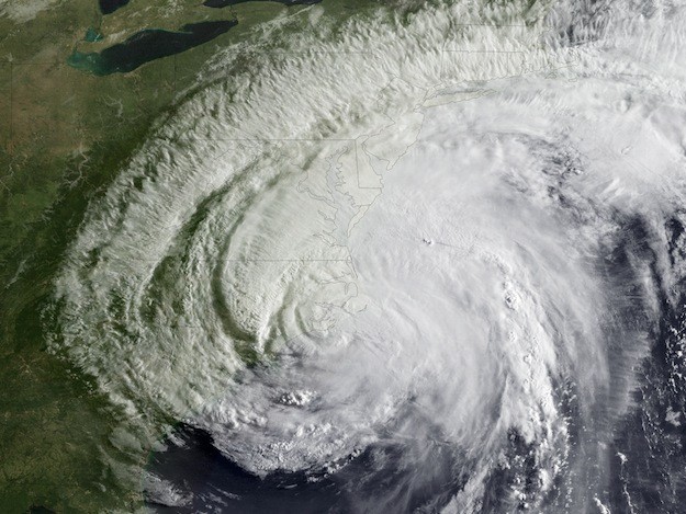
Conditions in the atmosphere and the ocean favor a near-normal hurricane season in the Atlantic Basin this season, NOAA announced today from Miami at its Atlantic Oceanographic and Meteorological Laboratory, and home to the Hurricane Research Division.
For the entire six-month season, which begins June 1, NOAA’s Climate Prediction Center says there’s a 70 percent chance of nine to 15 named storms (with top winds of 39 mph or higher), of which four to eight will strengthen to a hurricane (with top winds of 74 mph or higher) and of those one to three will become major hurricanes (with top winds of 111 mph or higher, ranking Category 3, 4 or 5). Based on the period 1981-2010, an average season produces 12 named storms with six hurricanes, including three major hurricanes.
“NOAA’s outlook predicts a less active season compared to recent years,” said NOAA Administrator Jane Lubchenco, Ph.D. “But regardless of the outlook, it’s vital for anyone living or vacationing in hurricane-prone locations to be prepared. We have a stark reminder this year with the 20th anniversary of Hurricane Andrew.” Andrew, the Category 5 hurricane that devastated South Florida on August 24, 1992, was the first storm in a late-starting season that produced only six named storms.
Favoring storm development in 2012: the continuation of the overall conditions associated with the Atlantic high-activity era that began in 1995, in addition to near-average sea surface temperatures across much of the tropical Atlantic Ocean and Caribbean Sea, known as the Main Development Region. Two factors now in place that can limit storm development, if they persist, are: strong wind shear, which is hostile to hurricane formation in the Main Development Region, and cooler sea surface temperatures in the far eastern Atlantic.
“Another potentially competing climate factor would be El Niño if it develops by late summer to early fall. In that case, conditions could be less conducive for hurricane formation and intensification during the peak months (August-October) of the season, possibly shifting the activity toward the lower end of the predicted range,” said Gerry Bell, Ph.D., lead seasonal hurricane forecaster at NOAA’s Climate Prediction Center.
“NOAA’s improvement in monitoring and predicting hurricanes has been remarkable over the decades since Andrew, in large part because of our sustained commitment to research and better technology. But more work remains to unlock the secrets of hurricanes, especially in the area of rapid intensification and weakening of storms,” said Lubchenco. “We’re stepping up to meet this challenge through our Hurricane Forecast Improvement Project, which has already demonstrated exciting early progress toward improving storm intensity forecasts.”
Lubchenco added that more accurate forecasts about a storm’s intensity at landfall and extending the forecast period beyond five days will help America become a more Weather-Ready Nation.
In a more immediate example of research supporting hurricane forecasting, NOAA this season is introducing enhancements to two of the computer models available to hurricane forecasters – the Hurricane Weather Research and Forecasting (HWRF) and the Geophysical Fluid Dynamics Laboratory (GFDL) models. The HWRF model has been upgraded with a higher resolution and improved atmospheric physics. This latest version has demonstrated a 20 to 25 percent improvement in track forecasts and a 15 percent improvement in intensity forecasts relative to the previous version while also showing improvement in the representation of storm structure and size. Improvements to the GFDL model for 2012 include physics upgrades that are expected to reduce or eliminate a high bias in the model’s intensity forecasts.
The seasonal outlook does not predict how many storms will hit land. Forecasts for individual storms and their impacts are provided by NOAA’s National Hurricane Center, which continuously monitors the tropics for storm development and tracking throughout the season using an array of tools including satellites, advance computer modeling, hurricane hunter aircraft, and land- and ocean-based observations sources such as radars and buoys.
Next week, May 27- June 2, is national Hurricane Preparedness Week. To help prepare residents of hurricane-prone areas, video and audio public service announcements featuring NOAA hurricane experts and the FEMA administrator are available in both English and Spanish.
“Every hurricane season we ask families, communities, and businesses to ensure they are prepared and visit www.ready.gov/hurricanes,” said Tim Manning, FEMA deputy administrator for protection and national preparedness. “Being prepared includes developing a family emergency plan, putting an emergency kit together or updating your existing kit, keeping important papers and valuables in a safe place, and getting involved to ensure your community is ready.”
NOAA’s outlook for the Eastern Pacific basin is for a near-normal hurricane season and the Central Pacific basin is expected to have a below-normal season. NOAA will issue an updated seasonal outlook for the Atlantic hurricane season in early August, just prior to the historical peak of the season.
[Source: NOAA]

Sign up for gCaptain’s newsletter and never miss an update

Subscribe to gCaptain Daily and stay informed with the latest global maritime and offshore news
Essential news coupled with the finest maritime content sourced from across the globe.
Sign Up