his visible image of Tropical Storm Isaac was captured by NOAA’s GOES-13 satellite on Sunday, Aug. 26 at 9:45 a.m. EDT and shows clouds from Tropical Storm Isaac from Cuba to northern Florida. Credit: NASA GOES Project
(Bloomberg) — Tropical Storm Isaac, which has delayed the opening of the Republican National Convention and scrubbed more than 650 flights, is expected to strengthen as it makes its way across the Gulf of Mexico closer to oil and gas interests before going ashore as a Category 2 hurricane.
The storm’s track has been drifting west from earlier forecasts that had it hugging Florida’s west coast and making landfall in the state’s Panhandle. It is now likely the storm will land near Biloxi, Mississippi, with winds of at least 105 miles (169 kilometers) per hour, the U.S. National Hurricane Center said.
Computer models disagree about the ultimate track and the hurricane center is having difficulty pinpointing Isaac’s path, according to a forecast analysis by Richard Pasch, a senior hurricane specialist with the center, and Dave Roberts, a U.S. Navy hurricane specialist.
“The track forecast beyond day 2 has become problematic,” Pasch and Roberts said at 11 a.m. New York time. “It should be noted that there is greater-than-usual uncertainty in the track forecast.”
A hurricane watch now extends from Indian Pass, Florida, to Morgan City, Louisiana, including New Orleans, which was devastated in 2005 when Hurricane Katrina went ashore just east of the city in Mississippi. A hurricane warning, meaning winds of at least 74 mph are expected to arrive within a day, now covers the Florida Keys, Florida Bay and the state’s coast from Bonita Beach to Ocean Reef, according to the center.
Florida Governor Rick Scott declared a statewide emergency yesterday and canceled his appearance at the Republican National Convention in Tampa. Rain and wind from the storm began lashing the state by midmorning.
The westward drift in the track may have spared Tampa, where Mitt Romney is expected to become the party’s presidential candidate. Delegates will convene tomorrow as scheduled and then recess until the next day, to be safe, Reince Priebus, the Republican National Committee Chairman, said yesterday.
“We think Tampa gets in the outer rain bands and some squally weather, some tropical storm force gusts, but they aren’t going to have those kinds of sustained winds,” said Dan Pydynowski, a senior meteorologist at AccuWeather Inc. in State College, Pennsylvania. “The storm is going to be too far to the west for that. They will notice it in Tampa but they are dodging a bullet and not taking a direct hit.”
Gulf Threat
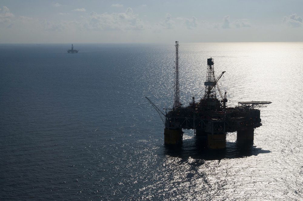
The track change has increased the possibility Isaac may disrupt oil and gas production in the western Gulf of Mexico, said Joel Widenor, co-founder of Commodity Weather Group LLC in Bethesda, Maryland. The company raised the risk for offshore energy rigs and platforms to 35 percent overnight.
About 8.6 percent of U.S. oil production and 1.6 percent of natural-gas output from the Gulf is shut because of Isaac, a Bureau of Safety and Environmental Enforcement report showed yesterday. The Gulf is home to 23 percent of U.S. oil production, 7 percent of natural gas output and 44 percent of the country’s refining capacity.
BP Plc began evacuating its Thunder Horse platform in the Gulf on Aug. 24 and suspended crude and natural-gas production there. BHP Billiton Ltd. said today that it is evacuating its Shenzi and Neptune operations in the Southern Green Canyon area.
Other companies, including Exxon Mobil Corp. and Royal Dutch Shell Plc, said they were evacuating non-essential workers and securing rigs and platforms.
Flights Scrubbed
At least 678 flights had been canceled in the U.S. today, according to FlightAware, an airline tracking company in Houston. Most of the cancellations occurred in Miami, where 220 departures and 243 arrivals were scrubbed.
Isaac is currently about 80 miles southeast of Key West, Florida with maximum sustained winds of about 65 mph, according to an 11 a.m. hurricane center advisory. The storm was moving west-northwest at 18 mph.
A tornado watch was posted in 15 southern Florida counties.
Forecasting the track of a hurricane depends on predicting what the upper level winds in the atmosphere will be doing, Pydynowski said. Hurricanes don’t move under their own power; instead they are pulled and pushed by other weather patterns.
“The wind higher-up is what is really steering these storms,” he said.
Isaac flooded Haiti with heavy rains on its path through the Atlantic and Caribbean and killed at least 4 people there, according to the Associated Press.
The Trump administration will hold the government's first sale of oil and gas drilling rights in the Gulf of Mexico since 2023 on Wednesday, a key test of industry appetite for offshore acreage at a time when the United States is seeking to unleash more domestic fossil fuel production.
Beacon Offshore Energy LLC, an oil explorer backed by Blackstone Inc., is betting on a drilling renaissance in the Gulf of Mexico as it starts up some of the most productive wells in the US using new technology to pump once-impossible-to-reach crude.
BP has reached a final investment decision on the Tiber-Guadalupe project in the Gulf of America (Gulf of Mexico), approving its second new production platform in less than two years...
September 29, 2025
Total Views: 1000
Get The Industry’s Go-To News
Subscribe to gCaptain Daily and stay informed with the latest global maritime and offshore news
— just like 107,511 professionals
Secure Your Spot
on the gCaptain Crew
Stay informed with the latest maritime and offshore news, delivered daily straight to your inbox
— trusted by our 107,511 members
Your Gateway to the Maritime World!
Essential news coupled with the finest maritime content sourced from across the globe.

 Join The Club


![Isaac Moves Towards Florida, Gulf Watches [UPDATE]](https://gcaptain.com/wp-content/uploads/2012/08/680794main_20120826-ISAAC-GOESSunday-FULL.jpeg)