La Niña Conditions Return
La Niña conditions have emerged in the equatorial Pacific and are expected to persist through the Northern Hemisphere winter, with forecasters predicting a 55% chance of transition to ENSO-neutral conditions...

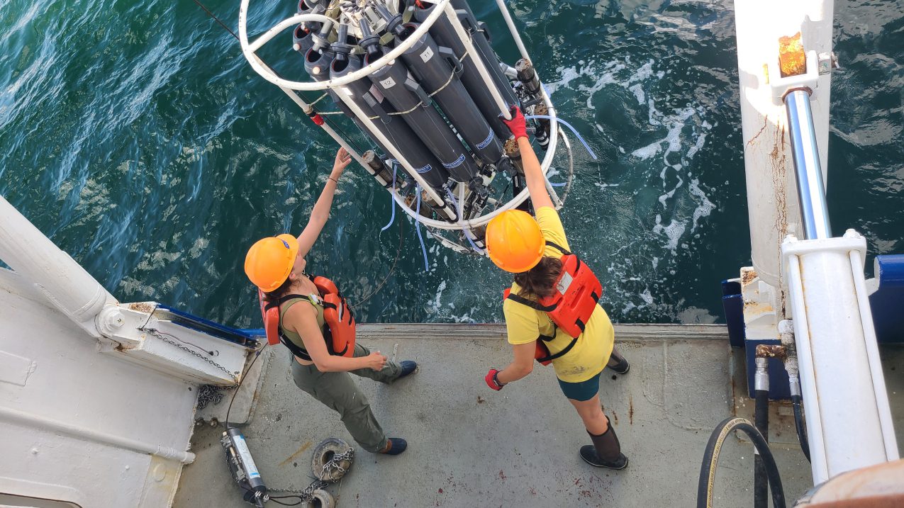
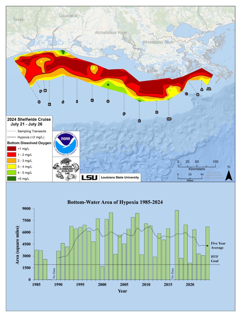
NOAA-supported scientists reported that this year’s Gulf of Mexico dead zone, an area of low oxygen harmful to marine life, is approximately 6,705 square miles, the 12th largest on record. The area, equivalent to over 4 million acres, is roughly the size of New Jersey.
The annual dead zone survey by Louisiana State University and LUMCON reveals that the current five-year average size of the dead zone in the Gulf of Mexico is 4,298 square miles, significantly exceeding the Mississippi River/Gulf of Mexico Hypoxia Task Force’s 2035 target of fewer than 1,900 square miles.
The dead zone is primarily caused by nutrient runoff leading to algae overgrowth and subsequent oxygen depletion.
“It’s critical that we measure this region’s hypoxia as an indicator of ocean health, particularly under a changing climate and potential intensification of storms and increases in precipitation and runoff,” said Nicole LeBoeuf, assistant administrator of NOAA’s National Ocean Service. “The benefit of this long-term data set is that it helps decision makers as they adjust their strategies to reduce the dead zone and manage impacts to coastal resources and communities.”

NOAA’s June forecast predicted an above-average dead zone of 5,827 square miles based on Mississippi River discharge and nutrient runoff data. The measured size fell within the forecast’s uncertainty range, highlighting the accuracy of the predictive models.
“The area of bottom-water hypoxia was larger than predicted by the Mississippi River discharge and nitrogen load for 2024, but within the range experienced over the nearly four decades that this research cruise has been conducted,” said Nancy Rabalais, Ph.D. professor at Louisiana State University and LUMCON, and co-chief scientist for the cruise. “We continue to be surprised each summer at the variability in size and distribution.”
Dead zones form when excess nutrients, carried to the Gulf via the Mississippi-Atchafalaya River Basin, cause algae overgrowth. As these algae decompose, they deplete oxygen in the water, forcing marine life to leave the area. Hypoxia affects fish diets, growth rates, reproduction, and the availability of commercially important species like shrimp.
The EPA’s Gulf Hypoxia Program, initiated in June 2022 with a $60 million investment from President Biden’s Bipartisan Infrastructure Law, collaborates with state, local governments, and Tribes to reduce nutrient pollution and protect the Gulf’s health.

Sign up for gCaptain’s newsletter and never miss an update

Subscribe to gCaptain Daily and stay informed with the latest global maritime and offshore news
Essential news coupled with the finest maritime content sourced from across the globe.
Sign Up