Update: Media reports indicate that these images have been discredited, with China saying the release of the images was a mistake. Back to the drawing board….
Previous:
Here is some of CNN’s coverage of new images, seen below, released by China’s government showing three large pieces of debris that may be wreckage debris from missing Malaysian Airlines flight MH370.
Of course whether or not objects seen in the images are in fact debris from the missing jet is anyone’s guess, especially considering the constant twists and turns of this incident so far, but the folks at CNN seem pretty convinced that at least this is solid lead consistent with the probable flight path of the plane.
A statement posted by China’s SASTIND along with the images said the three floating objects spotted measured 13 m × 18 m, 14 m × 19 m , and 24 m × 22 m. The images were pulled from a 20 km radius satellite image taken at 11 a.m. on March 9 at location 105.63 east longitude, 6.7 north latitude, the statement added.
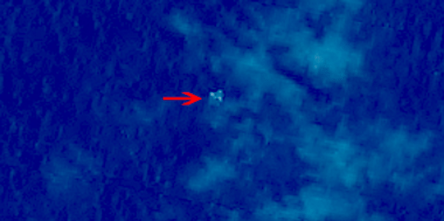
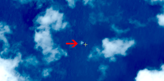
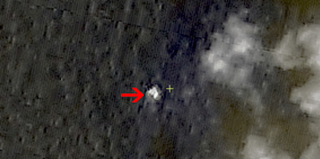
Images courtesy SUSTIND
Editorial Standards · Corrections · About gCaptain

 Join The Club