Trackline corridor (pictured in green) of the Fairweather’s planned survey mission.
“Much of Alaska’s coastal area has never had full bottom surveys to measure water depths,” according to Cmdr. James Crocker, commanding officer of the NOAA Ship Fairweather upon embarking on a 30-day survey mission to the Arctic this week. “A tanker, carrying millions of gallons of oil, should not be asked to rely on measurements gathered in the 19th century. Unfortunately, that’s exactly what navigators have to do.”
The Fairweather survey of sea lanes that were last measured by Captain James Cook in 1778 will collect much needed information about changes to the coastline but mariners hoping to use the new information might have to wait. According to NOAA the survey will not result in immediate chart updates rather, it will “collect needed information to determine NOAA’s future charting projects”.
Considering the size of the job at hand, over 2,000 nautical miles of bitterly cold shoreline, one might ask if a single NOAA ship is enough to handle the task…
According to Phil Parsons, a mariner working out of Dutch Harbor, “Shared pencil mark lines shared by some fishing boat captains are considered more accurate than many of NOAA’s regional charts. Working near the coast is especially dangerous up north.”
Many of today’s Alaskan coastal nautical charts, created by NOAA’s Office of Coast Survey, use sporadic depth readings reported by private vessels, some decades or centuries old. Those vessels lacked the ability to report their exact positions to enable them to gather data accurate enough to ensure quality measurements.
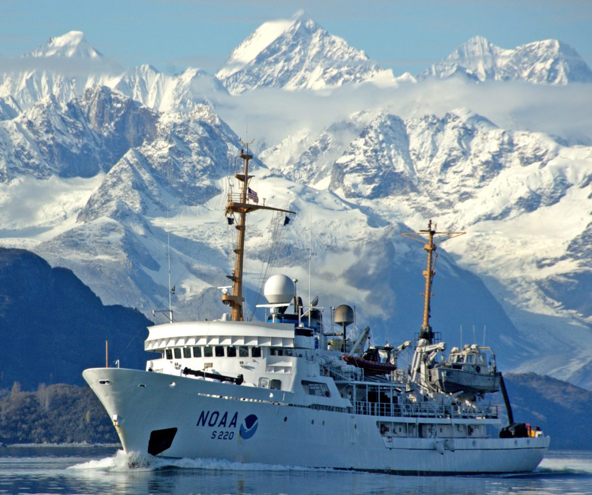
NOAA Ship Fairweather is part of the NOAA fleet of ships and aircraft operated, managed and maintained by NOAA’s Office of Marine and Aviation Operations, which includes both civilians and the commissioned officers of the NOAA Corps, one of the seven uniformed services of the United States. The ship is homeported in Ketchikan, Alaska.
Chris Vagasky (The Conversation)–The National Hurricane Center’s forecasts in 2024 were its most accurate on record, from its one-day forecasts, as tropical cyclones neared the coast, to its forecasts five days into...
By Valerie Volcovici, Rich McKay and Leah Douglas WASHINGTON, Feb 28 (Reuters) – Scientists and researchers are warning that the Trump administration’s firing of hundreds of workers at NOAA, the agency that...
By Lauren Rosenthal and Brian K Sullivan Feb 8, 2025 (Bloomberg) –The email arrived in US government workers’ inboxes just after 1 a.m. East Coast time on Friday, with the subject...
February 9, 2025
Total Views: 7321
Get The Industry’s Go-To News
Subscribe to gCaptain Daily and stay informed with the latest global maritime and offshore news
— just like 104,462 professionals
Secure Your Spot
on the gCaptain Crew
Stay informed with the latest maritime and offshore news, delivered daily straight to your inbox
— trusted by our 104,462 members
Your Gateway to the Maritime World!
Essential news coupled with the finest maritime content sourced from across the globe.

 Join The Club