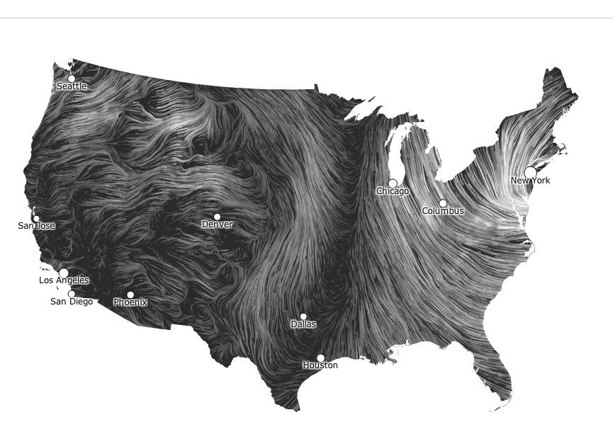
We’ve all seen those somewhat complicated NOAA weather forecasts with the 500 millibar lines and the frontal boundaries and unless you’re a meteorologist, or just really good at reading those charts, they’ve never really provided a good visual of what the wind is ACTUALLY doing.
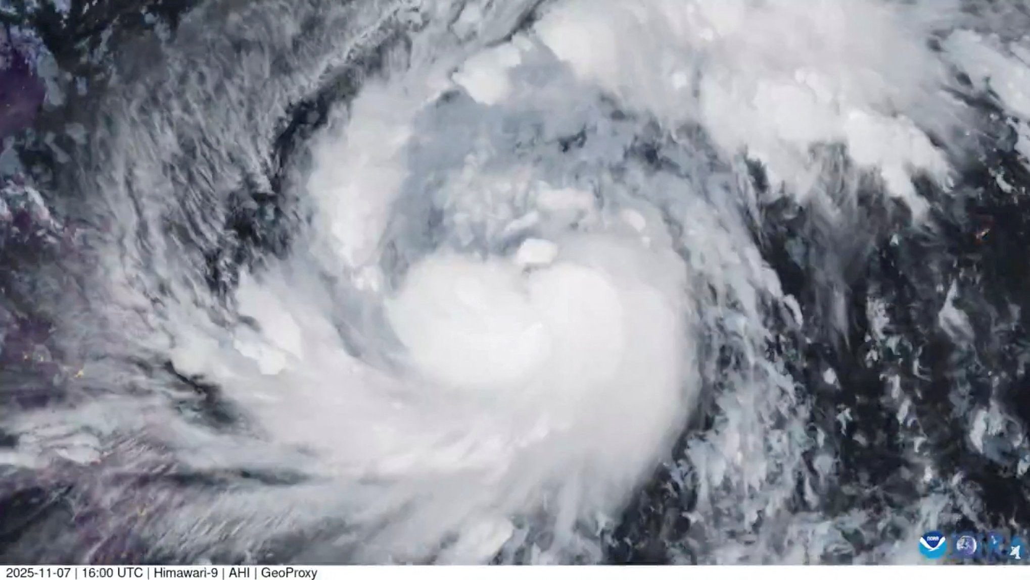
By Neil Jerome Morales Nov 9, 2025 (Bloomberg) –Super typhoon Fung-Wong hit the Philippines’ northeast late on Sunday with 185 kilometers per hour (115 miles per hour) winds and gusts of...
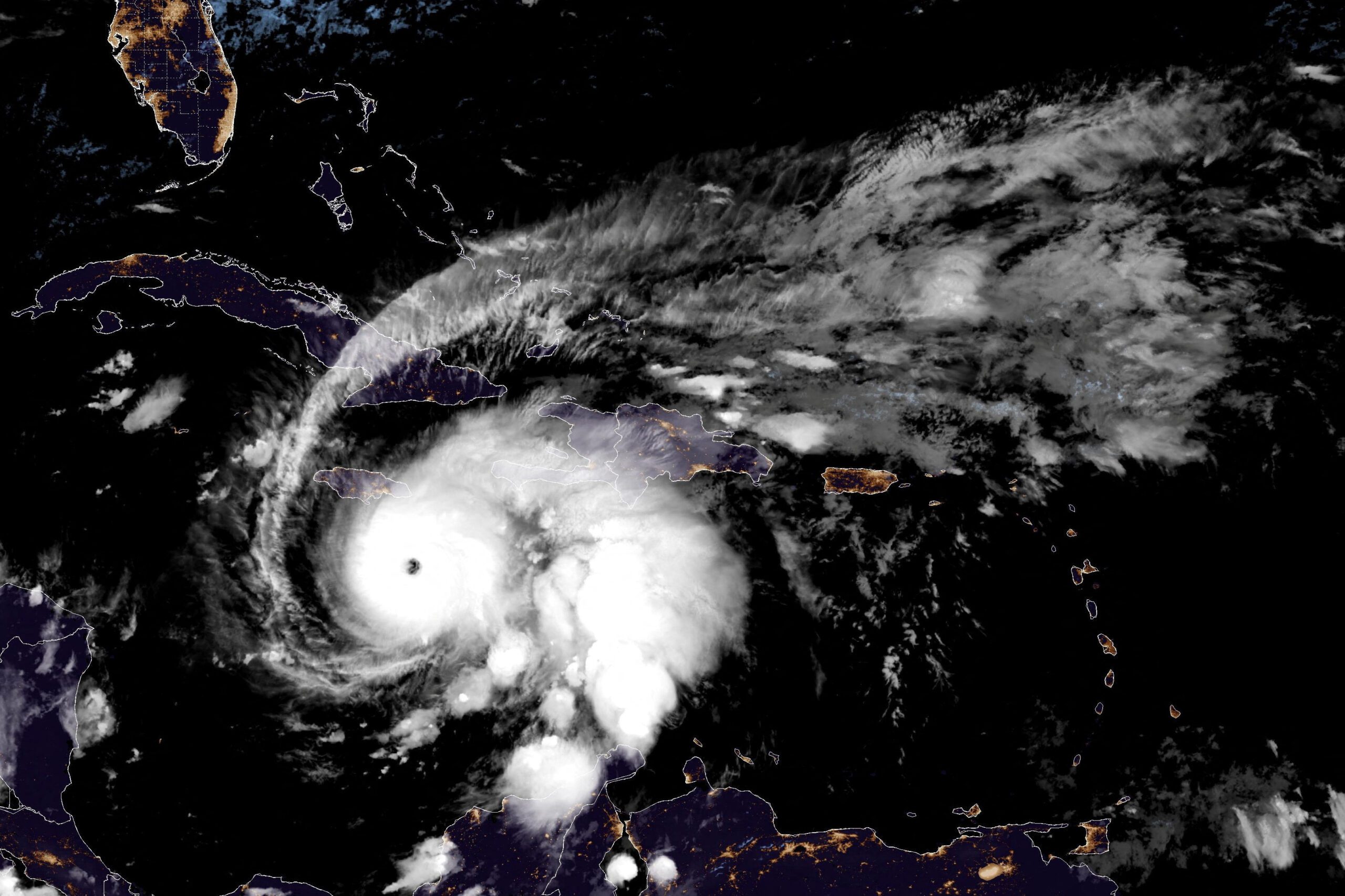
By Brian K. Sullivan and Scott Squires Oct 26, 2025 (Bloomberg) –Storm Melissa exploded in strength overnight, barreling toward an expected landfall Tuesday on Jamaica as a major hurricane and threatening...
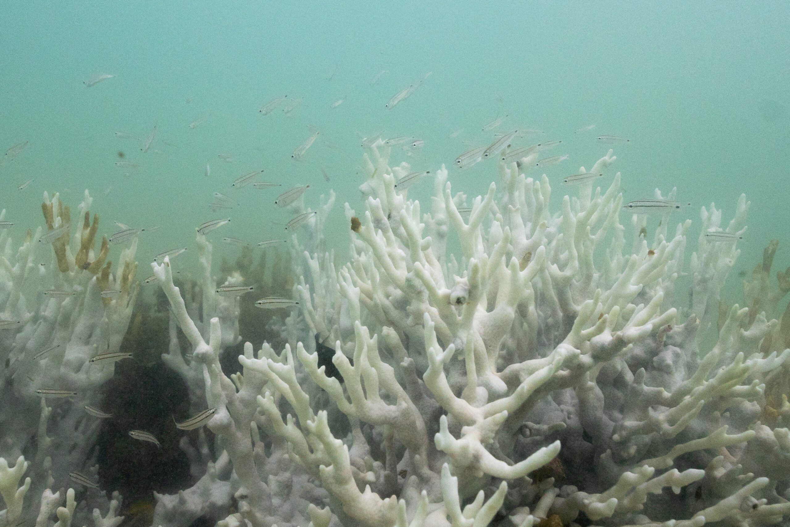
By Alison Withers COPENHAGEN, Oct 13 (Reuters) – Global warming is crossing dangerous thresholds sooner than expected with the world’s coral reefs now in an almost irreversible die-off, marking what scientists on...
October 12, 2025
Total Views: 1017
Get The Industry’s Go-To News
Subscribe to gCaptain Daily and stay informed with the latest global maritime and offshore news
— just like 107,046 professionals
Secure Your Spot
on the gCaptain Crew
Stay informed with the latest maritime and offshore news, delivered daily straight to your inbox
— trusted by our 107,046 members
Your Gateway to the Maritime World!
Essential news coupled with the finest maritime content sourced from across the globe.

 Join The Club