 The following article by CDR Michael Hendersen, Navigation Manager NOAA was originally published in the December 2010 edition of CAMM , Council Of American Master Mariners, magazine Sidelights. Click HERE to read the full issue of the magazine, including exclusive content by gCaptain’s founder, free online.
The maritime industry is preparing for major shifts in navigation, due to the improvements at the Panama Canal. For a longer view of maritime changes, the world is looking northward as well.
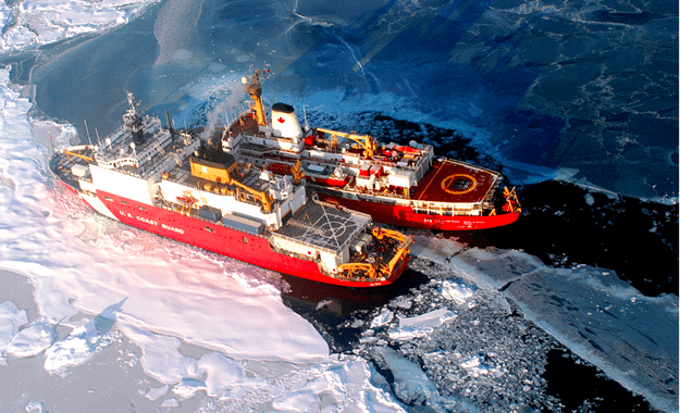
The last thirty years have seen a signif- icant retreat in Arctic sea ice, currently allowing for over a month of navigable water through the Arctic Ocean. As Arctic ice recedes, countries are look- ing forward to faster sea routes across the top of the world. A transit between Vladivostok and Rotterdam, using the northern route, can save approxi- mately 10 days and $300,000 per ship. Alternately, the voyage is nearly 11,000 nautical miles through the Pacific, Indian, and Atlantic Oceans – including transits through the Suez Canal and the Mediterranean Sea.
The reductions in ice coverage, seen over longer periods, have resulted in a doubling of vessel traffic in the Arctic since 2005. Mounting cargo demands, emerging resource development, and the growing popularity of ecotourism add to burgeoning interest in the region.
NOAA is working now, on several fronts, for the new era of Arctic naviga- tion.
U.S. joins Arctic Regional Hydrographic Commission
On October 6, 2010, NOAA led a U.S. delegation that formally established a new Arctic Regional Hydrographic Commission with four other nations. The commission, which also includes Canada, Denmark, Norway, and the Russian Federation, will promote coop- eration in hydrographic surveying and nautical chart making.
The problem is that many Arctic nau- tical charts are out of date or nonexistent. Inadequate charts pose a significant risk to marine safety, and could potentially lead to loss of life or environmental disaster.
NOAA issues draft U.S. Arctic Nautical Charting Plan
NOAA’s Office of Coast Survey recently drafted a nautical charting plan devot- ed exclusively to the U.S. Arctic.
NOAA is sharing the draft plan with other government partners, includ- ing the U.S. Navy, National Geospatial Intelligence Agency, and the U.S. Coast Guard, and will solicit comments from both industry and the public. (Send an email to [email protected] to get a PDF copy of the draft.) The draft provides detailed plans for additional nautical chart coverage in U.S. Arctic waters and describes the activities neces- sary to produce and maintain the charts. The final plan is slated for completion in May 2011.
The U.S. Exclusive Economic Zone includes 568,000 square nautical miles of U.S. Arctic waters. About a third of U.S. Arctic waters are navigationally sig- nificant. The majority of charted Arctic waters were surveyed with obsolete tech- nology dating back to the 1800s. Most of the shoreline along Alaska’s northern and western coasts has not been mapped since 1960, if ever, and confidence in the region’s nautical charts is extremely low.
NOAA surveys high transit areas
Responding to a request from the U.S. Navy, U.S. Coast Guard, Alaska Maritime Pilots, and the commercial shipping industry, NOAA sent one of its premier surveying vessels, NOAA Ship Fairweather, to detect navigational dangers in critical Arctic waters that have not been charted for more than 50 years. Fairweather, whose homeport is Ketchikan, Alaska, spent July and August examining seafloor features, measuring ocean depths and supplying data for updating NOAA’s nautical charts span- ning 350 square nautical miles in the Bering Straits around Cape Prince of Wales. The data will also support sci- entific research on essential fish habitat and will establish new tidal datums in the region.

 Join The Club


