Google has released a new Mash-up feature for their Maps service. Basically anyone can put together a map and submit it to google. Then users can overlay multiple specialty maps over google’s satellite view of the earth.
I have mashed-up a few marine and navigational tools in the map shown above. Tools include a great circle sailing calculator, tsunami warning map and VOS (vessel weather observations) and AMVER reports (from Mike’s Place). If you find any other maritime related maps enter them in the comments below and I’ll post the final version to our Weather Tools section.
By Yimou Lee TAIPEI, March 7 (Reuters) – China has stepped up grey-zone warfare against Taiwan, aiming to make the areas around the democratic island “saturated” with balloons, drones and civilian boats,...
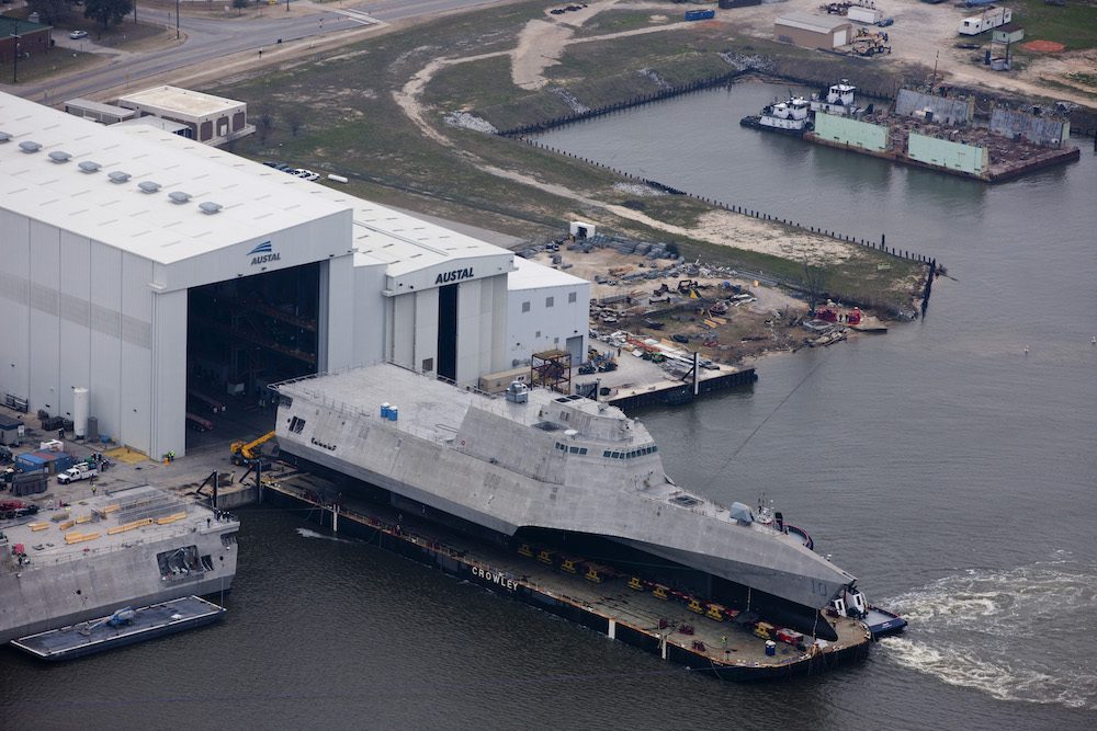
Austal USA has kicked off plans to construct a new manufacturing facility, marking a significant expansion of its shipyard capacity in Mobile, Alabama in support of U.S. Navy and Coast...
Oldendorff and Norsepower have announced an agreement to install three Norsepower Rotor Sails™ on board a modern bulk carrier to reduce its emissions. The vessel, Dietrich Oldendorff, will be equipped...
February 5, 2024
Total Views: 847
Why Join the gCaptain Club?
Access exclusive insights, engage in vibrant discussions, and gain perspectives from our CEO.
This website uses cookies to improve your experience while you navigate through the website. Out of these, the cookies that are categorized as necessary are stored on your browser as they are essential for the working of basic functionalities of the website. We also use third-party cookies that help us analyze and understand how you use this website. These cookies will be stored in your browser only with your consent. You also have the option to opt-out of these cookies. But opting out of some of these cookies may affect your browsing experience.
Necessary cookies are absolutely essential for the website to function properly. This category only includes cookies that ensures basic functionalities and security features of the website. These cookies do not store any personal information.
Any cookies that may not be particularly necessary for the website to function and is used specifically to collect user personal data via analytics, ads, other embedded contents are termed as non-necessary cookies. It is mandatory to procure user consent prior to running these cookies on your website.

 Join The Club