U.S. Coast Survey cartographers traveled with Union forces to produce battlefield maps during the Civil War (Map of the Battlefield of Chickamauga). Credit: NOAA
In recognition of the 150th anniversary of the American Civil War next year, NOAA’s Office of Coast Survey has released “Charting a More Perfect Union”, an extensive collection of Civil War-era maps, nautical charts, and documents that were prepared by the U.S. Coast Survey during war years (1861-1865). A statement issued by NOAA tell us:
Coast Survey’s collection includes 394 Civil War-era maps, including nautical charts used for naval campaigns, and maps of troop movements and battlefields. Rarely seen publications include Notes on the Coast, prepared by Coast Survey to help Union forces plan naval blockades against the Confederacy, and the annual report summaries by Superintendent Bache as he detailed the trials and tribulations of producing the maps and charts needed to meet growing military demands.
In the nation’s early years, the United States lost more ships to accidents than to war. In 1807, President Thomas Jefferson established the Survey of the Coast to produce the nautical charts necessary for maritime safety, defense and the establishment of national boundaries. By 1861, Coast Survey was the government’s leading scientific agency, charting coastlines and determining land elevations for the nation. Today, the Office of Coast Survey still meets its maritime responsibilities as a part of NOAA, surveying America’s coasts and producing the nation’s nautical charts. Keep Reading
In addition to maps and nautical charts, the collection features U.S. Coast Survey supervisor Alexander Dallas Bache’s annual Notes on the Coast of the United States, a series of secret reports used by the Union Army covering the Delaware Bay to the Mississippi Sound that contributed to the success of the Union blockading squadrons.
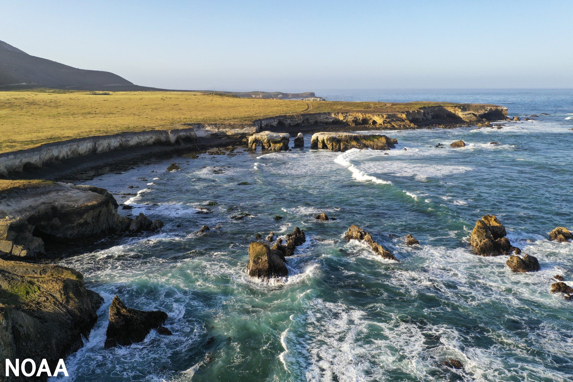
NOAA-Today, following input from tribal nations, state and federal agencies, Indigenous communities, and the public, NOAA released a proposal to designate a 5,617-square-mile area offshore of San Luis Obispo and...
by John Konrad (gCaptain) In the realm of seafaring, mariners maintain a keen eye on two things: weather and the maps that guide them safely through unknown waters. These nautical...
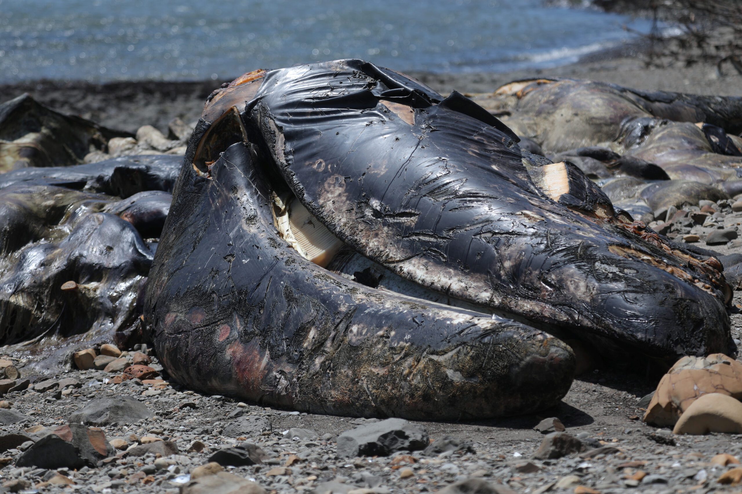
By Nathan Frandino and Daniel Trotta SAN FRANCISCO, June 29 (Reuters) – Gray whales on the North American Pacific coast fell this year to their lowest population since the late 1960s and...
July 2, 2023
Total Views: 2104
Why Join the gCaptain Club?
Access exclusive insights, engage in vibrant discussions, and gain perspectives from our CEO.
This website uses cookies to improve your experience while you navigate through the website. Out of these, the cookies that are categorized as necessary are stored on your browser as they are essential for the working of basic functionalities of the website. We also use third-party cookies that help us analyze and understand how you use this website. These cookies will be stored in your browser only with your consent. You also have the option to opt-out of these cookies. But opting out of some of these cookies may affect your browsing experience.
Necessary cookies are absolutely essential for the website to function properly. This category only includes cookies that ensures basic functionalities and security features of the website. These cookies do not store any personal information.
Any cookies that may not be particularly necessary for the website to function and is used specifically to collect user personal data via analytics, ads, other embedded contents are termed as non-necessary cookies. It is mandatory to procure user consent prior to running these cookies on your website.

 Join The Club