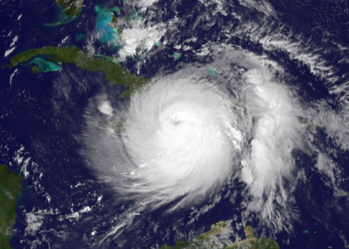
Hurricane Matthew approaching Haiti on Oct. 4, 2016, before heading towards Florida’s eastern coast. Credits: NASA/NOAA GOES Project
By Fred Pickhardt (Ocean Weather Services) – Given the unusual occurrence of 3 named tropical cyclones prior to the end of June, one might ask what should we expect for the remainder of the 2017 hurricane season?
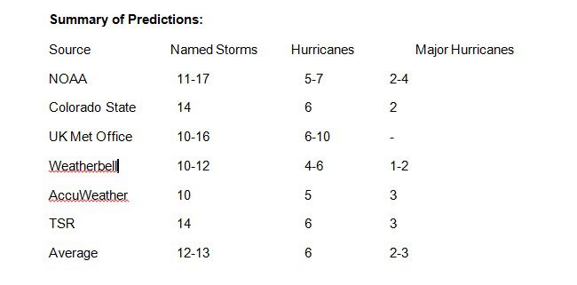
A number of forecast centers have already made their predictions for the 2017 hurricane season with most sources predicting either a normal to somewhat above normal season. There is, however, quite a range in the total number of expected named storms, ranging from as low as 10 to as much as 17. The most likely number being 12-13 storms. For hurricanes, the range is from 6-10 with the most likely number being about 6 hurricanes. For major hurricanes, estimates range between 1 and 4, the most likely number being 2 or 3.
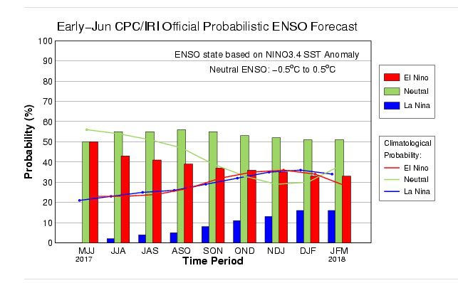
One factor most forecasters are looking at is that there will be either a weak El Nino or as neutral ENSO conditions will prevail during the peak of this year’s season as well as warmer than normal SST across the tropical Atlantic and Caribbean Sea. If we have a weak El Niño, then the likelihood is for a normal to somewhat below normal season. If, however, as predicted by NOAA, the current neutral ENSO conditions prevail, then a somewhat more active season is possible.
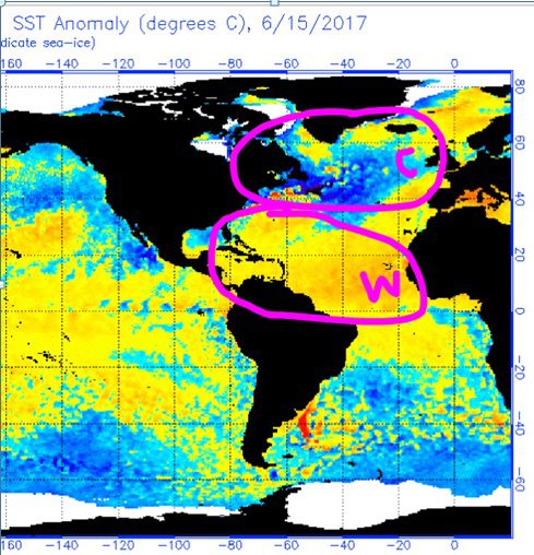
For this up-coming season, I have been looking at the SST Anomalies over the North Atlantic which have been showing a trend for cooler than normal temperatures north of about 40N latitude while mostly warmer than normal SST prevail to the south. If this continues, there should be a tendency for high pressure areas that move off New England or Canada to be enhanced which will tend to block or delay tropical cyclones from turning northeastward. This, in turn, would suggest a higher risk for storms moving northward over the western North Atlantic to threaten the US East Coast.
Updated: September 29, 2023 (Originally published June 21, 2017)
Editorial Standards · Corrections · About gCaptain

 Join The Club