Peru Court Hands Washington a Win in Fight Over Chinese-Owned Chancay Port
A Peruvian court ordered the government to oversee a Chinese-owned port near Lima, helping US efforts to curb Beijing’s growing power in the region.
An industry friend of mine recently told me that if you mapped world shipping activity it would look like a 1938 battle map with china at the center. So why not do just that? Here are the maps we came up with:
The following map from worldmapper.org uses relative size to show proportion of all shipping containers being loaded and unloaded in each country. (click on map to view pdf version).
Here is a world map showing where wal-mart gets its products:
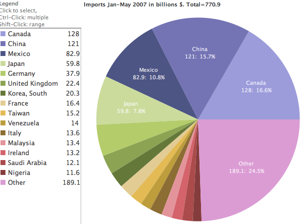
Here is a chart of world imports to the US for 2007 (to date) :
Updated: February 5, 2026 (Originally published July 19, 2007)
Sign up for gCaptain’s newsletter and never miss an update
Subscribe to gCaptain Daily and stay informed with the latest global maritime and offshore news
Essential news coupled with the finest maritime content sourced from across the globe.
Sign Up