For a second year in a row, U.S.-based ocean data specialist Saildrone is sending a fleet of storm chasing drones into the heart of the Atlantic Ocean’s hurricane alley to intercept large and destructive hurricanes, collecting critical data to make coastal communities safer.
Saildrone is again partnering with the National Oceanic and Atmospheric Administration (NOAA)’s Office of Oceanic and Atmospheric Research on the project.
This year, they plan send seven uncrewed surface vehicles (USVs) to brave the Atlantic hurricane season, collecting further insights into how hurricanes grow and intensify.
“Storms that intensify rapidly can cause extensive damage and loss of life and real-time observing systems are crucial to better understanding the atmospheric and oceanic processes that lead to the formation and intensification of these hurricanes,” said John Cortinas, Director of NOAA’s Atlantic Oceanographic and Meteorological Laboratory (AOML).
Image courtesy Saildrone
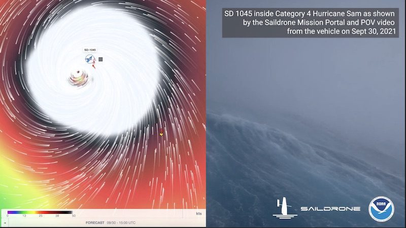
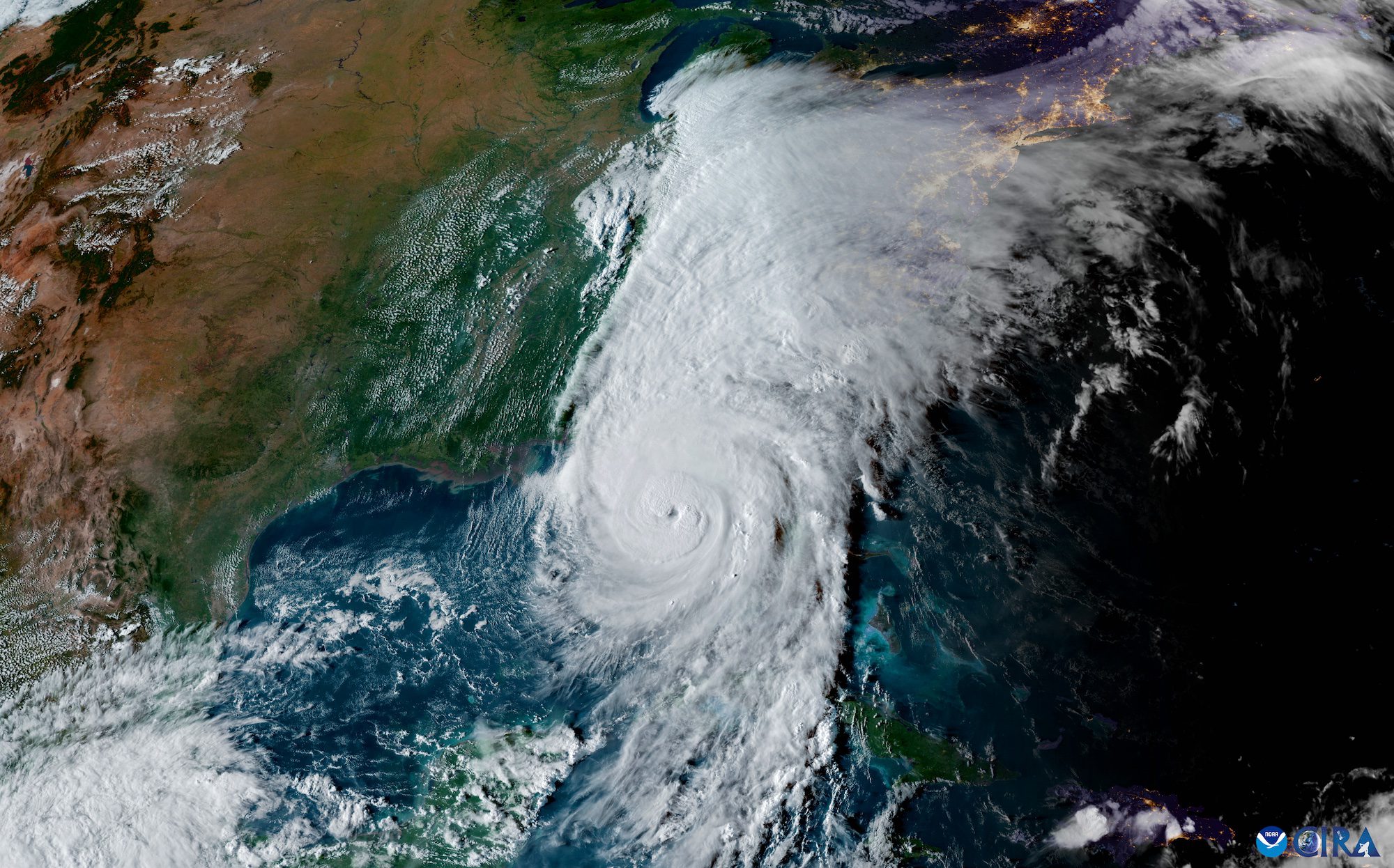
The Saildrone USVs made their hurricane season debut last year when Saildrone and NOAA sent five of the vehicles to the Atlantic Ocean and Gulf of Mexico to help better understand hurricanes’ rapid intensification. One of the drones sailed into the eyewall of Category 4 Hurricane Sam, located approximately 645 miles from Bermuda, where it faced massive 100-foot waves and 140 mph winds to film the first live video footage from inside the eye of a major hurricane in the open ocean.
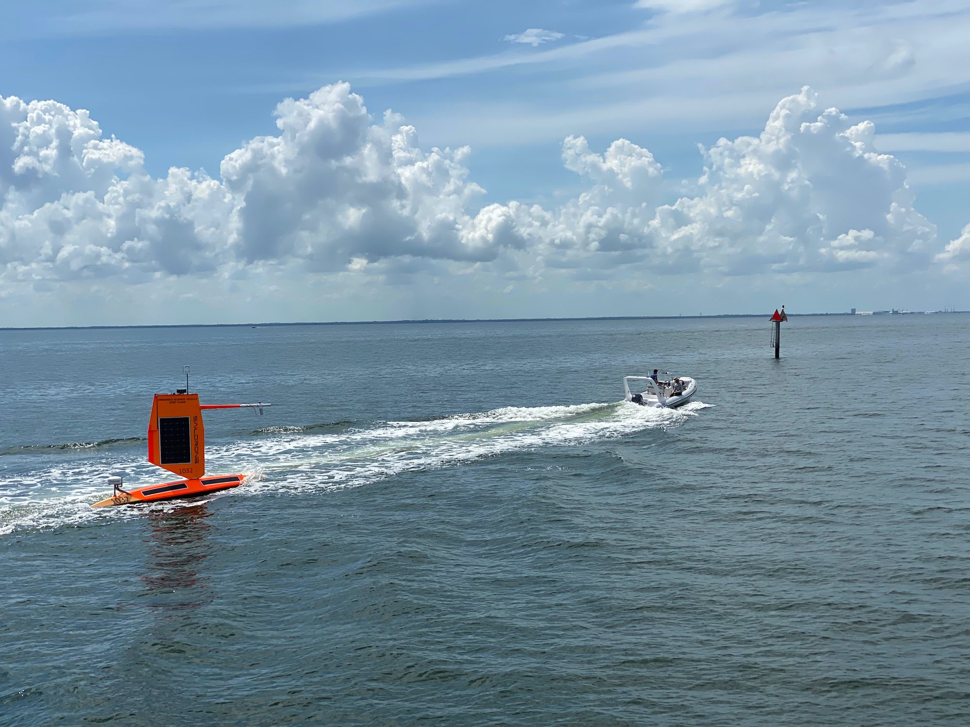
This week, one of the USVs set sail from Saildrone’s Ocean Mapping Headquarters in St. Petersburg, Florida to an operation area in the eastern Gulf of Mexico. Another was deployed from Port Aransas, TX, headed to the Western Gulf.
“We are excited to expand this effort to collect vital data in both the Atlantic and the Gulf of Mexico. We opened our Florida office earlier this year to support exactly this kind of mission, as well as our goal of mapping the entire sea floor around Florida,” said Saildrone CEO Richard Jenkins. “Combining in situ ocean data with a better understanding of the ocean floor, will help us predict both storm intensity and storm surges, keeping our coastal communities safer from these destructive events.”
By Danielle Bochove Jul 24, 2025 (Bloomberg) –The world’s oceans experienced a staggering amount of warming in 2023, as vast marine heat waves affected 96% of their surface, breaking records for intensity, longevity...
By Valerie Volcovici April 11 (Reuters) – The administration of President Donald Trump aims to eliminate the arm of the National Oceanic and Atmospheric Administration that oversees research on climate change and refocus the U.S....
The National Hurricane Center (NHC) achieved unprecedented accuracy in hurricane track forecasting during the 2024 Atlantic hurricane season, according to a preliminary forecast verification review by the National Weather Service....
March 7, 2025
Total Views: 168
Get The Industry’s Go-To News
Subscribe to gCaptain Daily and stay informed with the latest global maritime and offshore news
— just like 104,486 professionals
Secure Your Spot
on the gCaptain Crew
Stay informed with the latest maritime and offshore news, delivered daily straight to your inbox
— trusted by our 104,486 members
Your Gateway to the Maritime World!
Essential news coupled with the finest maritime content sourced from across the globe.

 Join The Club