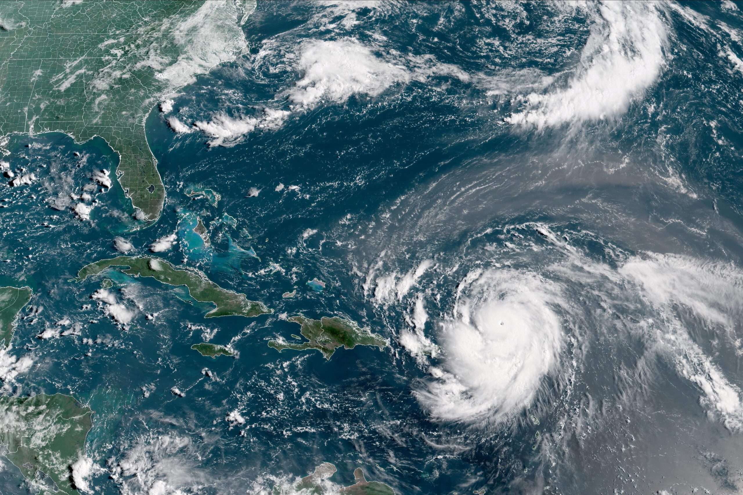
With top winds of 50 miles (80 kilometers) per hour, Arlene became only the sixth tropical system to emerge in the Atlantic in April since geostationary satellites began watching the basin starting in the mid 1960s. It was swallowed up by a larger system in the north Atlantic Friday, a day after it formed, the U.S. National Hurricane Center said.
Unfortunately, for people living along the Atlantic Coast as well as those trading energy and agricultural products, the emergence of Arlene doesn’t say much about how active the hurricane season that begins June 1 will be. When April tropical systems emerged in 1973 and 1992, storm activity was below average. In 1981 and 2003, it was above normal. This year is anyone’s guess.
“It’s a long time from April to peak season — long enough for lots of things to change — so you can’t use an April storm as any reliable harbinger for what to expect later in the year,” said Bob Henson, a meteorologist with Weather Underground, based in Boulder, Colorado.
Meanwhile, an ocean-warming El Nino could emerge in the Pacific later this year, disrupting weather patterns across the Atlantic enough to cut down on the number of storms, Henson said. Changing sea surface temperatures across the Atlantic could also influence storm formation.
In any event, Arlene becomes another entry in the log of weird weather that 2017 has created, including record warm temperatures in February, an explosion of tornado reports across the U.S., floods in Peru and scorching heat across Australia. Tropical storms in April surely emerged before satellite monitoring, but they probably went unnoticed, according to Phil Klotzbach, a hurricane researcher at Colorado State University.
“I would say that the odds of observing a storm like Arlene prior to the satellite era would be quite minimal,” Klotzbach said. “Unless a ship happened to encounter it, we wouldn’t have known it was there.”
By Brian K. Sullivan Aug 16, 2025 (Bloomberg) –Hurricane Erin strengthened on Saturday into a “catastrophic” Category 5 hurricane north of the Caribbean islands, reaching the top of the five-step, Saffir-Simpson...
The National Hurricane Center (NHC) achieved unprecedented accuracy in hurricane track forecasting during the 2024 Atlantic hurricane season, according to a preliminary forecast verification review by the National Weather Service....
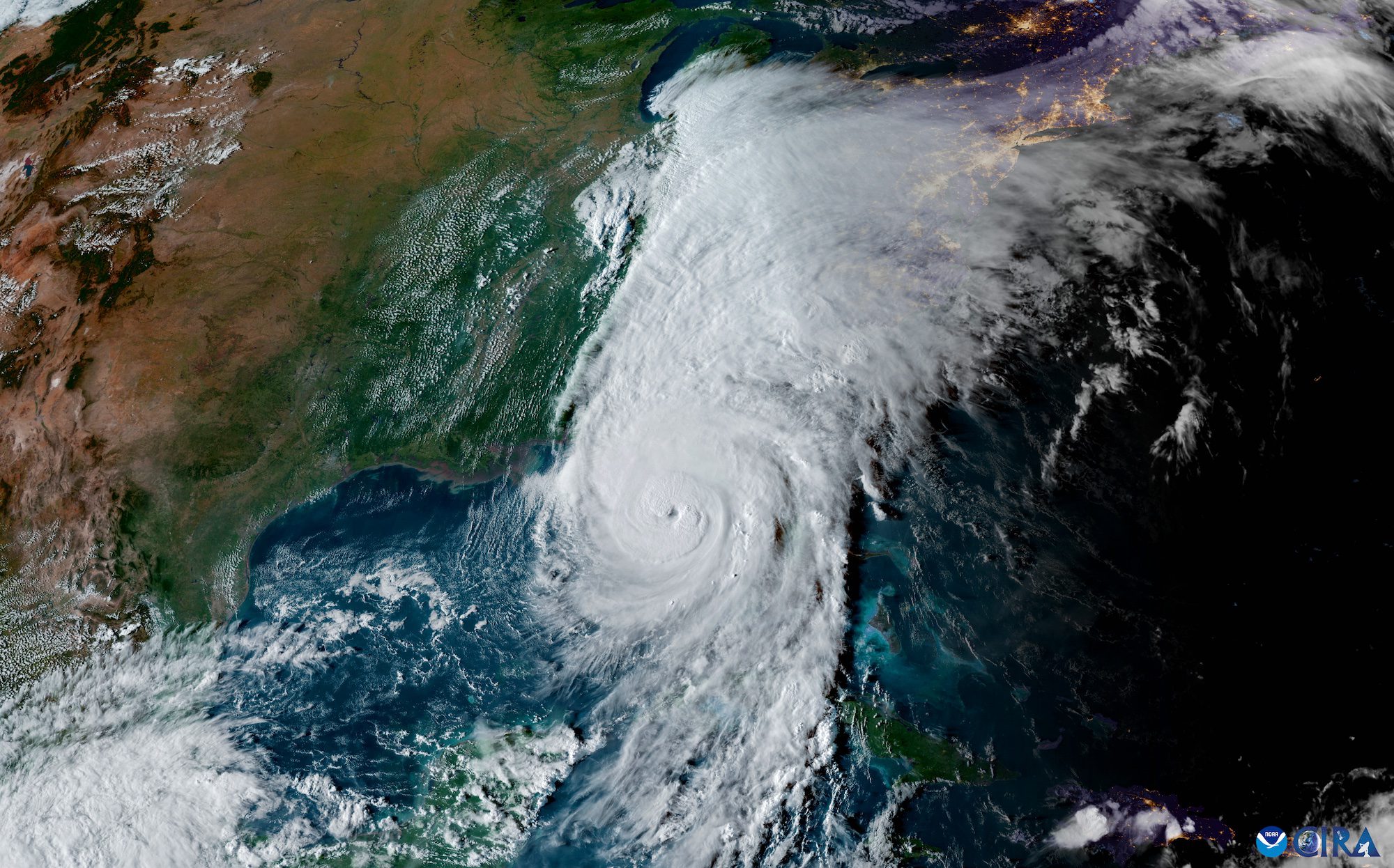
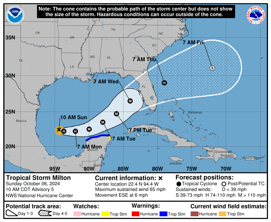
Tropical Storm Milton is rapidly intensifying as it moves across the Gulf of Mexico, prompting major concerns for the west coast of Florida. The National Hurricane Center (NHC) reports that...
October 6, 2024
Total Views: 1989
Get The Industry’s Go-To News
Subscribe to gCaptain Daily and stay informed with the latest global maritime and offshore news
— just like 104,729 professionals
Secure Your Spot
on the gCaptain Crew
Stay informed with the latest maritime and offshore news, delivered daily straight to your inbox
— trusted by our 104,729 members
Your Gateway to the Maritime World!
Essential news coupled with the finest maritime content sourced from across the globe.

 Join The Club