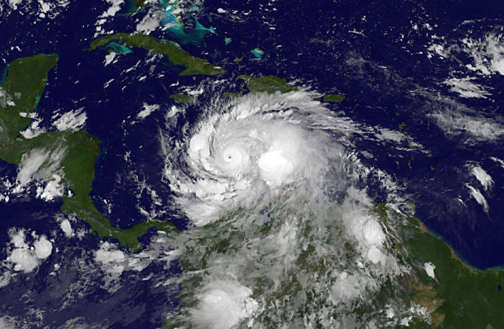
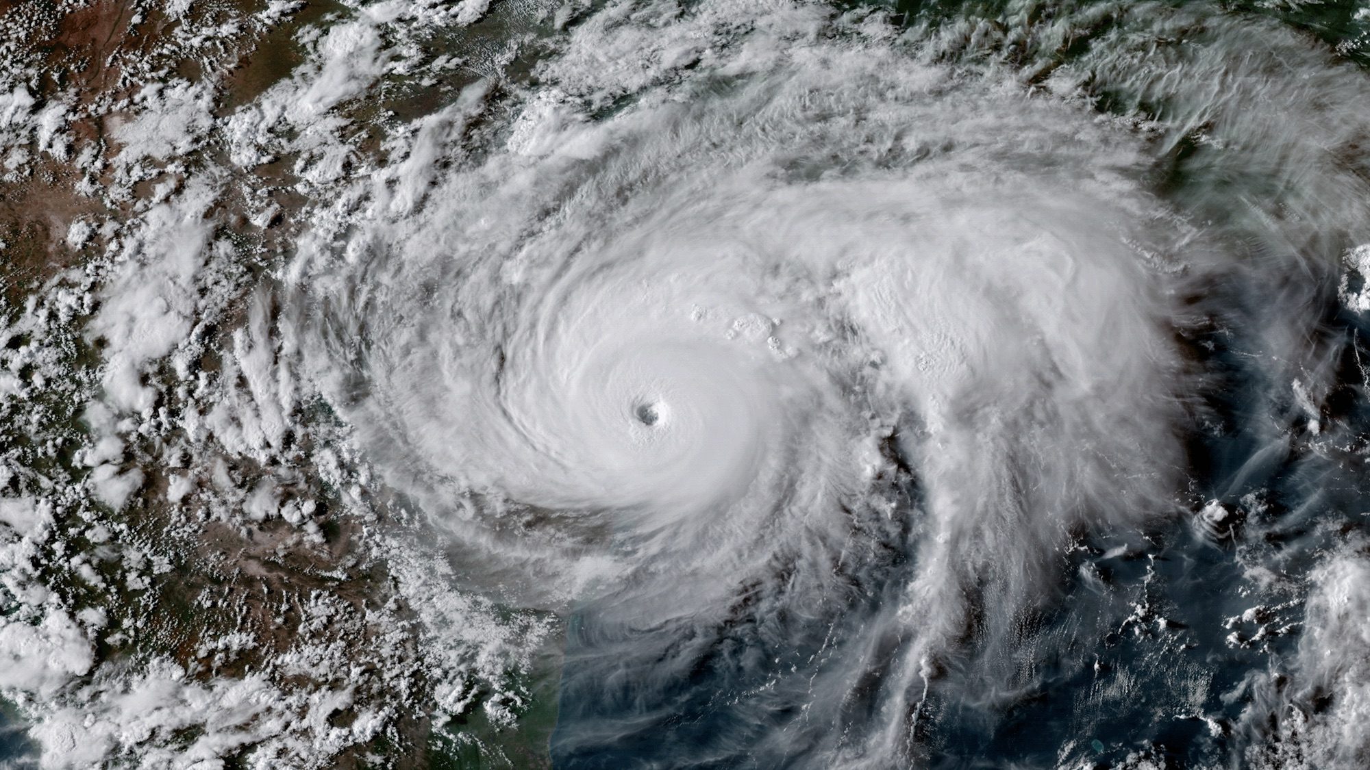
Hurricane Matthew has grown into an intense Category 4 hurricane with max sustained winds of 140 mph as it approaches western Haiti on Monday.
Over the weekend, Mathew actually reached Category 5 status late Saturday before dropping to Category 4 status the next day. A NASA satellite captured this video of the storm developing over the southeastern Caribbean:
A Hurricane Warning is currently in effect for Jamaica; Haiti; Cuban provinces of Guantanamo, Santiago de Cuba, Holguin, Granma, and Las Tunas; and the Southeastern Bahamas, including the Inaguas, Mayaguana, Acklins, Crooked Island, Long Cay, and Ragged Island.
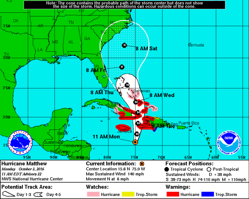
According to the National Hurricane Center, the center of Matthew is forecasted to approach southwestern Haiti Monday night, bringing with it life-threatening rain, wind and storm surge to portions of Haiti.
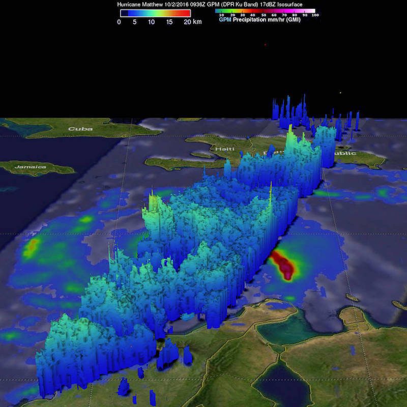
Another NASA satellite showed Matthew was packing heavy rainfall falling at a rate of over 6.4 inches in some areas. In fact some areas may received up 40 inches of rain!
“Heaviest rain was seen well to the east of Hurricane Matthew’s center,” said Hal Pierce of NASA’s Goddard Space Flight Center in Greenbelt, Maryland, who created the image below. “This area of strong convective storms has been persistent over the past few days. This area of intense rainfall is due to convergence between the trade winds (prevailing easterlies) and the wind flow from the south with Matthew. This area of heavy rainfall with Matthew may cause devastating torrential rainfall as it moves slowly over Haiti.” Up to 40 inches (1016 mm) of rainfall have been predicted over Haiti, according to NASA.
The storm is forecasted to move near eastern Cuba late Tuesday, and move near or over portions of the southeastern and central Bahamas Tuesday night and Wednesday.
The latest forecast from the NHC actually shows the eye of Matthew passing over Crooked Island, Bahamas, near where the El Faro sank one year ago during Hurricane Joaquin, by Wednesday morning:
Later this week Matthew will make its way up the southeast coast of the U.S. before models begin to differ on its forecasted track.
By Brian K. Sullivan (Bloomberg) –A tropical storm may loom in the Gulf of Mexico late Wednesday or early on July 11 as a low pressure system moves off Georgia...
By CW4 Michael Carr – Tropical Storm, and potentially Hurricane Barry was heading directly for us. Though still a thousand miles away, which might seem far away, that distance is...
By Eric Roston (Bloomberg) — Forecasters are expecting this year’s North Atlantic hurricane season to be roughly average, with about 14 named storms including six full-fledged hurricanes. Last week, the...
June 11, 2019
Total Views: 98
Get The Industry’s Go-To News
Subscribe to gCaptain Daily and stay informed with the latest global maritime and offshore news
— just like 107,366 professionals
Secure Your Spot
on the gCaptain Crew
Stay informed with the latest maritime and offshore news, delivered daily straight to your inbox
— trusted by our 107,366 members
Your Gateway to the Maritime World!
Essential news coupled with the finest maritime content sourced from across the globe.

 Join The Club