
 Join The Club


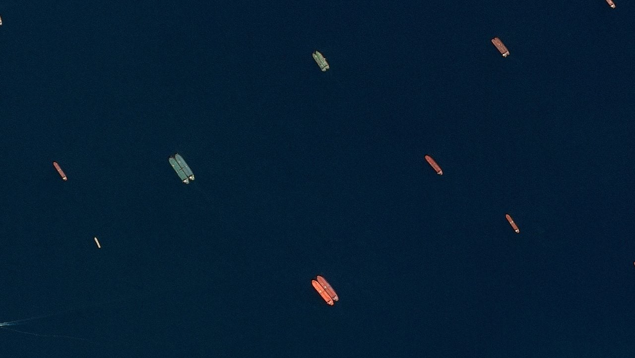
A satellite image of side-by-side ships at sea, off the coast of Sohar, Oman, June 9, 2026. SPOT © CNES 2026, Distribution Airbus DS/Handout via REUTERS
Kpler Expands ‘Dark Fleet’ Tracking With Airbus Satellite Deal
Maritime data provider Kpler has reached an agreement with Airbus to expand its ability to track vessels that disappear from conventional ship-tracking systems, adding daily satellite imagery to help identify ships operating without reliable Automatic Identification System (AIS) signals.
The agreement, announced Tuesday, will integrate imagery from Airbus’s SPOT Earth observation satellites with Kpler’s existing vessel-tracking network, allowing analysts to detect ships independently of their reported AIS positions.
The service will use high-resolution satellite imagery, with a resolution of 1.5 meters and a 60-kilometer swath, combined with artificial intelligence to identify vessels at sea and in port.
The technology is intended to address a growing challenge for maritime tracking: determining whether a vessel has deliberately switched off or manipulated its AIS signal, or whether its reported position has been affected by interference with satellite navigation systems.
That distinction has become increasingly important as AIS spoofing, GPS jamming and other forms of electronic interference complicate vessel tracking in major shipping corridors, particularly around conflict zones.
While some vessels deliberately manipulate their positions to conceal movements, others may report inaccurate locations because of widespread Global Navigation Satellite System (GNSS) interference affecting multiple ships in the same area.
By comparing AIS data with independently captured satellite imagery, Kpler says it can better distinguish between the two.
“No single data source tells the whole story,” said Jean-Charles Gordon, Kpler’s vice president of maritime and logistics.
Gordon said combining AIS information with satellite imagery and other independent sources would give shipping companies and governments a clearer picture of maritime activity, particularly when vessels disappear from electronic tracking systems.
The expanded capability could also prove useful in monitoring sanctions evasion and so-called shadow fleet operations, where vessels sometimes manipulate or disable AIS transmissions to obscure their movements.
In an earlier analysis of AIS spoofing and GNSS interference, Kpler identified the Persian Gulf and Strait of Hormuz, Black Sea, Baltic Sea and Red Sea among the maritime regions affected by navigation-signal interference. The company has also highlighted the importance of distinguishing deliberate AIS manipulation from external interference when assessing sanctions compliance and marine insurance risks.
AIS remains the primary means of tracking commercial shipping, transmitting information including a vessel’s position, speed, course and destination. Kpler says its existing network collects billions of AIS messages daily.
The Airbus partnership adds another source of information that does not depend on those transmissions, potentially allowing analysts to verify a vessel’s actual location even when its electronic track is missing or misleading.
The companies did not disclose financial terms or specify when the expanded detection service would become fully operational.

Subscribe for Daily Maritime Insights
Sign up for gCaptain’s newsletter and never miss an update
— trusted by our 106,597 members
Stay Informed. Stay Connected.
Get The Daily Insights That Power Maritime Professionals Worldwide
Essential maritime and offshore news, insights, and updates delivered daily straight to your inbox
— trusted by our 106,597 members
Have a news tip? Let us know.
Get The Industry’s Go-To News
Subscribe to gCaptain Daily and stay informed with the latest global maritime and offshore news