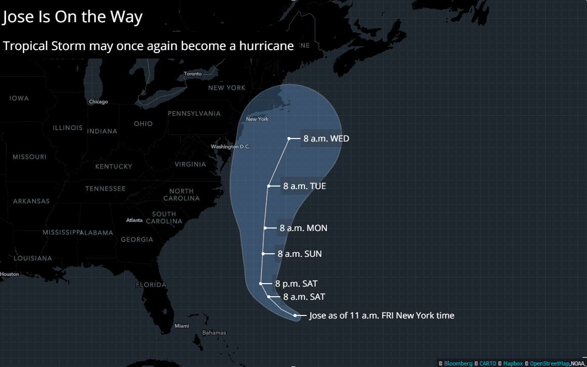
By Emma Ockerman (Bloomberg) Hurricane Jose may threaten New York City and other areas of the East Coast by next week, according to the National Hurricane Center.
The storm, about 480 miles (775 kilometers) south-southeast of Cape Hatteras, North Carolina, strengthened into a Category 1 hurricane late Friday as it churned through the Atlantic Ocean. Jose’s path could put it near New Jersey and New York by Wednesday morning, although it may weaken to a tropical storm again by then, the center said.
The storm may add to an already devastating 2017 Atlantic hurricane season, coming just after Hurricane Harvey inundated Texas and Hurricane Irma raked Florida’s west coast, leaving dozens of people dead and upending energy and agriculture markets. In 2012, Superstorm Sandy created about $70 billion of damage after hitting the New York metropolitan region.
As of noon New York time yesterday, Jose was moving northwest at 9 miles an hour with maximum sustained winds of 80 mph. Little change in strength is forecast during the next two days, the center said. Tropical storm watches could be issued for parts of the U.S. coast, from North Carolina to New England, over the next day or two, according to the advisory, the 45th so far on the long-lived weather system.
Jose could affect five refineries along the East Coast that are able to process about 1.1 million barrels a day of oil, Bloomberg data showed.
If it continues toward New York City, Jose could disrupt vessels carrying crude oil, petrochemicals and refined products along the Atlantic seaboard, “particularly those making deliveries to New York Harbor,” Shunondo Basu, a Bloomberg New Energy Finance meteorologist and natural gas analyst in New York, said on Friday.
Staying Offshore?
Still, some forecasters see Jose staying far enough offshore to avoid any major impact to the U.S. but mariners should stay alert. The hurricane center’s margin of error for a storm five days out is about 225 miles, on average.
AccuWeather Inc. sees the storm passing within 200 miles of the Northeast. Landfall in New England during the middle of the week can’t be ruled out, senior meteorologist Dan Pydynowski said in a statement. If landfall were to occur, the most likely location would be far eastern Long Island or southeastern New England, especially Cape Cod.
There’s an 18 percent chance of tropical storm-force winds in New York City between Tuesday and Wednesday, said Jeff Masters, co-founder of Weather Underground in Ann Arbor, Michigan.
If Jose continues on its path, the most immediate impact could be tall, swelling waves “pounding the coasts” until at least Wednesday, Masters said.
Category one hurricane Norma, meanwhile, remains stationary about 250 miles south of the popular tourist destination of Cabo San Lucas, Mexico, and is forecast to start moving slowly north later on Saturday. Tropical storm warnings and watches are in effect, with heavy rains likely and maximum sustained winds of about 75 miles per hour.
As the busy 2017 hurricane season continues, a depression west of the Cabo Verde Islands in the central Atlantic Ocean strengthened into Tropical Storm Lee, the NHC said. Lee is forecast to move slowly west or west-northwest for a few days.
Meanwhile, storm watches were issued for parts of the Caribbean islands of St. Lucia, Martinique, Guadeloupe and Dominica from a system that may become a tropical cyclone.
Tags:
Subscribe for Daily Maritime Insights
Sign up for gCaptain’s newsletter and never miss an update
By Neil Jerome Morales Nov 9, 2025 (Bloomberg) –Super typhoon Fung-Wong hit the Philippines’ northeast late on Sunday with 185 kilometers per hour (115 miles per hour) winds and gusts of...
By Brian K. Sullivan and Scott Squires Oct 26, 2025 (Bloomberg) –Storm Melissa exploded in strength overnight, barreling toward an expected landfall Tuesday on Jamaica as a major hurricane and threatening...
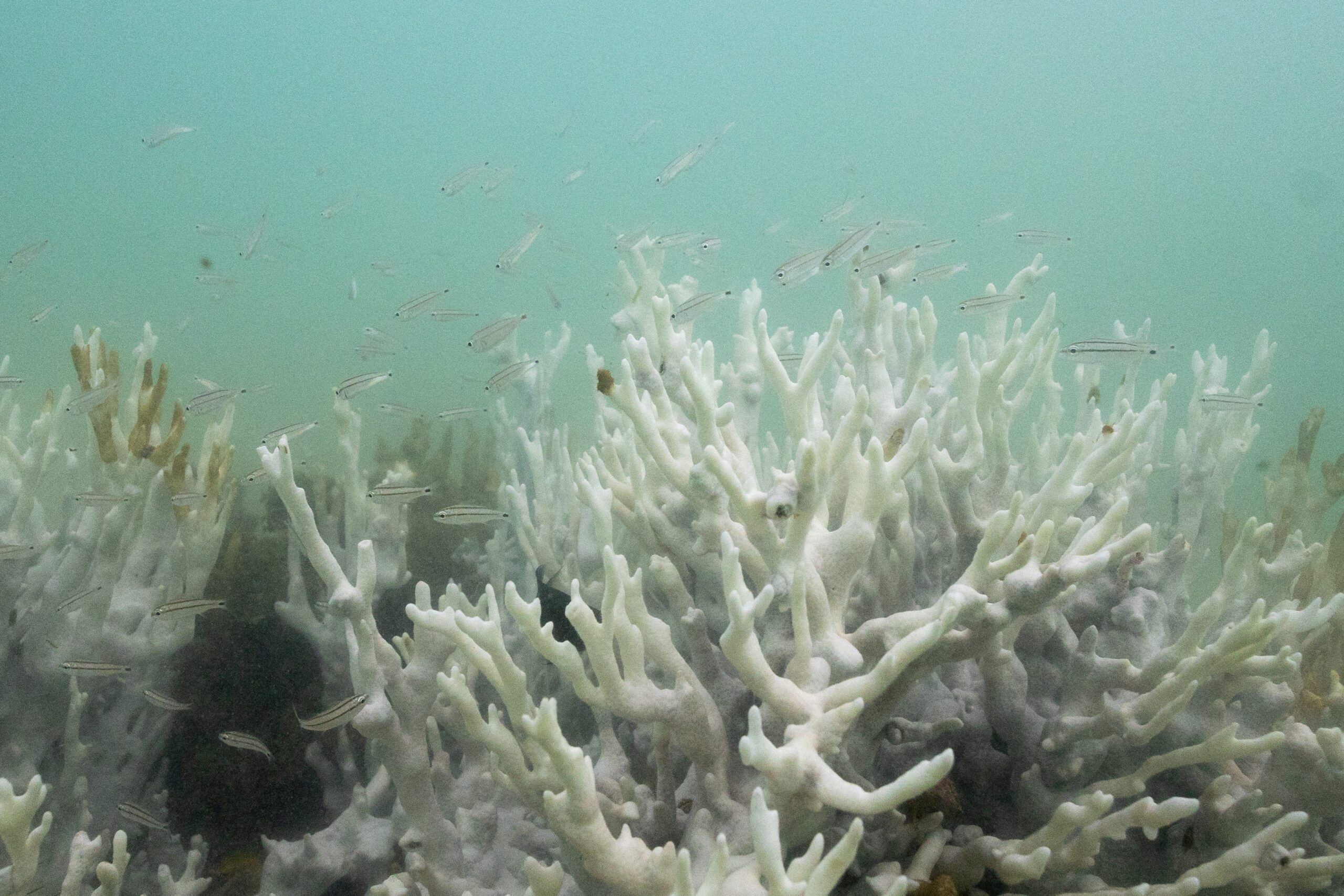
By Alison Withers COPENHAGEN, Oct 13 (Reuters) – Global warming is crossing dangerous thresholds sooner than expected with the world’s coral reefs now in an almost irreversible die-off, marking what scientists on...
October 12, 2025
Total Views: 1017
Get The Industry’s Go-To News
Subscribe to gCaptain Daily and stay informed with the latest global maritime and offshore news
— just like 107,038 professionals
Secure Your Spot
on the gCaptain Crew
Stay informed with the latest maritime and offshore news, delivered daily straight to your inbox
— trusted by our 107,038 members
Your Gateway to the Maritime World!
Essential news coupled with the finest maritime content sourced from across the globe.

 Join The Club