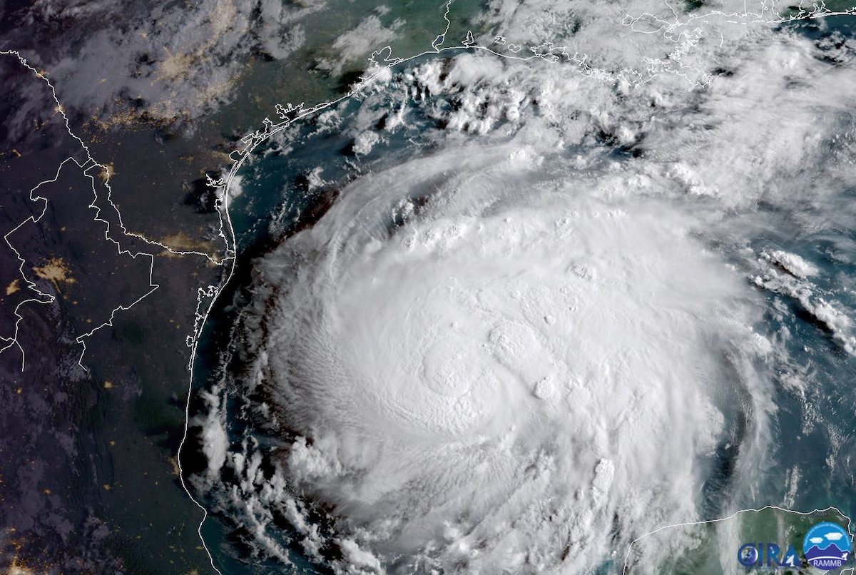
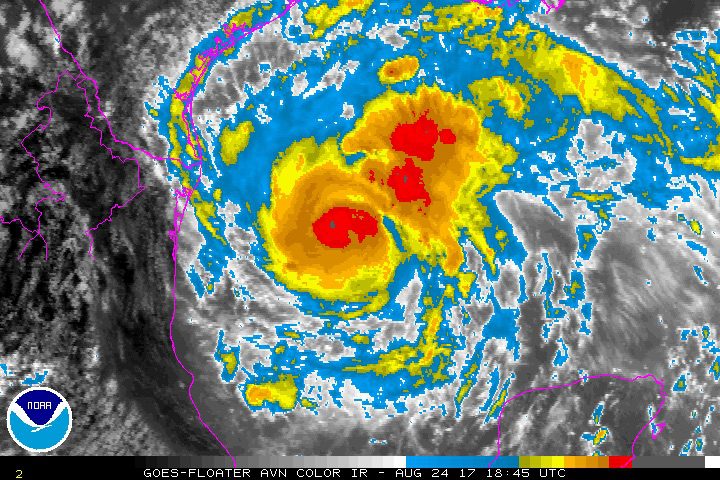
Hurricane Harvey is seen in the Texas Gulf Coast, U.S., in this NOAA GOES satellite image on August 24, 2017. NOAA/Handout via Reuters
Offshore oil and gas operators in the Gulf of Mexico are evacuating platforms and rigs in preparation for Hurricane Harvey, which is forecast to make landfall along the mid-Texas coast late Friday night as a major hurricane.
The National Hurricane Center reported Thursday that Harvey, now a hurricane, is rapidly intensifying as it approaches the middle Texas coast. Harvey is expected to become a major hurricane by Friday.
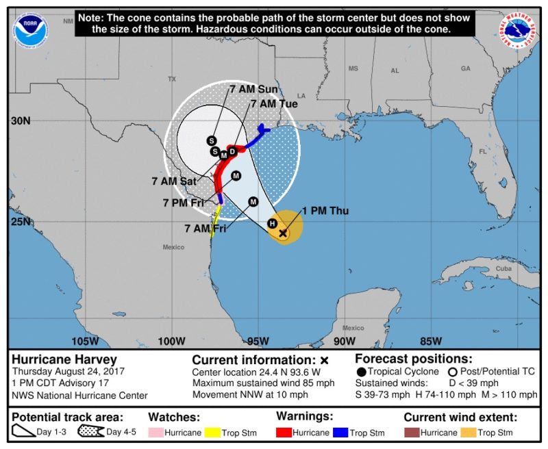
As of 1 p.m. CDT on Thursday, the NHC tracked the eye of Hurricane Harvey was located about 335 miles southeast of Corpus Christi, Texas with maximum sustained winds of 85 mph. Harvey is moving towards the north-northwest near 10 mph, but is expected to turn towards the northwest later Thursday.
On the forecast track, Harvey will approach the middle Texas coast on Friday and make landfall Friday night or early Saturday, according to the NHC. It is forecast to make landfall as a major hurricane (wind speed greater than 110 MPH), the NHC said.
Once over land, the NHC said Harvey’s forward speed is forecast to slow down during the next couple of days.
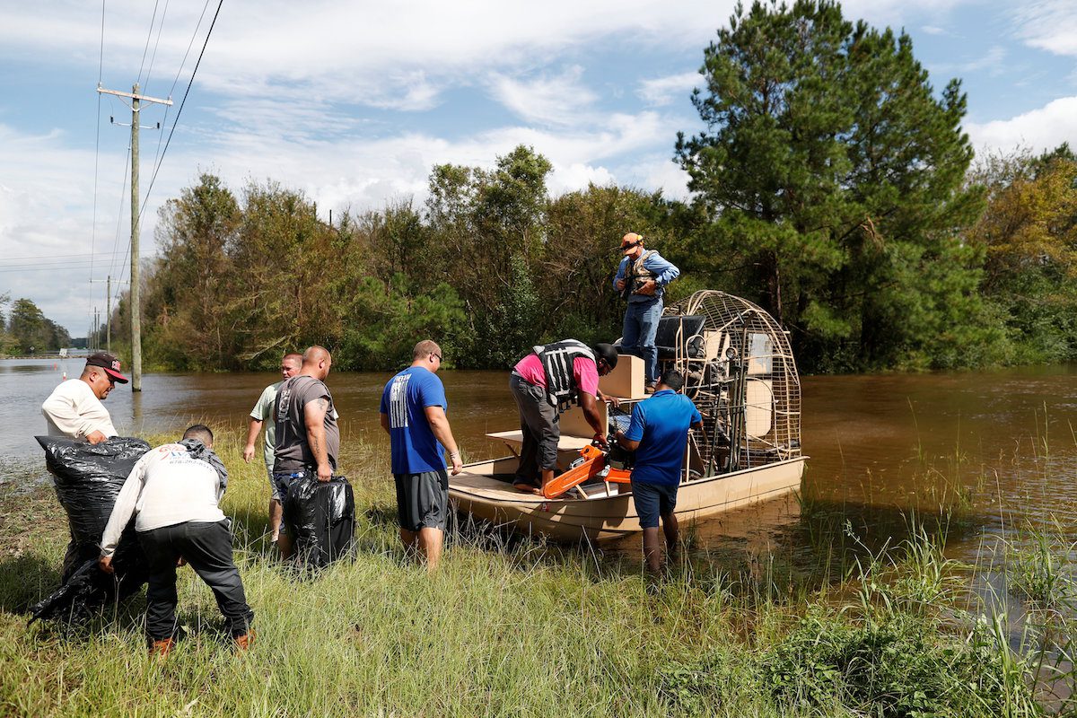
Harvey is expected to produce total rain accumulations of 12 to 20 inches and isolated maximum amounts of 30 inches over the middle and upper Texas coast through next Wednesday, likely to cause life-threatening flooding.
Storm surge is forecasted to max out at 12 feet from the north entrance to Padre Island National Seashore near Corpus Christi all the way up to Sargent, Texas, the NHC predicts.
The NHC say Hurricane conditions are likely within the hurricane warning area late Friday or Friday night, with tropical storm conditions expected to first reach the coast in the hurricane warning area Friday.
In the Gulf of Mexico, the Bureau of Safety and Environmental Enforcement (BSEE) says it has activated its Hurricane Response Team, which is monitoring the operators’ activities.
As of 11 a.m. CDT, workers have been evacuated from 39 production platforms and 1 rig, representing 5.29% and 10% of the manned platforms and rigs in the GoM, respectively. No DP rigs have had to move off location.
The BSEE estimates that, based on operators’ reports, approximately 9.56 percent of the current oil production in the Gulf of Mexico has been shut-in, equating to 167,231 barrels of oil per day. Approximately 0.04 percent of the natural gas production, or 1,135 million cubic feet per day, has also been shut-in.
Current Watches and Warnings (1 p.m. CDT Thursday)
A Storm Surge Warning is in effect for…
* Port Mansfield to High Island Texas
A Storm Surge Watch is in effect for…
* South of Port Mansfield Texas to the Mouth of the Rio Grande
A Hurricane Warning is in effect for…
* Port Mansfield to Matagorda Texas
A Tropical Storm Warning is in effect for…
* North of Matagorda to High Island Texas
* South of Port Mansfield Texas to the Mouth of the Rio Grande
A Hurricane Watch is in effect for…
* South of Port Mansfield Texas to the Mouth of the Rio Grande
A Tropical Storm Watch is in effect for…
* South of the Mouth of the Rio Grande to Boca de Catan Mexico
Editorial Standards · Corrections · About gCaptain

 Join The Club