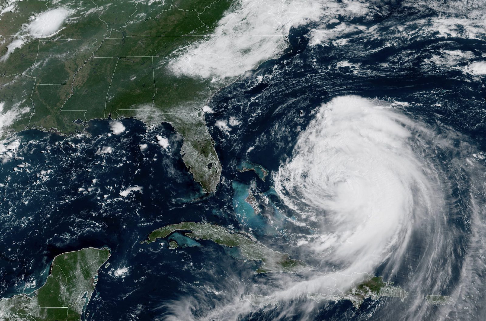
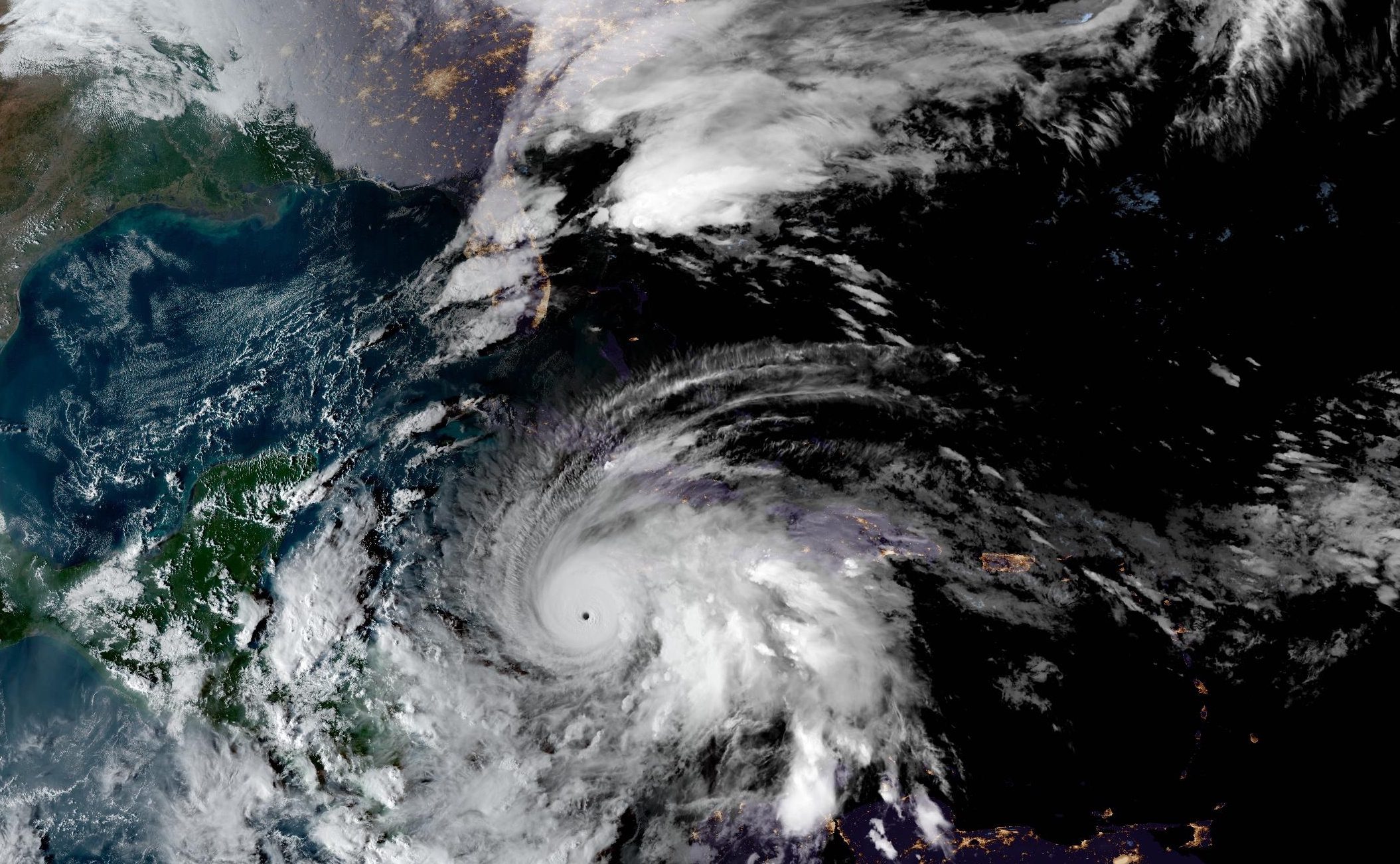
Hurricane Erin is generating dangerous sea conditions across the western Atlantic with forecasted significant wave heights reaching extreme levels as the storm moves between the U.S. East Coast and Bermuda.
According to the latest National Hurricane Center advisory, Erin is currently located about 690 miles SSE of Cape Hatteras, North Carolina, with maximum sustained winds of 105 mph. The large hurricane has hurricane-force winds extending outward up to 80 miles from its center and tropical-storm-force winds reaching out to 205 miles.
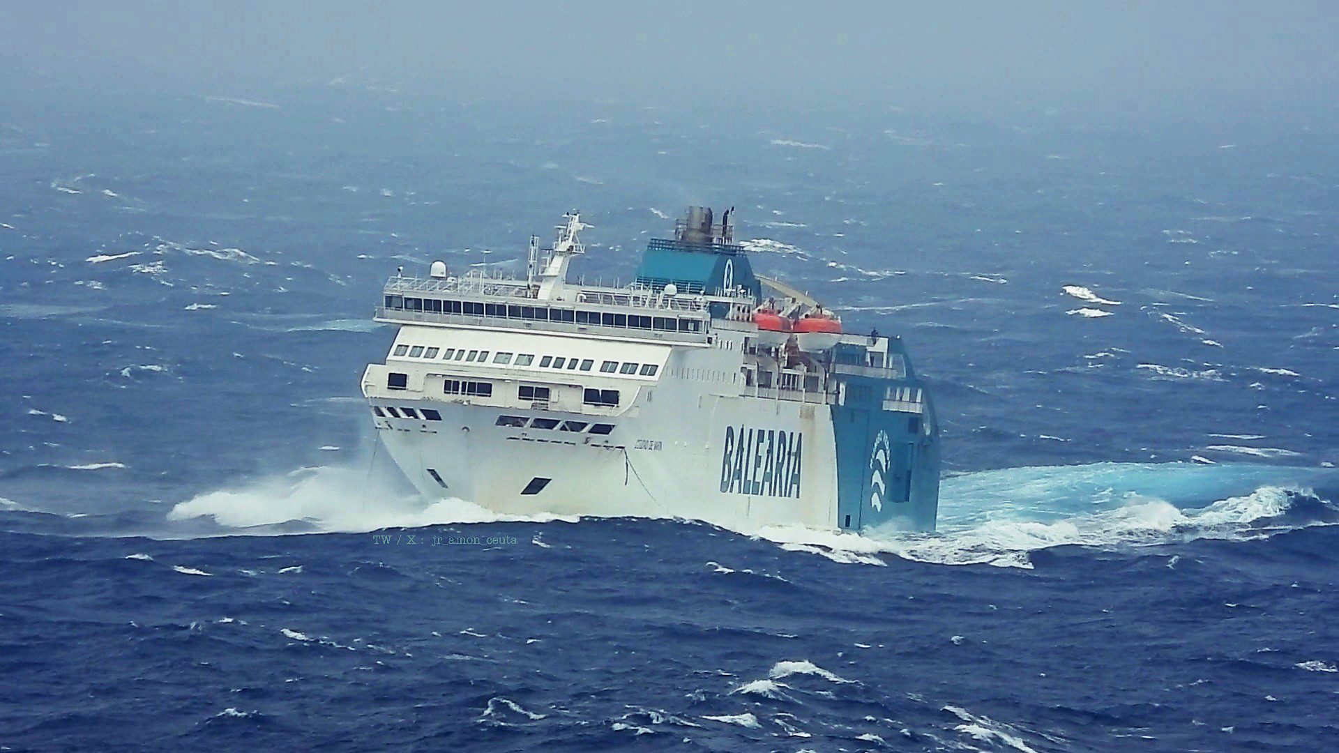
Maritime forecasts predict seas will reach exceptional heights in the coming days. “Seas 4 meters or greater within 360 NM NE quadrant…420 NM SE quadrant…420 NM SW quadrant…and 300 NM NW quadrant with seas to 14.5 meters,” states the 48-hour forecast for waters north of 31N.
For Atlantic waters from 07N to 31N west of 35W, conditions are expected to be even more severe, with the 48-hour forecast indicating “seas to 16 meters”, or 53 feet, within 330 NM of the southern semicircle of the hurricane.
The National Hurricane Center emphasizes that “individual waves may be more than twice the significant wave height,” suggesting potential maximum wave heights could exceed 30 meters in some areas.
Mariners should exercise extreme caution as Erin moves northward today, followed by a northeastward motion on Thursday. On the forecast track, the center will pass between the U.S. east coast and Bermuda on Wednesday and Thursday.
The National Weather Service has issued Storm Surge and Tropical Storm warnings for the North Carolina Outer Banks, with tropical storm conditions expected to begin late Wednesday or Wednesday night.
Forecasters note that “swells generated by Erin will affect the Bahamas, Bermuda, the east coast of the United States, and Atlantic Canada during the next several days,” creating “life-threatening surf and rip currents” throughout the region.
Mariners should consult the latest forecasts before venturing offshore, as the NHC cautions that “forecast winds in and near active tropical cyclones should be used with caution due to uncertainty in forecast track, size, and intensity.”
Editorial Standards · Corrections · About gCaptain

 Join The Club