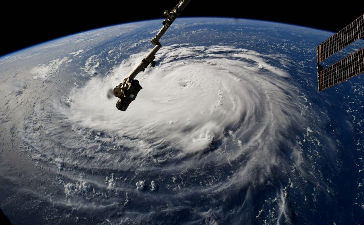
FILE PHOTO: Hurricane Florence is seen from the International Space Station as it churns in the Atlantic Ocean towards the east coast of the United States, September 10, 2018. NASA/Handout via REUTERS/File Photo
By Brian K. Sullivan (Bloomberg) –After a frenzied start, the Atlantic hurricane season could turn out to be the most active since 2005, when a record 28 storms formed.
Colorado State University has raised its annual forecast to call for 20 named storms, up from its outlook issued in June calling for 19. Five tropical storms have already spun out of the western Atlantic this year, with two hitting the U.S. so far. This is the fastest start in the record books dating to 1851 and, while the storms have been weak and short-lived, most forecasters see ominous signs for the rest of the season that ends Nov. 30.
“Overall, it’s looking like a very active season in store,” said Phil Klotzbach, a hurricane researcher with Colorado State University. “Conditions in the Atlantic look conducive for an active season with warm sea surface temperatures and relatively low shear.”
Klotzbach anticipates a total of 20 named storms this season, with each getting a name when its winds reach tropical-storm strength of 39 miles (63 kilometers) per hour. He forecasts nine hurricanes, four of which will reach winds of 111 mph or more. An average season produces 12 systems of tropical-storm strength or greater in the Atlantic. But warm water, which fuels hurricanes, is building.
Last year 18 named storms formed in the Atlantic.
Gulf Coast Risk
With no brake on the number of storms, the possibility a major hurricane will hit the U.S. coastline or the oil-rich Gulf of Mexico has also risen. Colorado State’s forecast says there is a 69% chance a major hurricane will hit the U.S. coast, higher than the 20th-century average of 52%. Along the Gulf Coast, the odds of a strike between Brownsville, Texas, and the Florida panhandle are 44%, higher than the 30% 20th-century average.
So far this year, Tropical Storms Bertha and Cristobal struck the U.S. While weak, Cristobal’s path through offshore energy production areas temporarily shut 34% of crude oil output and 32% of natural gas production. The Gulf accounts for 16% of U.S. crude production and 2.4% of its natural gas output.
A potential for a La Nina in the Pacific could also make the season ripe for storms. While La Nina would be on the other side of the globe, the changes it brings to the earth’s weather will cut wind shear across the Atlantic. Shear, when winds blow at different directions or speeds, can tear a storm’s structure apart, weakening or destroying it.
Another ominous sign is that two storms, Dolly and Edouard, formed deep in the North Atlantic, which is atypical.
“It is unusual to see so many early season storms go as far to the north, which reflects the fact that ocean temperatures are at near-record warm levels across much of the Atlantic, ” said Jeff Masters, a meteorologist for Yale Climate Connections.
Record Warmth
Through May, world ocean and land temperatures are second-warmest on record, lagging only 2016, according to the National Centers for Environmental Information. Oceans in the Northern Hemisphere were record warm in May.
“We’re getting into the hottest part of the year and it is going to get hotter,” said Jim Rouiller, lead meteorologist at the Energy Weather Group LLC.
In addition to the warm ocean temperatures and low wind shear across the Atlantic, there are a lot of storms causing flooding across Africa, Rouiller said. African storms provide the building blocks for hurricanes as they move west into the Atlantic during the heart of the season, which runs from about Aug. 20 to Oct. 1.
The rains will also keep dry air and dust from wandering into the Atlantic, Rouiller said. Last month, two large plumes of dust and dry air spread from Africa to the U.S., which helped stymie storms in the Atlantic for a time.
“This is going to be a Roman candle effect for storms shooting off the African continent,” Rouiller said. “A very active season is exactly what it looks like.”
© 2020 Bloomberg L.P
Editorial Standards · Corrections · About gCaptain
This article contains reporting from Reuters, published under license.

 Join The Club