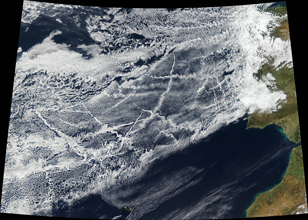
The above satellite image was captured on by a NASA satellite on January 16, 2018 and shows criss-crossing cloud bands caused by ships in the eastern Atlantic Ocean off Spain and Portugal.
Although the white trails look vaguely like contrails left behind by airplanes, they actually result from ship exhaust.
The narrow clouds, known as ship tracks, form when water vapor condenses around microscopic pollution particles that ships emit as exhaust. Due to smaller and more abundant particles than those of the surrounding clouds, the ship trails typically are brighter and thicker in appearance and with easily defined boundaries.
NASA says these sort of ship tracks typically form when low-lying stratus and cumulus clouds are present.
Some of the clouds in the image stretch hundreds of miles from end to end, with the narrow ends being youngest (closest to the ship), while the broader, wavier ends are older.
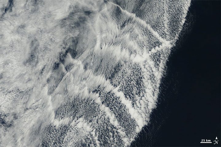
NASA captured a similar image over the eastern Pacific Ocean in early October 2009:
A bank of clouds off North America’s west coast shows a series of white ship tracks captured on October 5, 2009.
“Some of the pollution particles generated by ships (especially sulfates) are soluble in water and serve as the seeds around which cloud droplets form. Clouds infused with ship exhaust have more and smaller droplets than unpolluted clouds. As a result, the light hitting the polluted clouds scatters in many directions, making them appear brighter and thicker than unpolluted marine clouds, which are typically seeded by larger, naturally occurring particles such as sea salt,” according to NASA.
These natural-color images were captured by the Moderate Resolution Imaging Spectroradiometer (MODIS) instrument aboard the Aqua satellite launched in 2002.
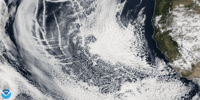
Update: A new NASA satellite image taken February 12, 2018, shows ship tracks off the U.S. west coast.
By Salvatore R. Mercogliano – As we celebrate the fiftieth anniversary of mankind’s first steps upon the lunar surface, many have focused their attention to the heavens, but a key...
The U.S. Master of P&O operated cruise ship “Azura” is currently facing unprecedented charges brought against him by French prosecutors for the violation of European pollution limits. Master Evans Hoyt potentially...
The world’s first large-scale ocean cleanup system was launched from San Francisco over the weekend to a location offshore California where it will undergo testing before its deployment to the...
September 10, 2018
Total Views: 120
Get The Industry’s Go-To News
Subscribe to gCaptain Daily and stay informed with the latest global maritime and offshore news
— just like 105,765 professionals
Secure Your Spot
on the gCaptain Crew
Stay informed with the latest maritime and offshore news, delivered daily straight to your inbox
— trusted by our 105,765 members
Your Gateway to the Maritime World!
Essential news coupled with the finest maritime content sourced from across the globe.

 Join The Club