Update: Hurricane Lee is now category 5 with sustained winds of 155 mph. Get the latest on Lee at Hurricanes.gov.
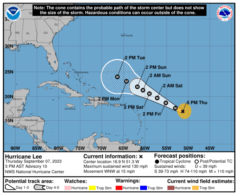
Hurricane Lee has rapidly intensified into a category 4 storm over the Central Atlantic with maximum sustained winds of 130 mph, the NWS National Hurricane said in a 5 p.m. AST update on Thursday.
Additional strengthening is expected tonight and hurricane models are forecasting that Lee will become a category 5 hurricane at some point in the next day or so. The NHC is forecasting Lee will reach maximum intensity within the next day with sustained winds topping out at 165 mph.
On the forecast track, the core of Lee will move north of the northern Leeward Islands during the next several days. Some fluctuations in intensity are expected, but Lee is expected to remain a powerful major hurricane well into next week.
Currently there are no coastal watches or warnings, but the National Hurricane Center said interests in the northern Leeward Islands should continue to monitor the storm.
At 5 p.m. AST , the clear eye of Hurricane Lee, with an estimated minimum central pressure of 953 mb, was located near latitude 16.9 North, longitude 51.3 West, moving toward the west-northwest near 15 mph. Hurricane-force winds extend outward up to 30 miles from the center, while tropical-storm-force winds extend outward up to 140 miles.
An Air Force Reserve Hurricane Hunter aircraft is scheduled to investigate Lee tonight, which should provide much-needed data to better evaluate the hurricane’s intensity.
Confidence remains high in the track for Lee, with almost no change made to the NHC track forecast. Lee should continue moving west-northwestward along the southern edge of the subtropical ridge for the next 5 days. The ridge is forecast to weaken by early next week, causing Lee to slow down, but any potential northward turn and specific impacts beyond a week are uncertain.
The biggest risk from Lee during the next 5 days will be high seas and dangerous surf. Rip currents and hazardous surf will spread across the northern Caribbean by Friday and begin impacting the U.S. mainland by Sunday.
Below you will find the NHC’s Tropical Analysis and Forecast Branch’s Tropical Atlantic Marine Weather Briefing for today, Thursday, September 7, which details the main hazards related to Hurricane Lee and Tropical Storm Margot, which has just formed in the eastern Atlantic.
By Brian K. Sullivan and Scott Squires Oct 26, 2025 (Bloomberg) –Storm Melissa exploded in strength overnight, barreling toward an expected landfall Tuesday on Jamaica as a major hurricane and threatening...
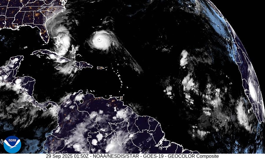
By Brian K. Sullivan Sep 28, 2025 (Bloomberg) –Two Atlantic storms are forecast to swerve away from the US East Coast and spare the shoreline a direct hit, but may bring...
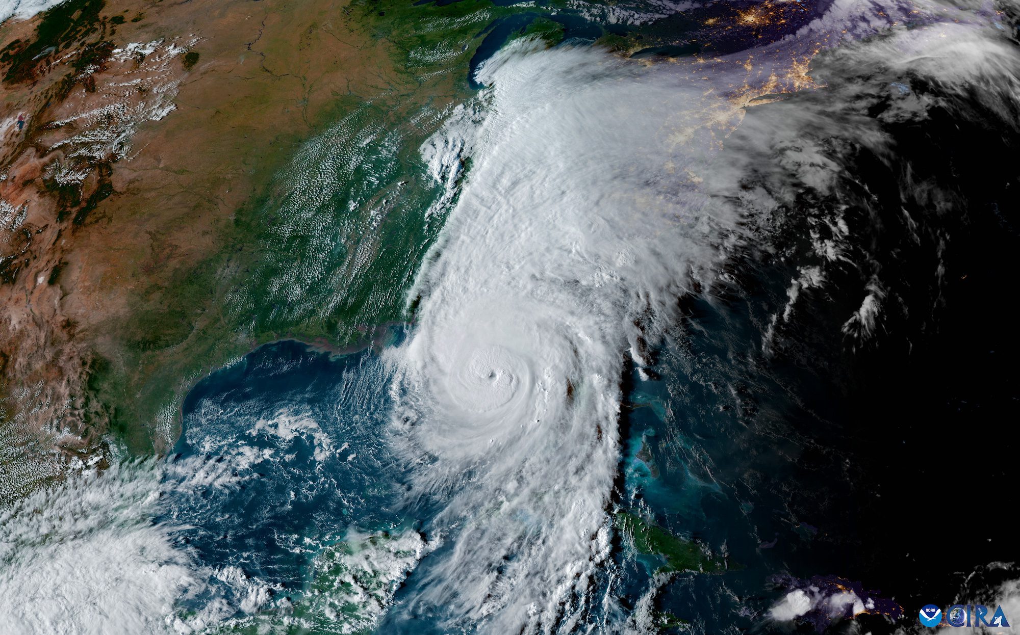
The 2024 Atlantic hurricane season is drawing to a close on November 30, marking a year of extraordinary storm activity that defied typical patterns. With 18 named storms, including 11...
November 25, 2024
Total Views: 1118
Get The Industry’s Go-To News
Subscribe to gCaptain Daily and stay informed with the latest global maritime and offshore news
— just like 104,453 professionals
Secure Your Spot
on the gCaptain Crew
Stay informed with the latest maritime and offshore news, delivered daily straight to your inbox
— trusted by our 104,453 members
Your Gateway to the Maritime World!
Essential news coupled with the finest maritime content sourced from across the globe.

 Join The Club