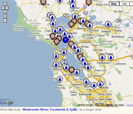
The interactive map, shown above, was released by the California State Water Resource Control Board and serves to inform the public by plotting the locations and details of any wastewater spills in California. The State Water Resource Control Board tells us:
These interactive geographic information system (GIS) maps, updated nightly, plot all certified sanitary sewer overflows (SSOs) and Private Lateral Sewage Discharges from sanitary sewer collection systems (not including any spills from wastewater (sewage) treatment plants), reported by agencies into the state’s online California Integrated Water Quality System. This includes the spill location, amount, source, and name of the responsible or reporting agency.
Thanks to gCaptain forum member Domer, for bringing this to gCaptain’s attention via the forum. The map was accompanied by the following statement from Domer.
California now has a new google map that tracks spills in the San Francisco Bay. It’s mostly for wastewater but how long before this map starts plotting maritime oil spills worldwide? Considering the number of environmentalists out there maybe that should be included in the next version of gTrax  ?
?
There’s a thought, Domer…
To view the SSO Incident Map go to: http://www.waterboards.ca.gov/water_issues/programs/sso/sso_map/sso_pub.shtml.
Image above via Treehugger.com
Updated: February 5, 2026 (Originally published January 5, 2010)
Editorial Standards · Corrections · About gCaptain

 Join The Club


