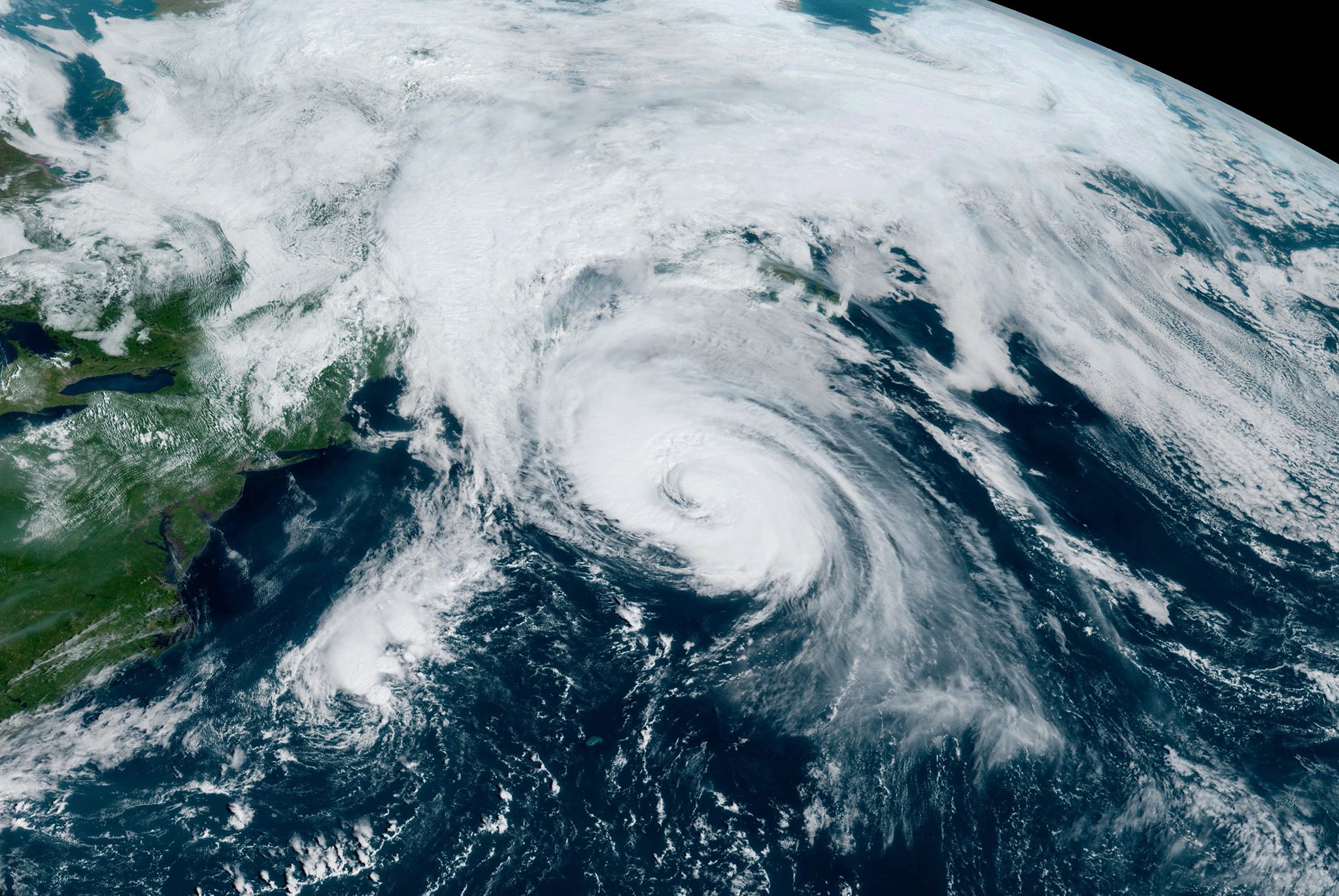
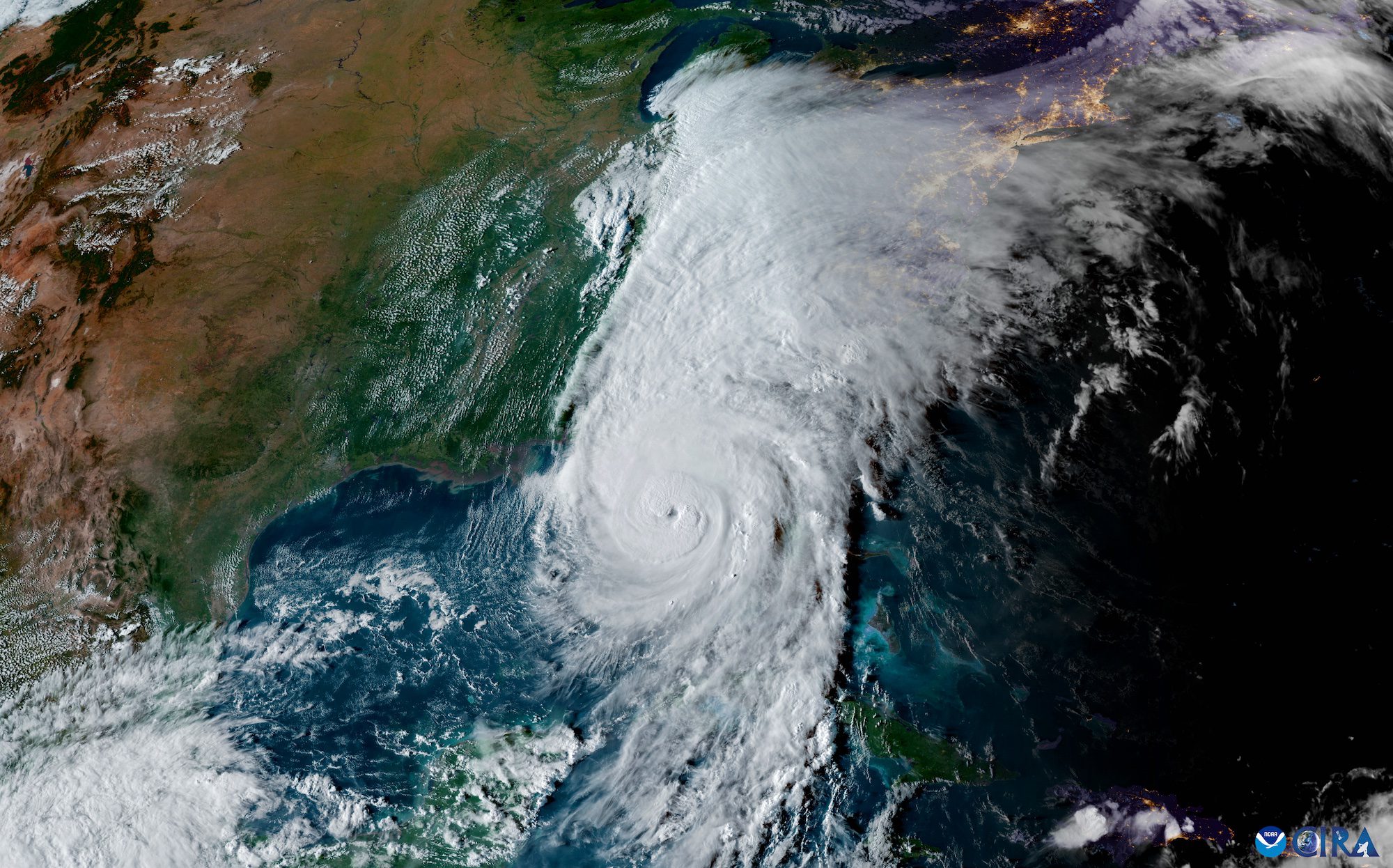
Hurricane Larry is continuing to produce significant wave heights of 47 feet as it moves quickly towards eastern Newfoundland.
At 11 a.m. AST, the center of Hurricane Larry was located over the Atlantic Ocean about 595 miles (9550 km) southwest of Cape Race, Newfoundland. The storm is moving quickly toward the north-northeast near 29 mph with faster north-northeast to northeast motion expected during the next day or two. On the forecast track, the center of Larry will pass well southeast of Nova Scotia today, and move over southeastern Newfoundland Friday night.
Maximum sustained winds are near 80 mph (130 km/h) with higher gusts. Hurricane-force winds extend outward up to 90 miles (150 km) from the center and tropical-storm-force winds extend outward up to 240 miles (390 km). The estimated minimum central pressure is 971 mb (28.68 inches).
Little change in strength is expected before landfall in Newfoundland.
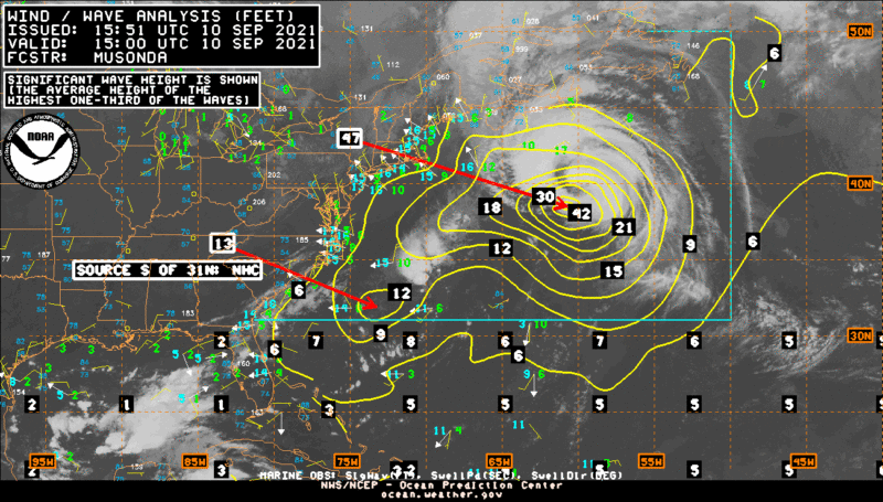
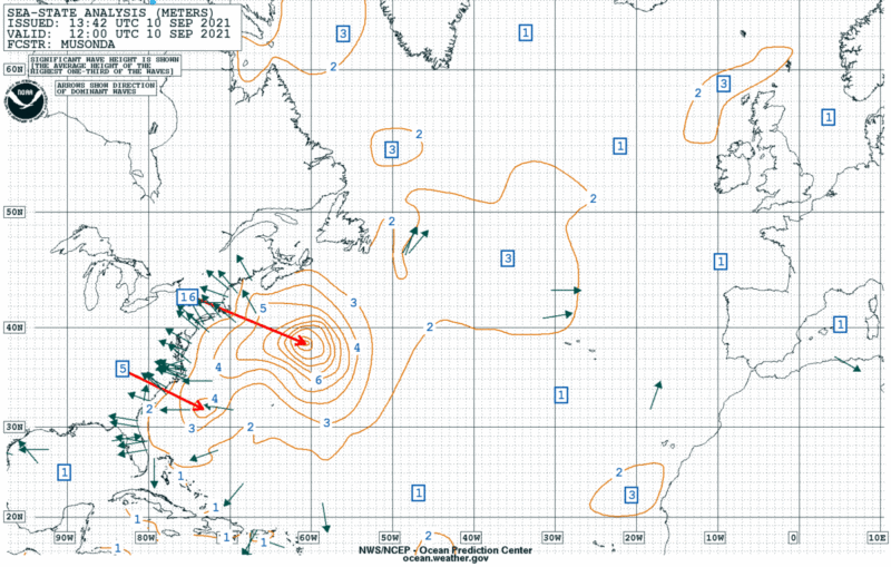
Significant wave heights today, defined by the average of the top third highest waves, could hit heights of up to 16 meters (52 feet), according to forecasts. Individual waves could be much higher.
Swells generated by Larry will continue to affect the Bahamas on Friday. Significant swells from Larry will continue affecting Bermuda, the east coast of the United States, and Atlantic Canada through Saturday night. “These swells are likely to cause life-threatening surf and rip current conditions,” the NWS National Hurricane Center said in its 11 a.m. AST update.
Wind and Wave Analysis (Observed). Updated: Fri, 10-Sep-2021 07:06:52 UTCSea State Analysis. Updated: Fri, 10-Sep-2021 13:43:57 UTC
By Brian K. Sullivan Aug 16, 2025 (Bloomberg) –Hurricane Erin strengthened on Saturday into a “catastrophic” Category 5 hurricane north of the Caribbean islands, reaching the top of the five-step, Saffir-Simpson...
The National Hurricane Center (NHC) achieved unprecedented accuracy in hurricane track forecasting during the 2024 Atlantic hurricane season, according to a preliminary forecast verification review by the National Weather Service....
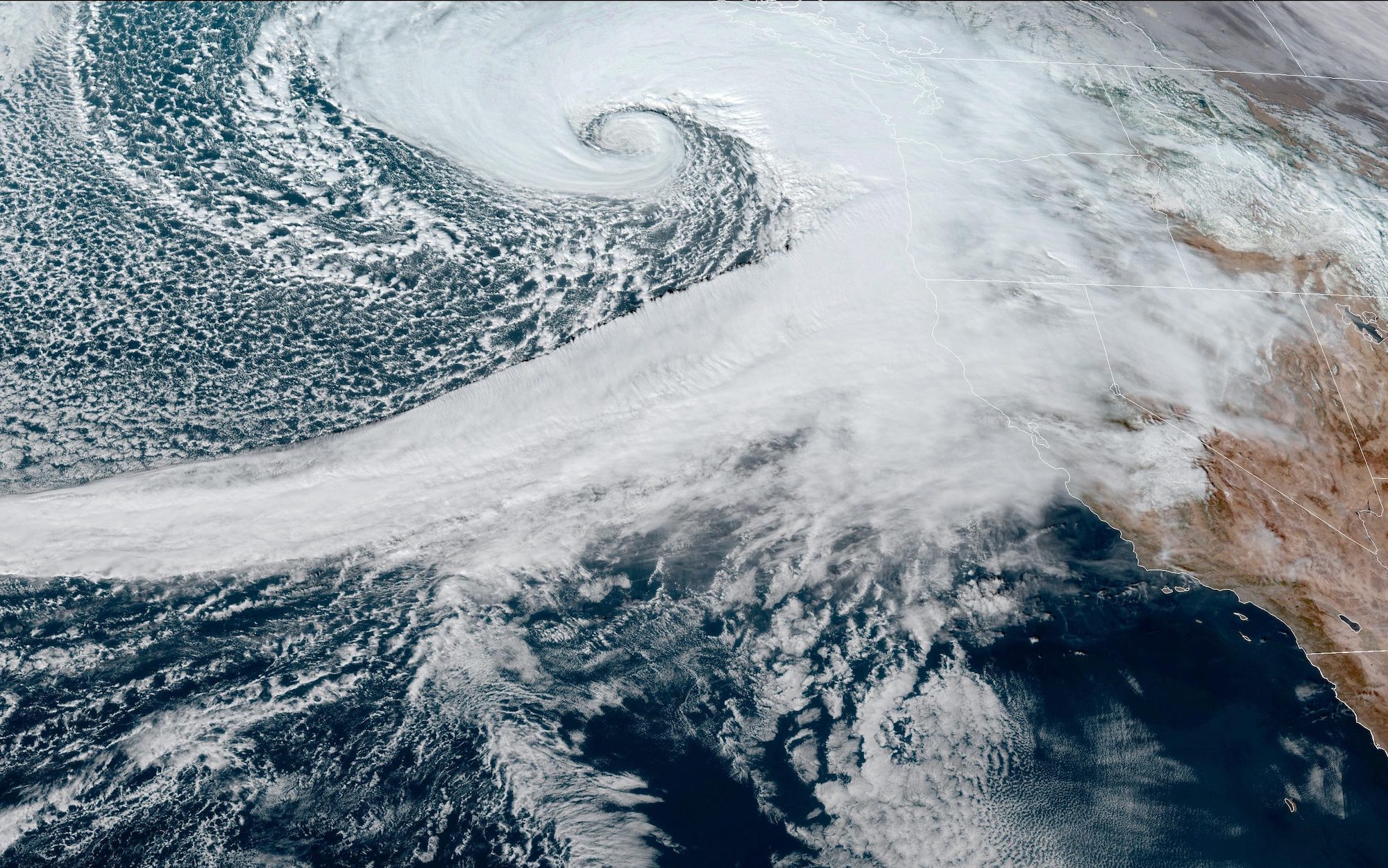
A rapidly intensifying weather system, known as a “bomb cyclone,” has developed off the U.S. West Coast, creating perilous conditions for mariners and coastal communities in the Pacific Northwest. The...
November 19, 2024
Total Views: 3773
Get The Industry’s Go-To News
Subscribe to gCaptain Daily and stay informed with the latest global maritime and offshore news
— just like 106,110 professionals
Secure Your Spot
on the gCaptain Crew
Stay informed with the latest maritime and offshore news, delivered daily straight to your inbox
— trusted by our 106,110 members
Your Gateway to the Maritime World!
Essential news coupled with the finest maritime content sourced from across the globe.

 Join The Club