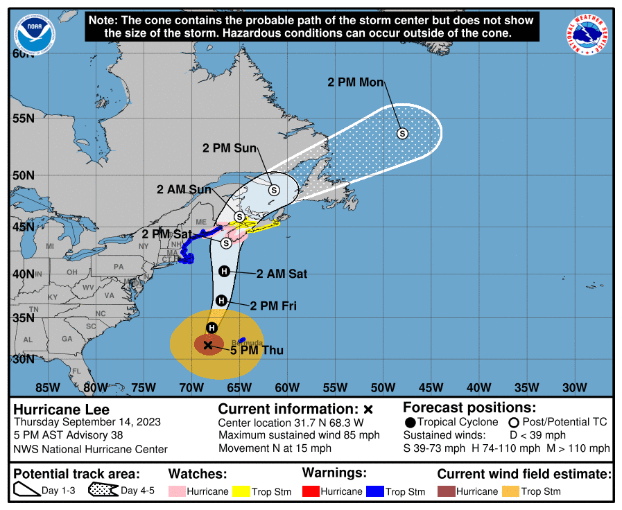
A Hurricane Warning remains in effect for the Atlantic High Seas associated with Hurricane Lee with peak seas of around 47 feet near the center as the system moves slowly to the north off the U.S. East Coast.
Hurricane Lee is a large system that poses a danger to mariners, with significant wave heights up to 12 feet extending outwards as far as 435 nautical miles from the center. Lee will continue produce dangerous waves, with long period SE swells that can cause life-threatening surf and rip current conditions along the coast.
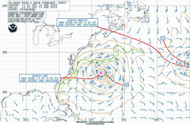
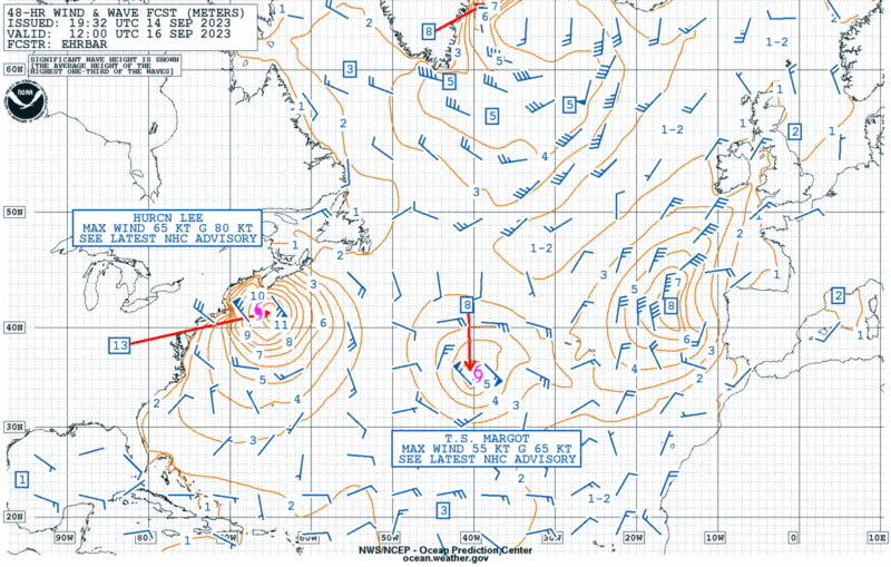
Early Friday: 24-hour wind & wave analysis (in feet)Early Saturday: 48-hour wind & wave analysis (in meters)
Hurricane Lee is currently a Cat 1 hurricane with sustained winds of 85 mph.
The National Weather Service’s Ocean Prediction Center is forecasting significant wave heights of 13 meters (42 ft) off the coast of Maine and Nova Scotia through Saturday morning before conditions are expected to improve (see the forecast charts above).
Significant wave heights are a measure of the average height of the tallest one-third of waves, so individual waves are sure to be much larger.
Hurricane conditions and coastal flooding is possible in portions of Maine, New Brunswick and Nova Scotia. Tropical storm conditions are expected as far south as southern New England.
Check the Ocean Prediction Center’s website for the latest Atlantic forecasts. You can also watch the NWS National Hurricane Center’s Tropical Analysis and Forecast Branch’s (TAFB) Tropical Atlantic Marine Weather Briefing from Thursday below:
Update: Hurricane Lee is now category 5 with sustained winds of 155 mph. Get the latest on Lee at Hurricanes.gov. Hurricane Lee has rapidly intensified into a category 4 storm...
September 7, 2023
Total Views: 4015
Get The Industry’s Go-To News
Subscribe to gCaptain Daily and stay informed with the latest global maritime and offshore news
— just like 105,985 professionals
Secure Your Spot
on the gCaptain Crew
Stay informed with the latest maritime and offshore news, delivered daily straight to your inbox
— trusted by our 105,985 members
Your Gateway to the Maritime World!
Essential news coupled with the finest maritime content sourced from across the globe.

 Join The Club