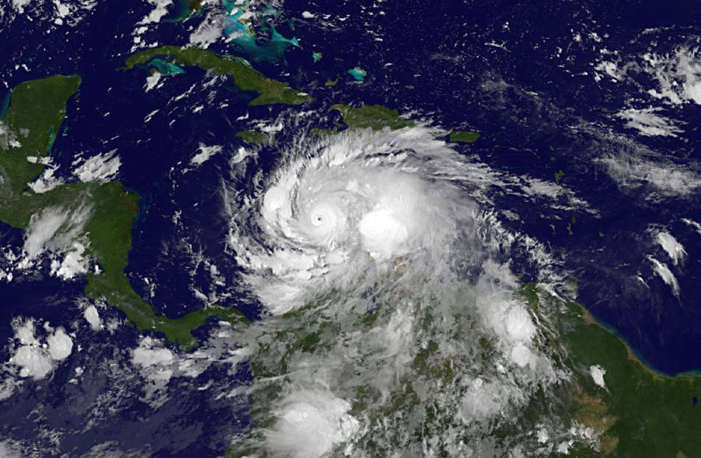
Hurricane Matthew has grown into an intense Category 4 hurricane with max sustained winds of 140 mph as it approaches western Haiti on Monday.
Over the weekend, Mathew actually reached Category 5 status late Saturday before dropping to Category 4 status the next day. A NASA satellite captured this video of the storm developing over the southeastern Caribbean:
A Hurricane Warning is currently in effect for Jamaica; Haiti; Cuban provinces of Guantanamo, Santiago de Cuba, Holguin, Granma, and Las Tunas; and the Southeastern Bahamas, including the Inaguas, Mayaguana, Acklins, Crooked Island, Long Cay, and Ragged Island.
According to the National Hurricane Center, the center of Matthew is forecasted to approach southwestern Haiti Monday night, bringing with it life-threatening rain, wind and storm surge to portions of Haiti.
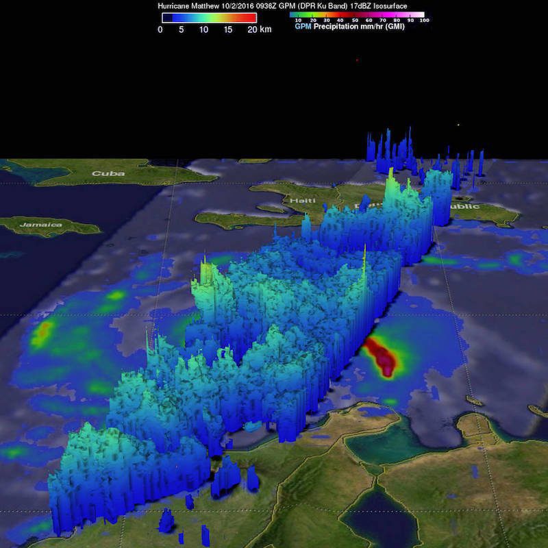
Another NASA satellite showed Matthew was packing heavy rainfall falling at a rate of over 6.4 inches in some areas. In fact some areas may received up 40 inches of rain!
“Heaviest rain was seen well to the east of Hurricane Matthew’s center,” said Hal Pierce of NASA’s Goddard Space Flight Center in Greenbelt, Maryland, who created the image below. “This area of strong convective storms has been persistent over the past few days. This area of intense rainfall is due to convergence between the trade winds (prevailing easterlies) and the wind flow from the south with Matthew. This area of heavy rainfall with Matthew may cause devastating torrential rainfall as it moves slowly over Haiti.” Up to 40 inches (1016 mm) of rainfall have been predicted over Haiti, according to NASA.
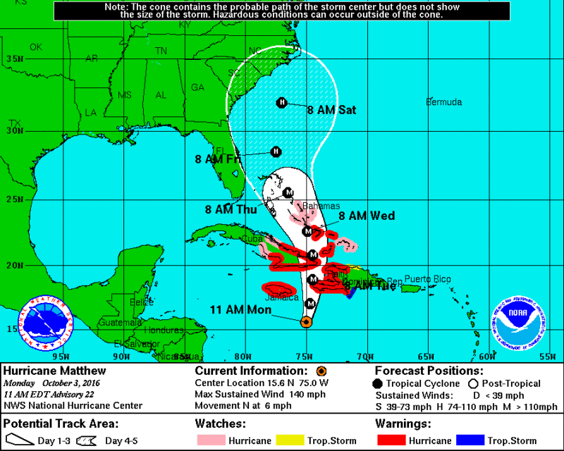
The storm is forecasted to move near eastern Cuba late Tuesday, and move near or over portions of the southeastern and central Bahamas Tuesday night and Wednesday.
The latest forecast from the NHC actually shows the eye of Matthew passing over Crooked Island, Bahamas, near where the El Faro sank one year ago during Hurricane Joaquin, by Wednesday morning:
Later this week Matthew will make its way up the southeast coast of the U.S. before models begin to differ on its forecasted track.
CAIRO, March 2 (Reuters) – The Houthi Transport Ministry in Yemen said on Saturday there had been a “glitch” in undersea communication cables in the Red Sea as a result of actions...
by Captain John Konrad (gCaptain) In the current American labor landscape, the stark contrast between the assertive strides of transportation unions and the maritime sector’s unique labor challenges is striking....
By Mikhail Flores MANILA, Dec 2 (Reuters) – Evacuations were under way in the Philippines after a quake of at least magnitude 7.5 struck the southern region of Mindanao on Saturday night,...
December 2, 2023
Total Views: 2162
Why Join the gCaptain Club?
Access exclusive insights, engage in vibrant discussions, and gain perspectives from our CEO.
This website uses cookies to improve your experience while you navigate through the website. Out of these, the cookies that are categorized as necessary are stored on your browser as they are essential for the working of basic functionalities of the website. We also use third-party cookies that help us analyze and understand how you use this website. These cookies will be stored in your browser only with your consent. You also have the option to opt-out of these cookies. But opting out of some of these cookies may affect your browsing experience.
Necessary cookies are absolutely essential for the website to function properly. This category only includes cookies that ensures basic functionalities and security features of the website. These cookies do not store any personal information.
Any cookies that may not be particularly necessary for the website to function and is used specifically to collect user personal data via analytics, ads, other embedded contents are termed as non-necessary cookies. It is mandatory to procure user consent prior to running these cookies on your website.

 Join The Club


![A screengrab of a map showing an earthquake Mindanao, Philippines on Dec 2, 2023. (Image: US Geological Survey [USGS])](https://gcaptain.com/wp-content/uploads/2023/12/Screenshot-2023-12-02-at-10.45.17-AM-copy.png.webp)


