
 Join The Club


Weather
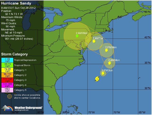
Hurricane Sandy Monday Morning Update
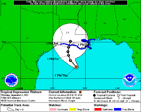
Update: Radar suggest that the center may be moving faster than forecast and will make landfall near Atlantic City sooner than forecast perhaps by late this
Update: Radar suggest that the center may be moving faster than forecast and will make landfall near Atlantic City sooner than forecast perhaps by late this
![Maersk Line – How Do Ships Ride Out Storms Like Hurricane Sandy? [INTERVIEW]](https://gcaptain.com/wp-content/uploads/2012/10/Picture-53.jpg)
[vimeo]http://vimeo.com/52383530[/vimeo] Steffen Conradsen, Head of Global Execution at Maersk Line, the world’s largest containership owner, gives us

As Hurricane Sandy moves up America’s northeast coast, most ships are now operating under the direction of shipping company emergency response plans and
(Bloomberg) — Hurricane Sandy was barreling northward along the U.S. East Coast as forecasters warned it would converge with two other systems to create
Applied Weather Technology, Inc. (AWT), announced today at SMM Hamburg its Fleet Decision Support System (FleetDSS). The new fleet management system is
The National Hurricane Center reports today that Tropical Storm Chris has become a post-tropical cyclone, centered at midday Friday about 335 miles

When the first hurricane emerges from the Atlantic Ocean or Gulf of Mexico this season, NOAA will use a new statistical model to help predict the start of the
Getting updates from your weather routing service can be helpful but many mariners prefer to do their own forecasting at sea. The problem is the maps

The U.S. Integrated Ocean Observing System, or IOOS®, is a vast, coordinated network of people and technology working together to deliver data on our
(Dow Jones) Anadarko Petroleum Corp. (APC) said Wednesday that it has removed nonessential workers from the company’s Gunnison, Nansen and Boomvang oil

The above is the latest time-lapse video of Hurricane Irene’s formation and landfall from NOAA’s Visualization lab via their YouTube channel. This
HIGH PRIORITY ALERT FROM MORAN SHIPPING Please urgently be advised that the U.S. Coast Guard CAPTAIN OF THE PORT has set Hurricane Condition X RAY for the Port
By Arian Campo-Flores, Valerie Bauerlein and Mike Esterl, Dow Jones & Co Hurricane Irene thrashed the Bahamas early Thursday, with widespread damage
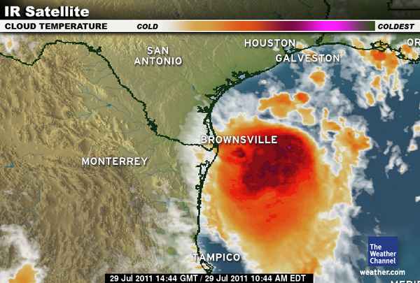
The satellite presentation of hurricane Irene has continued to improve this afternoon. A large area of deep convection with very cold cloud tops has expanded

By John J. Miller Tropical Storm Emily petered out over Cuba last week, but the National Oceanic and Atmospheric Administration warns of “high hurricane

If only ships could sail as fast as airplanes, then we could conduct weather avoidance the Fedex way. Watch the video below to see a screenshot of planes
HOUSTON (Dow Jones)–BP PLC (BP, BP.LN) said Thursday it is pulling all personnel from offshore oil platforms located in the southern Green Canyon area
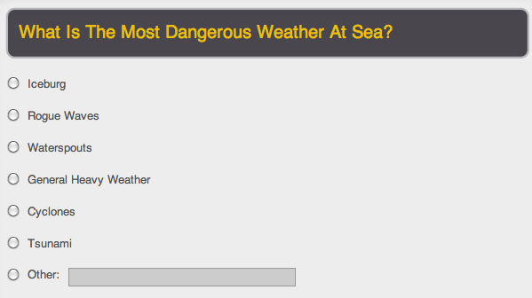
[polldaddy poll=”919366″] Do you have a story about severe weather? Be sure to leave your comments below! Also, Check Out our previous
Recent Chesapeake Bay icebreaking footage courtesy of the Maryland Department of Natural
Check out this video of the Antarctic cruise ship, Clelia II, as it “limps” back to Argentina in heavy seas. The vessel, with 100 passengers and
Join the 105,959 members that receive our newsletter.
Have a news tip? Let us know.

Maritime and offshore news trusted by our 105,959 members delivered daily straight to your inbox.


Essential news coupled with the finest maritime content sourced from across the globe.
Sign Up
