Marinebuzz.com points us to World Port Source, a website that plots all the ports of the world on an easy to use and familiar Google Map. World Port Source provides interactive satellite images, maps and contact information for 3,086 ports in 189 countries around the world. The website states:
Due to the complex interrelation of ports, cargo carriers, cruise ship lines, shipping agencies, terminal operators and dozens of other transportation related businesses, government agencies and public authorities the completion of this website will be a journey of discovery rather than a destination with closure.
The first objective in developing this site is to provide contact information and satellite images of ports and harbors throughout the world. Over time, this foundation of world ports will be cross referenced with the people and companies who make their livelihood servicing the world’s largest and most valuable transportation network.
Along with the above mentioned features, the site provides links to all container liner service companies, news and Local Views, which provides an index to close-up satellite images of features in and around the ports of the world.
By Yimou Lee TAIPEI, March 7 (Reuters) – China has stepped up grey-zone warfare against Taiwan, aiming to make the areas around the democratic island “saturated” with balloons, drones and civilian boats,...
Austal USA has kicked off plans to construct a new manufacturing facility, marking a significant expansion of its shipyard capacity in Mobile, Alabama in support of U.S. Navy and Coast...
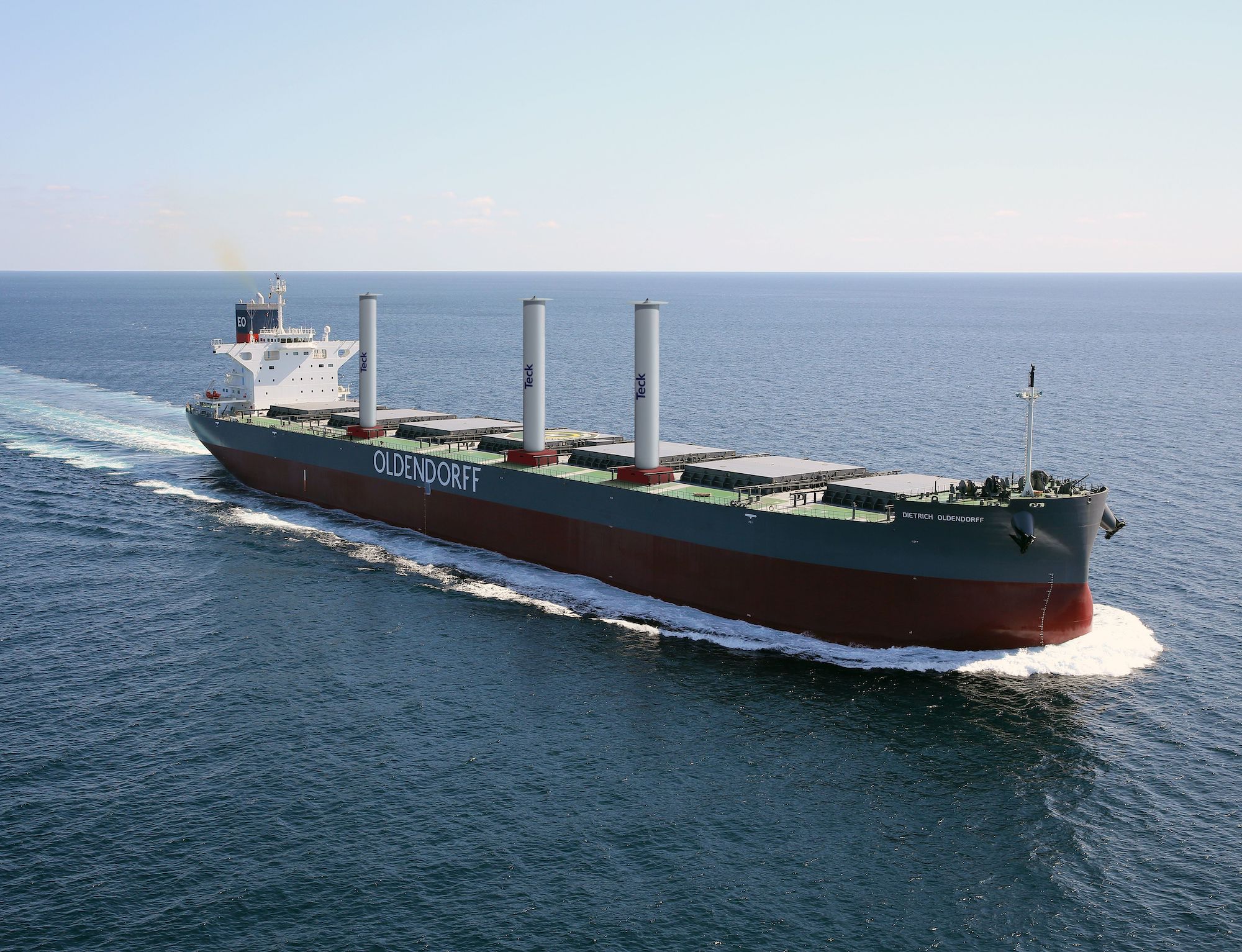
Oldendorff and Norsepower have announced an agreement to install three Norsepower Rotor Sails™ on board a modern bulk carrier to reduce its emissions. The vessel, Dietrich Oldendorff, will be equipped...
February 5, 2024
Total Views: 839
Why Join the gCaptain Club?
Access exclusive insights, engage in vibrant discussions, and gain perspectives from our CEO.
This website uses cookies to improve your experience while you navigate through the website. Out of these, the cookies that are categorized as necessary are stored on your browser as they are essential for the working of basic functionalities of the website. We also use third-party cookies that help us analyze and understand how you use this website. These cookies will be stored in your browser only with your consent. You also have the option to opt-out of these cookies. But opting out of some of these cookies may affect your browsing experience.
Necessary cookies are absolutely essential for the website to function properly. This category only includes cookies that ensures basic functionalities and security features of the website. These cookies do not store any personal information.
Any cookies that may not be particularly necessary for the website to function and is used specifically to collect user personal data via analytics, ads, other embedded contents are termed as non-necessary cookies. It is mandatory to procure user consent prior to running these cookies on your website.

 Join The Club