3) Predicted Routes Chart. Plotted by Southern Florida’s weather center this chart overlays the different computer predictions onto one chart. Mostly it shows how inaccurate computer based weather modeling is today.
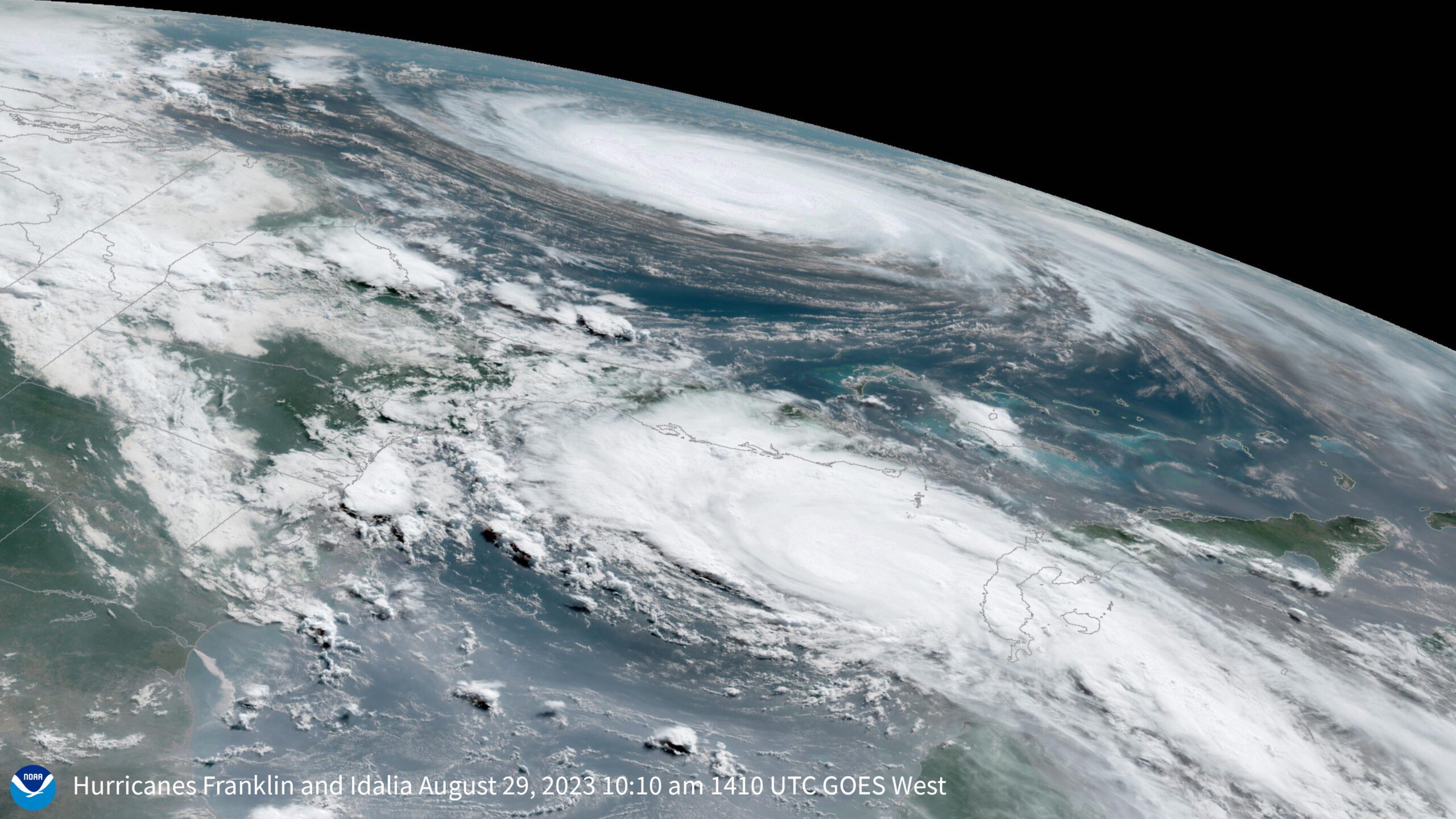
4) NOAA Satellite Image of Hurricane Dean. Click on the photo to see the Hi Resolution version.
The 2024 Atlantic hurricane season is expected to be exceptionally active, according to researchers at Colorado State University. In their initial forecast, they predict 11 hurricanes, marking the highest prediction...
by Murray Scown, Lund University and Frances Eleanor Dunn, Utrecht University (TheConversation) Perilously situated between rising sea levels and pressures from upstream lie coastal river deltas and their roughly half...
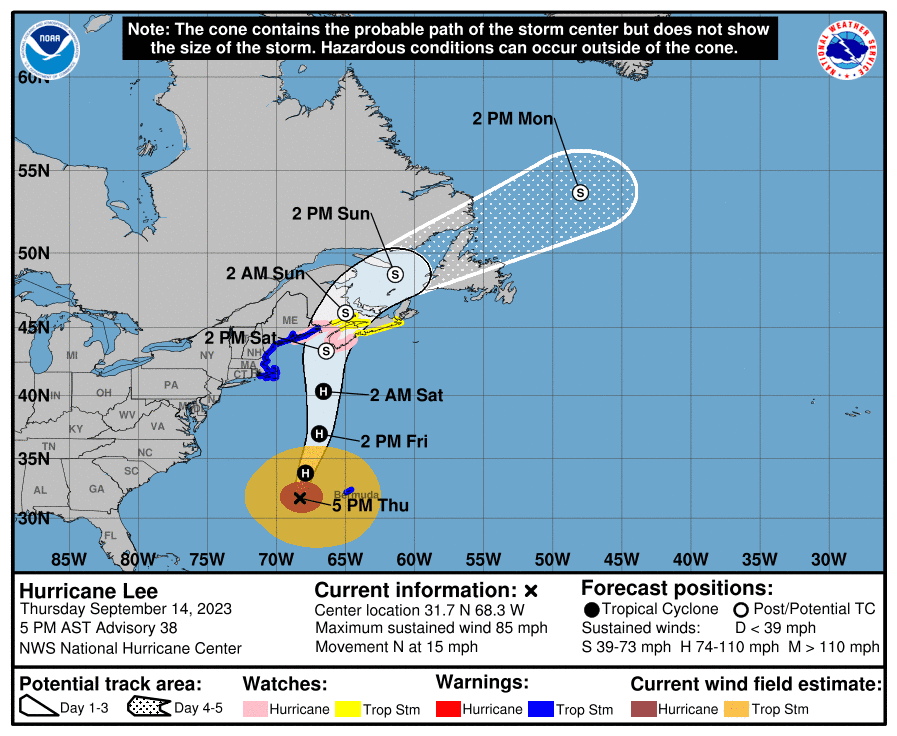
A Hurricane Warning remains in effect for the Atlantic High Seas associated with Hurricane Lee with peak seas of around 47 feet near the center as the system moves slowly...
September 14, 2023
Total Views: 4080
Why Join the gCaptain Club?
Access exclusive insights, engage in vibrant discussions, and gain perspectives from our CEO.
This website uses cookies to improve your experience while you navigate through the website. Out of these, the cookies that are categorized as necessary are stored on your browser as they are essential for the working of basic functionalities of the website. We also use third-party cookies that help us analyze and understand how you use this website. These cookies will be stored in your browser only with your consent. You also have the option to opt-out of these cookies. But opting out of some of these cookies may affect your browsing experience.
Necessary cookies are absolutely essential for the website to function properly. This category only includes cookies that ensures basic functionalities and security features of the website. These cookies do not store any personal information.
Any cookies that may not be particularly necessary for the website to function and is used specifically to collect user personal data via analytics, ads, other embedded contents are termed as non-necessary cookies. It is mandatory to procure user consent prior to running these cookies on your website.

 Join The Club