Update 17:00 EST: The storm went ashore at about 5 a.m. in Guiuan, eastern Samar, the Philippines Atmospheric, Geophysical and Astronomical Services Administration said.
Haiyan had top winds of almost 196 miles (315 kilometers) per hour when it was about 489 miles southeast of Manila, the U.S. Navy’s Joint Typhoon Warning Center said at 2 p.m. East Coast time, with winds gusting to as high as 235 mph.
There has never been an Atlantic Hurricane this strong.
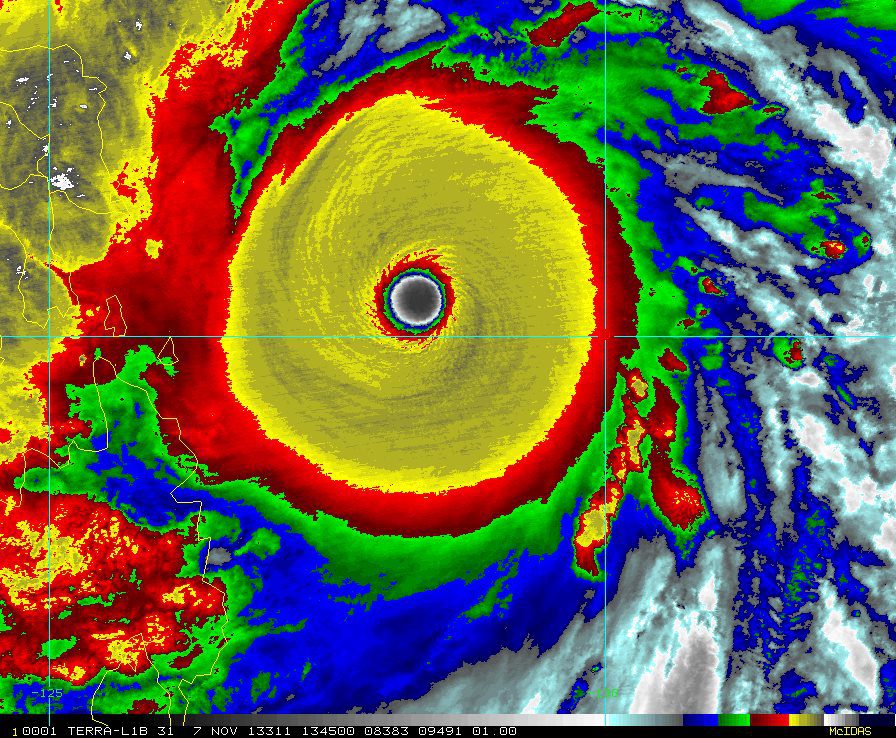
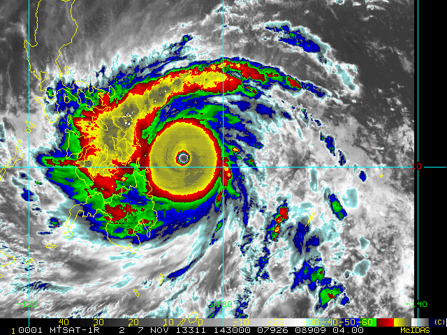
Image courtesy of CIRA/RAMMB http://rammb.cira.colostate.edu/
Update (14:30 EST) via Ocean Weather Services: Super Typhoon Haiyan (aka Yolanda) is closing in on the Philippines with sustained winds up to 170 knots. The radius of hurricane force winds, however. extends outward only 30-35NM to the south and 45-50NM to the north while 50kt winds extend outward 55-60NM south and 65-70NM north. The eye of Haiyan will move over the northern portion of the Leyte Gulf during the next few hours and across Leyte Island in about 4-8 hours..
As gCaptain’s unofficial ship routing meteorologist expert, Fred Pickhardt, points out, “this may be a record breaker.”
Brian McNoldy, a Senior Research Associate at the University of Miami’s Rosenstiel School of Marine and Atmospheric Science in Miami, Fla. noted that on the morning (EST) of Nov. 7, “Haiyan has achieved tropical cyclone perfection. It is now estimated at 165kts (190mph), with an 8.0 on the Dvorak scale… the highest possible value.”
McNoldy later added that “Haiyan’s estimated intensity nudged up again to 170kts (195mph) and 895mb central pressure.”
Super Typhoon Haiyan continues to develop and now has reached an unbelievable max wind of 165 knots as it bears down on the central Philippines. Via Ocean Weather Services
MANILA, Nov 7 (Reuters) – Authorities in the Philippines grounded air and sea transport on Thursday and urged fishing boats to return to port, as an approaching super typhoon, the most powerful storm on earth this year, gathered speed.
Typhoon Haiyan is expected to make landfall early on Friday between the central islands of Samar and Leyte.
With centre winds of 215 kph (133 mph) and gusts of up to 250 kph, the storm, rated as category five, the most severe, was moving west-northwest at 33 kph in the Pacific Ocean.
President Benigno Aquino appealed to citizens to evacuate danger zones. “I am calling for community teamwork and cooperation,” he said on national television and radio.
Aquino said 100 coastal areas face the threat of storm surges, bringing waves higher than 5 m to 6 m, and ordered action by local officials to limit damage and loss of lives.
Thousands of residents were moved from coastlines, river banks, and mountain slopes to safer spots, while military transport vehicles were put on standby.
Strong winds and heavy rain buffeted areas in the path of the storm, as the state weather bureau raised alert levels in more than 20 parts of the central Philippines.
The coast guard suspended ferry operations, ordered a halt to fishing and warned deep-sea fishing boats to seek shelter or return to port. Carrier Cebu Pacific announced the suspension of more than 100 local flights.
Hospitals were put on alert, with schools and some offices shut and power and communication lines turned off for safety.
Officials used bullhorns to urge residents of coastal and upland villages to move to safer areas, as trees were trimmed and boats dragged to shore.
The state weather bureau raised storm alert to level 4 on the coconut-growing islands of Samar and Leyte. Officials in 12 more central provinces also began stockpiling food, water and relief supplies.
An estimated 10 million people face disruption from typhoon Haiyan, say international relief agencies that are stepping up operations to tackle the storm.
“The humanitarian impact of Haiyan threatens to be colossal, not only in areas directly in its path, but also for nearby islands such as Bohol,” said Patrick Fuller of the International Federation of Red cross and Red Crescent Societies.
Particularly vulnerable, he added, were thousands of people living in makeshift shelters on Bohol after a magnitude 7.2 earthquake last month that killed more than 200 people and displaced thousands.
An average of 20 typhoons hit the Philippines every year. In 2011, typhoon Washi killed 1,200 people, displaced 300,000 and destroyed more than 10,000 homes.
In September, another category-five storm, typhoon Usagi, with central winds of 205 kph and gusts of up to 240 kph, battered the northern island of Batanes before causing damage in southern China.
Bopha, last year’s strongest storm, flattened three coastal towns on the southern island of Mindanao, killing 1,100 people and wreaking damage estimated at $1.04 billion. (Reporting by Manuel Mogato; Editing by Clarence Fernandez)
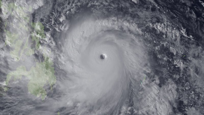
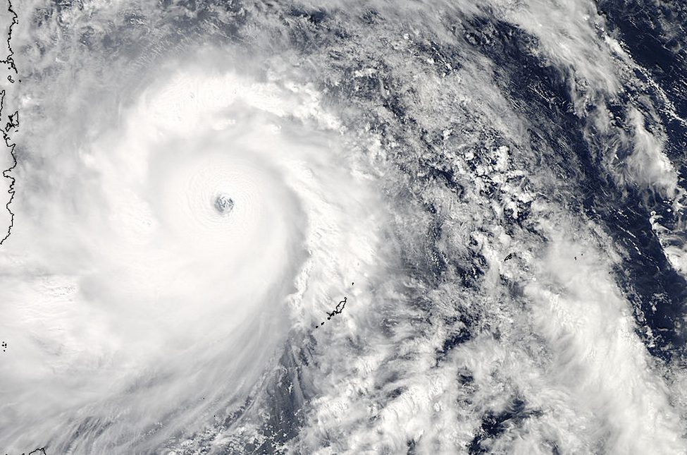
Super Typhoon Haiyan is seen approaching the Philippines in this Japan Meteorological Agency handout image taken at 0630 GMT (0130 EST) November 7, 2013. REUTERS/Japan Meteorological AgencyNOAA/HandoutThis visible image of Super Typhoon Haiyan approaching the Philippines was taken from the MODIS instrument aboard NASA’s Aqua satellite on Nov. 7, 2013 at 04:25 UTC/Nov. 6 at 11:25 p.m. EDT. Image Credit: NASA Goddard MODIS Rapid Response Team
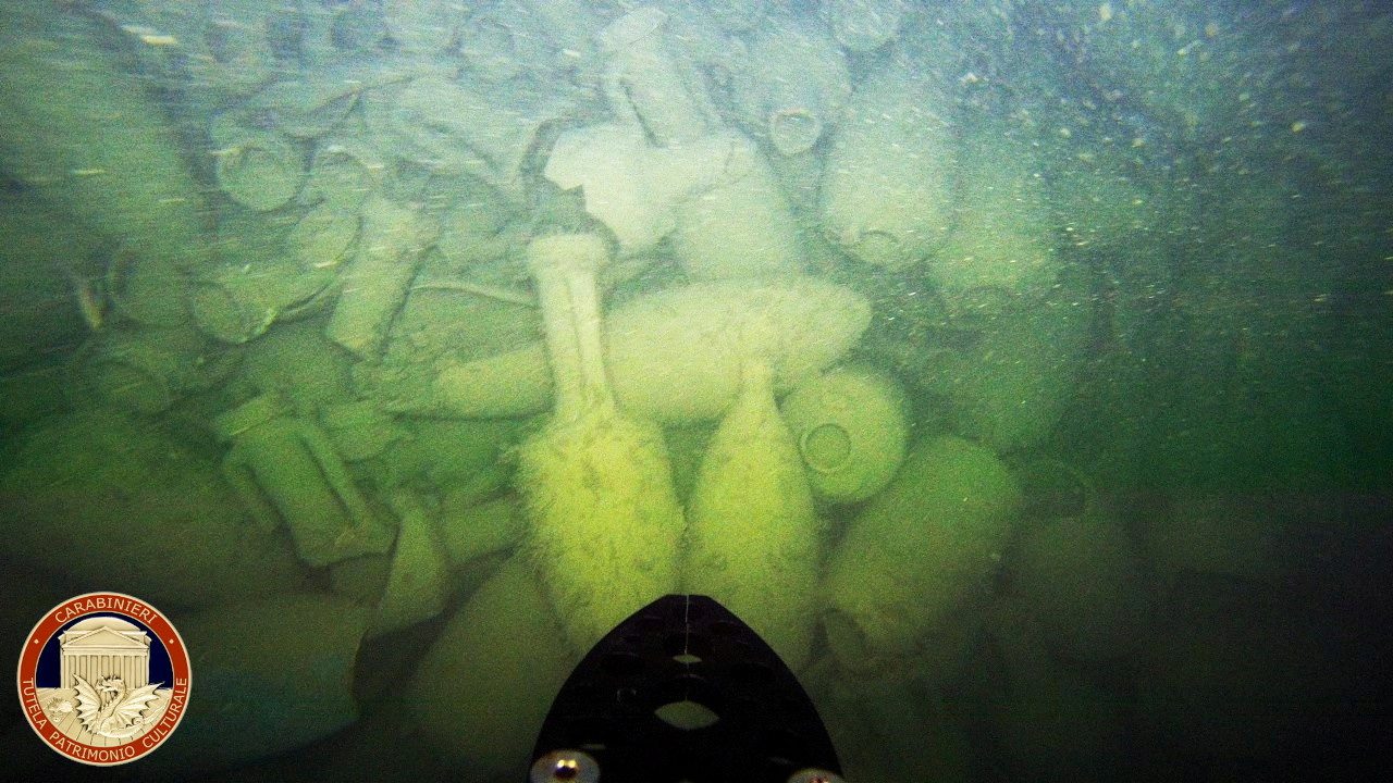
ROME, (Reuters) – The wreck of an ancient Roman cargo ship from more than 2,000 years ago has been found off the coast near Rome, the arts squad of Italy’s Carabinieri police said on Friday....
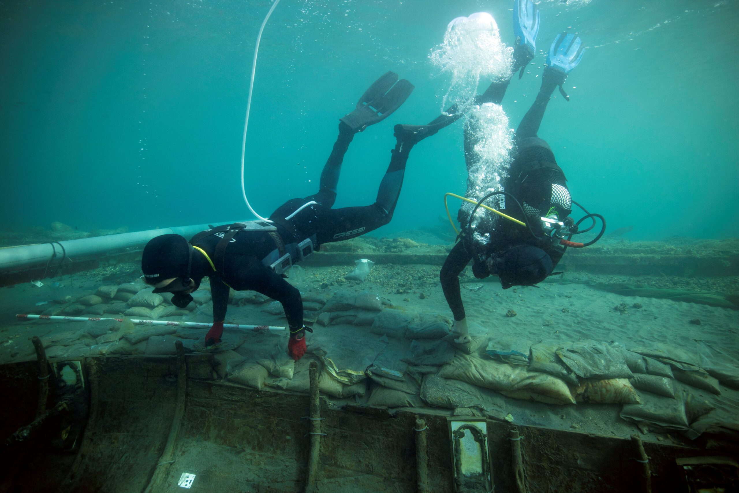
MADRID, (Reuters) – A group of Spanish archaeologists have made detailed diagrams of a 2,500-year-old Phoenician shipwreck to help work out how best to recover it from the sea before a storm...
Amid National Safe Boating Week and Memorial Day Weekend, we are left reminded of the risks that come with holiday fun. Memorial Day weekend is often when people take to...
May 25, 2023
Total Views: 982
Why Join the gCaptain Club?
Access exclusive insights, engage in vibrant discussions, and gain perspectives from our CEO.
This website uses cookies to improve your experience while you navigate through the website. Out of these, the cookies that are categorized as necessary are stored on your browser as they are essential for the working of basic functionalities of the website. We also use third-party cookies that help us analyze and understand how you use this website. These cookies will be stored in your browser only with your consent. You also have the option to opt-out of these cookies. But opting out of some of these cookies may affect your browsing experience.
Necessary cookies are absolutely essential for the website to function properly. This category only includes cookies that ensures basic functionalities and security features of the website. These cookies do not store any personal information.
Any cookies that may not be particularly necessary for the website to function and is used specifically to collect user personal data via analytics, ads, other embedded contents are termed as non-necessary cookies. It is mandatory to procure user consent prior to running these cookies on your website.

 Join The Club