The technology capital firm Vantage Point, oil services provider Schlumberger, Google and Virgin Oceanic are among a few of the diverse companies behind the PacX Challenge to send a robot across the Pacific Ocean, the longest distance ever attempted by an unmanned ocean vehicle.
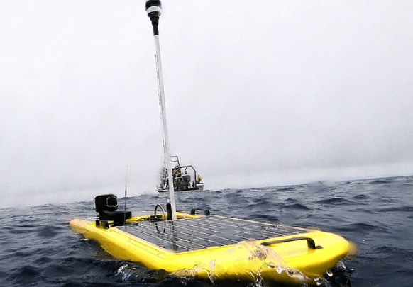
Departing from San Francisco on Thursday four robots began a voyage across the Pacific to ports in Japan and Australia. The purpose of the crossing is to foster new scientific discoveries by collecting vast amounts of ocean data. Liquid Robotics and Google Earth are powering the project with robotic hardware and software capable of transiting the ocean unassisted.
The four Wave Gliders are expected to collect approximately 2.25 million discrete data points during their more than 300 voyage. Along the way they will transmit valuable ocean data on salinity, water temperature, waves, weather, fluorescence, and dissolved particles. Further, the enormous data set will be provided free of charge – in real-time – to scientists, educators, students, and the general public.
During their 33,000 nautical mile journey, the Wave Gliders will travel across some of the world’s most challenging environments. The Wave Gliders will begin their journey together to Hawaii, and then split into pairs, one pair continuing to Japan (over the Marianas Trench, where Virgin Oceanic will complete the first of its Five Deep Dives) and the other pair to Australia.
When they reach their final destinations, the Wave Gliders will have earned a Guinness World Record for the longest voyage completed by an unmanned ocean vessel.
But it could be a perilous journey as the robots must navigate to avoid storms, floating debris and strong equatorial currents. At the launch, Bill Vass, Liquid Robotics’ chief executive, told reporters, “It’s a tough thing to do and we may not make it.”
In addition to natural hazards, the robot’s greatest challenge is avoiding ships. gCaptain met with Liquid Robotics at an exhibition in San Francisco last year who confirmed that the robots will be carrying AIS units to avoid approaching ships. “The robots will be alerted to oncoming vessels and have been programed with software that enables the units to maneuver and avoid a collision,” said one scientist.
Yet dangers remain.
The robots use wave energy to propel themselves and have a top speed of 2 knots. Further, the robots have a very low freeboard and antenna height which reduces the visibility of the unit and the distance at which it can locate nearby ships. Combined, these drawbacks limit the ability of the units to stay clear of ships.
Liquid Robotics is not looking to eliminate all risk, but according to Graham Hine, Liquid Robotics’ Senior Vice President for operations, “The mission is to push the boundaries of understanding, to prove to the world that this sort of technology can expand our understanding of the oceans.”
“Liquid Robotics invites scientists to embark on a grand challenge journey with us as we cross the Paciï¬c on a voyage of scientiï¬c discovery,” said Ed Lu, chief of innovative applications at Liquid Robotics. “These Wave Gliders are much like small ‘spacecraft’ that open up new opportunities for robotic exploration. I challenge all scientists who are interested in advancing ocean exploration to take advantage of this unique opportunity. What scientiï¬c questions can we address with this new and unique data set?”
The PacX Challenge partners are equally optimistic of success. According to Jenifer Austin Foulkes, the head of Google Oceans, “Most of the ocean remains unexplored with less than 10 percent of it mapped out. This expedition creates an opportunity for students, marine researchers, and aspiring oceanographers to follow these brave Liquid Robotics ocean robots as they cross the Pacific virtually through the Ocean Showcase on the Google Earth website. They can also check back daily in Google Earth to see the latest posts from scientists communicating weather and climate data back from these ‘R2D2s’ of the sea.“
NOTE TO MARINERS:
The robots are currently enroute from San Francisco to Hawaii. If your vessel is traveling this route please keep a good lookout for the units, monitor and plot their location daily (position updates are available via google earth) and provide them with a large CPA.
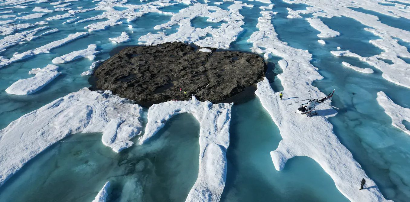
by Kevin Hamilton (University of Hawaii) In 2021, an expedition off the icy northern Greenland coast spotted what appeared to be a previously uncharted island. It was small and gravelly,...
Editor’s Note: This article was originally published by gCaptain in 2016 and is being republished now because it’s lessons are timeless and possibly more relevant in 2022 as today’s ships...
by Salvatore R. Mercogliano, Ph.D. (gCaptain) This Veteran’s Day we remember the thousands of Soldiers, Sailors, Marines, Airmen, and Coast Guardsmen who gave their lives in defense of the United States...
November 11, 2022
Total Views: 1533
Why Join the gCaptain Club?
Access exclusive insights, engage in vibrant discussions, and gain perspectives from our CEO.
This website uses cookies to improve your experience while you navigate through the website. Out of these, the cookies that are categorized as necessary are stored on your browser as they are essential for the working of basic functionalities of the website. We also use third-party cookies that help us analyze and understand how you use this website. These cookies will be stored in your browser only with your consent. You also have the option to opt-out of these cookies. But opting out of some of these cookies may affect your browsing experience.
Necessary cookies are absolutely essential for the website to function properly. This category only includes cookies that ensures basic functionalities and security features of the website. These cookies do not store any personal information.
Any cookies that may not be particularly necessary for the website to function and is used specifically to collect user personal data via analytics, ads, other embedded contents are termed as non-necessary cookies. It is mandatory to procure user consent prior to running these cookies on your website.

 Join The Club