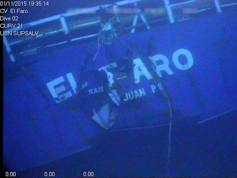
Stern of the El Faro wreck. Photo credit: NTSB
The National Transportation Safety Board on Thursday said it would launch a second expedition to search for evidence in its investigation of the loss of the cargo ship El Faro, which sank in the Atlantic during a hurricane on October 1, 2015.
A key objective of the upcoming mission will be locate the missing voyage data recorder and to provide investigators with a more extensive and detailed survey of the shipwreck.
The exact launch date is expected to begin in April and last about two weeks, although the exact launch date will be announced at a later date.
“The voyage data recorder may hold vital information about the challenges encountered by the crew in trying to save the ship,” said NTSB Chairman Christopher A. Hart. “Getting that information could be very helpful to our investigation.”
RELATED: First Photos and Video of El Faro Wreckage
The 790-foot ship was located in about 15,000 feet of water near the Bahamas on October 31. Over the following few weeks, the ship and the debris field were documented with a video camera mounted on a remotely operated vehicle.
Video revealed that the navigation bridge structure and the deck below it had separated from the ship. The missing structure included the mast and its base where the VDR was mounted, yet neither the mast nor the VDR was found in the vicinity. The initial search mission was completed on November 15.
After reviewing the data and video of the wreckage, investigators determined that a return mission to El Faro was warranted.
In the upcoming search, a search area of approximately 35 square kilometers (13.5 square miles) will be photo- and video-documented by Sentry, an autonomous underwater vehicle (AUV) that will be launched from the research vessel Atlantis, owned by the U.S. Navy and operated by the Woods Hole Oceanographic Institution (WHOI). Sentry can work at depths of nearly 20,000 feet and can be equipped with a wide array of sonar, camera and other sensors.
A VDR of the type that was mounted on El Faro is capable of recording conversations and sounds on the navigation bridge, which could provide investigators with important evidence as they seek to understand the sequence of events that led to the sinking. Investigators also hope to obtain high quality images of the bridge, debris field, and hull.
If the VDR is located, another mission using a remotely operated vehicle capable of recovering the recorder will be initiated.
Unlock Exclusive Insights Today!
Join the gCaptain Club for curated content, insider opinions, and vibrant community discussions.

 Join The Club


![A screengrab of a map showing an earthquake Mindanao, Philippines on Dec 2, 2023. (Image: US Geological Survey [USGS])](https://gcaptain.com/wp-content/uploads/2023/12/Screenshot-2023-12-02-at-10.45.17-AM-copy.png.webp)


