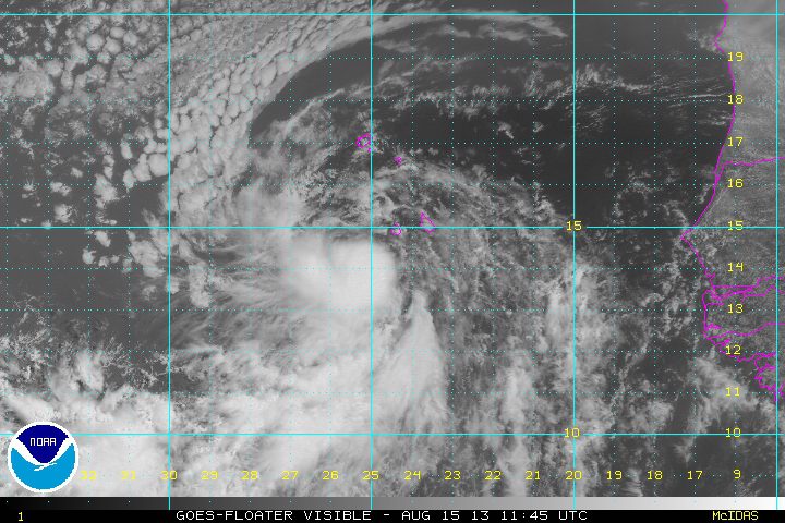
TS Erin formed late Wednesday over the eastern North Atlantic and was moving west-northwestward at about 13 knots with max winds of about 35 knots. Conditions are favorable during the next 48 to 72 hours for some slow development , however, after that drier air may tend to weaken this system. Time will tell if Erin survives the dry air or not.
TS Erin 1145Z 15 Aug 2013 Visible Satellite image via NOAA
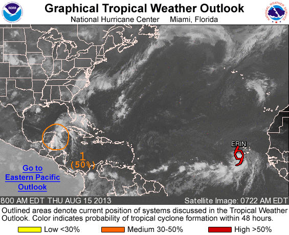
Farther to the west, another disturbance (Invest 92L) over the Northwest Caribbean was approaching the Yucatan Peninsula but much of the shower activity is already overland so development is not likely in the short term, but development may be possible once it moves over the southern Gulf of Mexico.
An update Thursday from the U.S. National Hurricane Center said that the area of low pressure still has a 50 percent chance of becoming a tropical cyclone during the next 48 hours
Invest 92L 1345Z 15 Aug 2013 NOAA Visual Satellite image
By Yimou Lee TAIPEI, March 7 (Reuters) – China has stepped up grey-zone warfare against Taiwan, aiming to make the areas around the democratic island “saturated” with balloons, drones and civilian boats,...
Austal USA has kicked off plans to construct a new manufacturing facility, marking a significant expansion of its shipyard capacity in Mobile, Alabama in support of U.S. Navy and Coast...
Oldendorff and Norsepower have announced an agreement to install three Norsepower Rotor Sails™ on board a modern bulk carrier to reduce its emissions. The vessel, Dietrich Oldendorff, will be equipped...
February 5, 2024
Total Views: 846
Why Join the gCaptain Club?
Access exclusive insights, engage in vibrant discussions, and gain perspectives from our CEO.
This website uses cookies to improve your experience while you navigate through the website. Out of these, the cookies that are categorized as necessary are stored on your browser as they are essential for the working of basic functionalities of the website. We also use third-party cookies that help us analyze and understand how you use this website. These cookies will be stored in your browser only with your consent. You also have the option to opt-out of these cookies. But opting out of some of these cookies may affect your browsing experience.
Necessary cookies are absolutely essential for the website to function properly. This category only includes cookies that ensures basic functionalities and security features of the website. These cookies do not store any personal information.
Any cookies that may not be particularly necessary for the website to function and is used specifically to collect user personal data via analytics, ads, other embedded contents are termed as non-necessary cookies. It is mandatory to procure user consent prior to running these cookies on your website.

 Join The Club