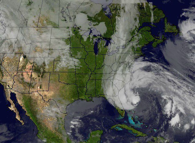
Superstorm Sandy, pictured on Oct. 27, 2012. Image: NASA
The U.S. National Weather Service (NWS) on Thursday announced some key changes to its Hurricane warning system, particularly in the way it handles post-tropical cyclones.
NWS says the the changes were motivated by experiences associated with Hurricane Sandy last October, when forecasters, relying on the definitions set out in the old (current) system, dropped the hurricane warnings when the Superstorm became post-tropical even though the storm still presented a significant danger to areas along the East Coast.
Gallery: 20 Incredible Aerial Photographs of Damage Caused by Hurricane Sandy
NWS says the new system, which is set to go into effect beginning June 1, will broaden the definitions of hurricane and tropical storm watches and warnings by allowing them to remain in effect or be issued after a tropical cyclone becomes post-tropical, yet still poses significant threat life and property.
Specifically, the new system will define the NWS watch/warnings as follows:
- Hurricane/Typhoon Warning: An announcement that sustained winds of 64 knots (74 mph or 119 km/hr) or higher are expected somewhere within the specified area in association with a tropical, subtropical, or post-tropical cyclone. Because hurricane preparedness activities become difficult once winds reach tropical storm force, the warning is issued 36 hours in advance of the anticipated onset of tropical-storm-force winds (24 hours for the Western North Pacific). The warning can remain in effect when dangerously high water or a combination of dangerously high water and waves continue, even though winds may be less than hurricane force.
- Hurricane Watch: An announcement that sustained winds of 64 knots (74 mph or 119 km/hr) or higher are possible within the specified area in association with a tropical, subtropical, or post-tropical cyclone. Because hurricane preparedness activities become difficult once winds reach tropical storm force, the hurricane watch is issued 48 hours in advance of the anticipated onset of tropical storm force winds.
- Tropical Storm Warning: An announcement that sustained winds of 34 to 63 knots (39 to 73 mph or 63 to 118 km/hr) are expected somewhere within the specified area within 36 hours (24 hours for the Western North Pacific) in association with a tropical, subtropical, or post-tropical cyclone.
- Tropical Storm Watch: An announcement that sustained winds of 34 to 63 knots (39 to 73 mph or 63 to 118 km/hr) are possible within the specified area within 48 hours in association with a tropical, subtropical, or post-tropical cyclone.
For more information and an example of a National Hurricane Center Public Advisory (TCP) issued for an ongoing post-tropical cyclone can be found HERE. For the full service change notice, click HERE.
Unlock Exclusive Insights Today!
Join the gCaptain Club for curated content, insider opinions, and vibrant community discussions.

 Join The Club