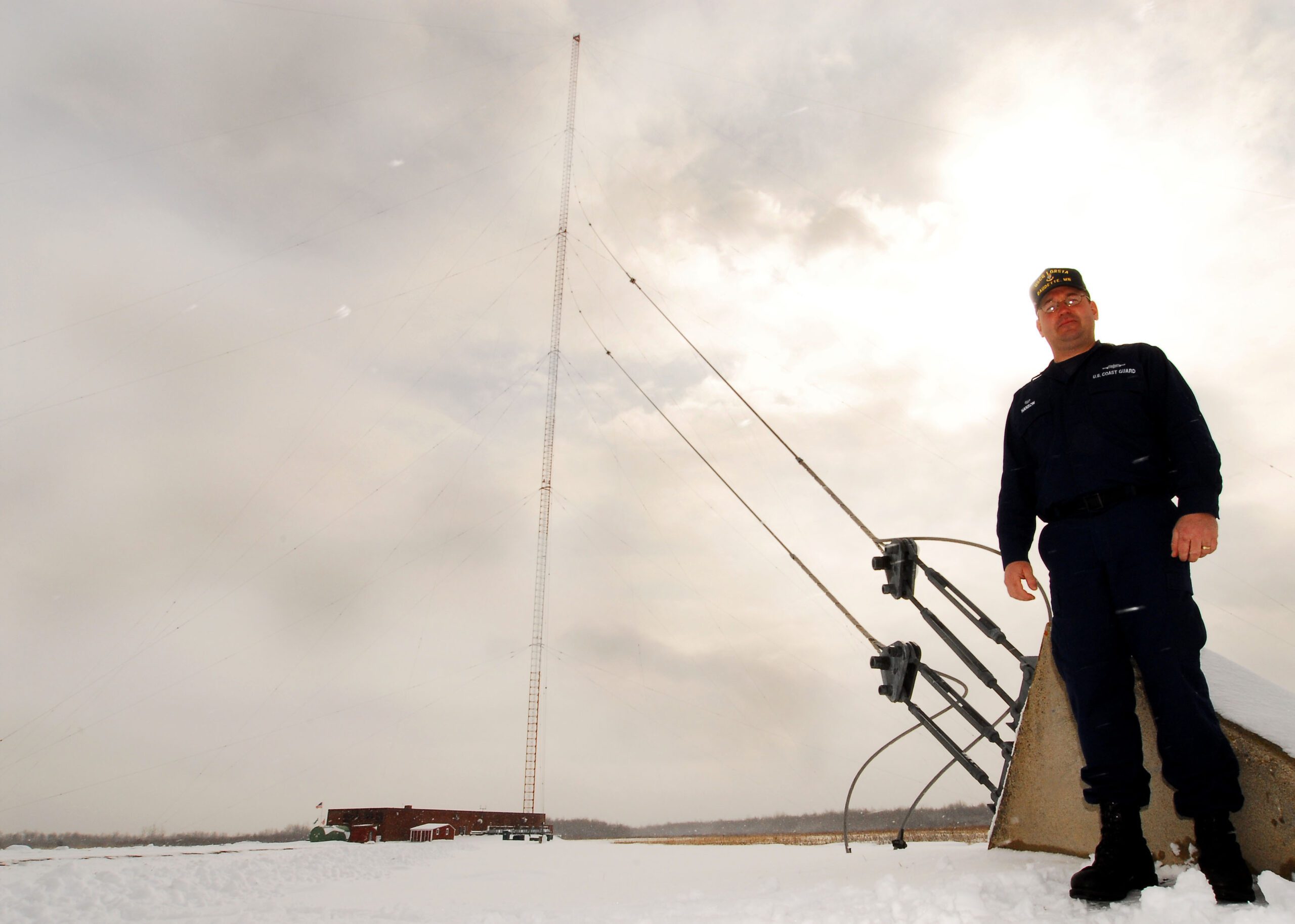
February 14th, 2008 ·
LORAN Coverage
Following the recent budget approval by President Bush, LORAN , the Coast Guard’s terrestrial based LOng RANge navigation system has been given a reprieve by the Department of Homeland Security.
The on again, off again, LORAN is on again
On Feb. 7, DHS spokeswoman Laura Keehner said the department decided to use an enhanced version, eLORAN, to provide backup to GPS. The system will “mitigate any safety, security or economic effects of a GPS outage or disruption,” she said.
The Transportation Department’s Volpe National Transportation Systems Center urged development of an alternative to GPS in a 2001 report which concluded the satellite-based system could be knocked out by jamming its high-frequency, low-power signals. The report suggested LORAN as a backup. Keehner added that eLORAN has the capability GPS lacks in urban canyons as well as in heavy foliage to provide precise location and navigation information to first responders working in such areas.
The Coast Guard operates 24 LORAN stations nationwide to help users, including ships and planes, determine their location. Nineteen have been upgraded to eLORAN, which broadcasts a data channel to improve accuracy, signal availability and integrity of information. The International LORAN Association says the modernization boosts position accuracy to between 8 feet and 65 feet, with availability measured at 99.9 percent and integrity at 99.99 percent.
(Ed. Note: thanks to my colleague Capt. Jack Richards for leading me to this information at MaritimeLicensing.com)
I can foresee a day when Chart Plotters will have three inputs; GPS, the European Union’s Galileo , and LORAN. You will be allowed to select or average the available signals.
_____________________________
This post was written by Richard Rodriguez, Rescue Tug Captain, and US Coast Guard approved instructor for License Training. You can read more of his articles at the BitterEnd of the net.
Tags: · eloran
February 5th, 2008 ·

Could it be time to dig out your old ten point dividers and loran-c charts? Probably not but the same technology behind these devices is making a comeback. HKLaw tells us:
Budget of the United States Government for Fiscal Year 2009 and related documents. Among other things, the Budget documents note enhanced LORAN (eLORAN) has been identified as the primary candidate as the national backup system for position, navigation, and timing. This budget includes funding for modernization of LORAN-C as the first step to implementation of eLORAN. Through a contracting-out arrangement, the Coast Guard will operate the LORAN-C/eLORAN system on behalf of the DHS National Protection and Programs Directorate. In addition, the budget provides $20 million in new funding for more USCG marine inspectors.
eLORAN FAQ
What is eLORAN?
Enhanced Loran is an internationally standardized positioning, navigation, and timing (PNT) service for use by many modes of transport and other applications. It is the latest in the long-standing and proven series of low-frequency, LOng-RAnge Navigation (LORAN) systems and takes full advantage of 21st century technology.
eLORAN meets the accuracy, availability, integrity and continuity performance requirements for aviation non-precision instrument approaches, maritime harbor entrance and approach maneuvers, land-mobile vehicle navigation and location-based services, and is a precise source of time and frequency for applications such as telecommunications.
eLORAN is an independent, dissimilar, complement to Global Navigation Satellite Systems (GNSS). It allows GNSS users to retain the safety, security and economic benefits of GNSS, even when their satellite services are disrupted. (Source: USCG NavCen)
Why is it needed?
- e-Navigation is a potential enabler of new applications to meet emerging and future requirements for marine navigation
- e-Navigation has the potential to deliver direct benefits to users through improved operational capabilities and also to reduce Light Dues if it enables the GLAs to remove physical AtoNs
- the benefits of e-Navigation could be seriously eroded through the measures that would have to be taken to avoid prejudicing safety in the event of failure of a GNSS (Global Navigation Satellite System) that was the sole source of input position data
Translated that means eLORAN will be able to enable new technologies like positioning devices that work indoors and it provides redundancy to gps and gallileo systems.
How Is It Different From GPS?

Post 9/11 Concerns:
“And look: the weaknesses of LORAN are so different from those of
GPS. GPS is vulnerable to interference because the distant satellites
deliver so little power to our receivers. LORAN, with its megawatt
stations and tall transmitting antennas, is at least 10,000 times harder
to jam. Then, you cut out single-point failures by using microwave
signals from satellites and low-frequency signals from LORAN. On
land, where buildings and mountains block GPS signals, LORAN
travels along the earth’s surface, deep into city centres, even into
buildings and - for aviation - down into the valleys, to ground level. And
like GPS, LORAN’s a complete navigation and timing system.” Professor David Last
eLORAN in Operation

To find out more visit the USCG Navigation Center’s eLORAN page then download their eLORAN info PDF.
Tags: · dynamic positioning, electronic navigation, eloran, enhanced loran, gnss, gps, marine electronics, Navigation