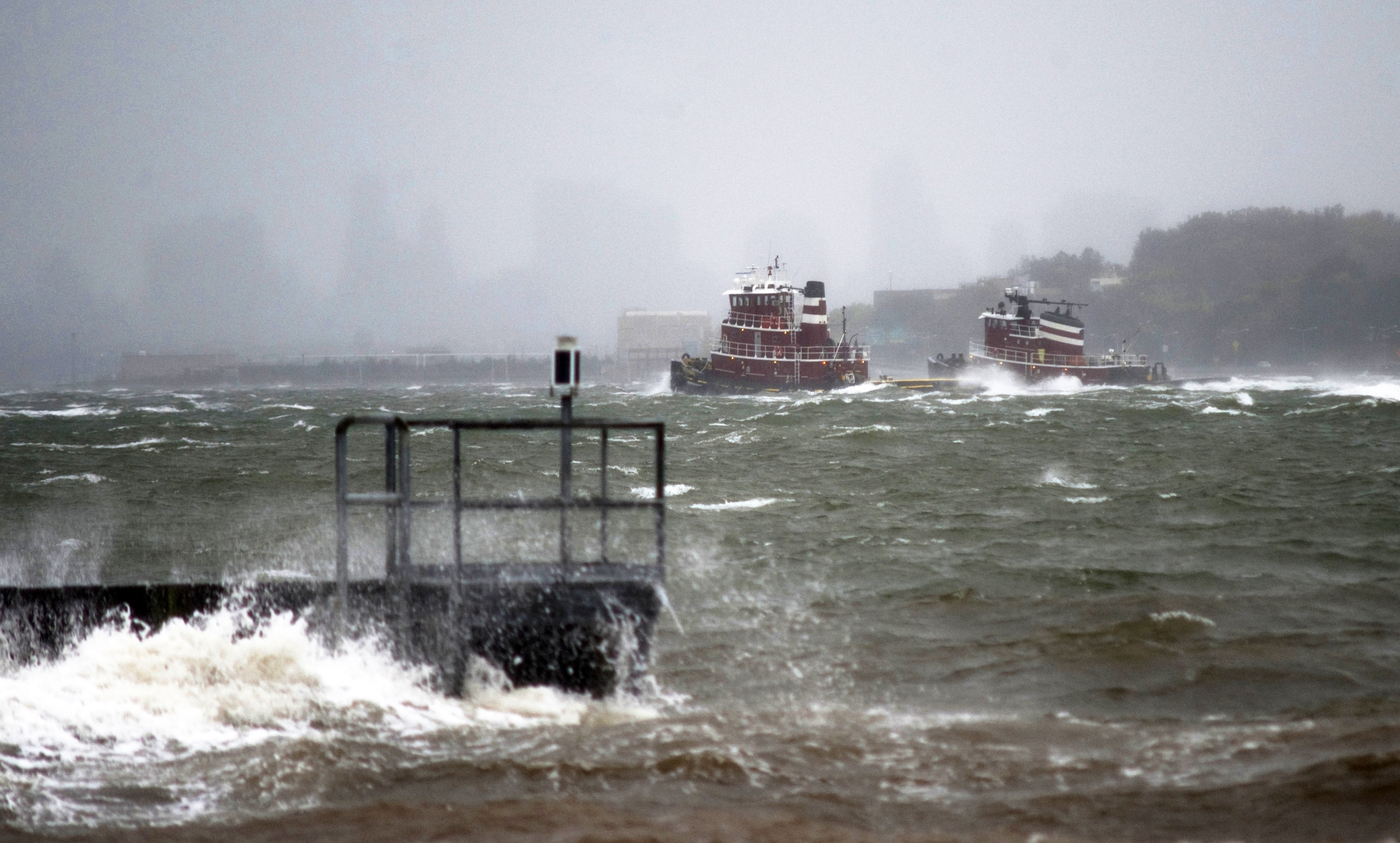
NEW YORK – Tug vessels steam into New York Harbor through heavy wind and rough waters as Hurricane Sandy approaches New York Harbor, Monday, Oct. 29, 2012. U.S. Coast Guard photo by Petty Officer 2nd Class Erik Swanson.
(Bloomberg) As midnight approaches America’s east coast Hurricane Sandy continues to lash the shoreline with wind, rain and snow. The system came ashore near Atlantic City, New Jersey, at 8 p.m. New York time, and by 9 p.m. the National Hurricane Center said it was receiving reports of hurricane-force wind gusts over Long Island and the New York metropolitan areas. Sandy is no longer a hurricane because it’s drawing energy from temperature differences and not the ocean, making the transition to a superstorm that may push a wall of water ashore in the Northeast.
As of 9 p.m. Eastern time, Sandy was 15 miles (24 kilometers) northwest of Atlantic City, moving west-northwest at 21 miles per hour with top sustained winds of 80 mph. It’s forecast to turn north by tomorrow and cross through Pennsylvania to reach New York on Oct. 31, the center said.
Rains are soaking the mid-Atlantic states, 3 feet (0.9 meters) of snow may fall in the Appalachians and a record- breaking storm surge may wash over Manhattan’s Battery Park.
Sandy’s winds had stretched to about 1,100 miles from end to end earlier today, according to the National Hurricane Center. It was the largest tropical system on record, forecasters said. A wind gust to 79 mph was reported at John F. Kennedy International Airport in New York, and another to 90 mph was reported at Islip, New York, the center said in the 9 p.m. Eastern time advisory.
Tides along the coast will be near their peak when the storm goes ashore, which may mean record amounts of water washing onto land, according to Jeff Masters, co-founder of Weather Underground in Ann Arbor, Michigan.
“These may be the highest storm tides ever recorded going back a century,” Masters said by telephone. “We’re looking, potentially, at a very expensive disaster for New York City.”
Sandy is so large that the storm will be felt along the East Coast from Maine to Virginia, Masters said.
“The timing certainly matters, but the location isn’t that important because some of the strongest winds are quite a ways removed from the center,” Masters said. “It’s a superstorm, it’s aptly named in terms of its size, its low central pressure, the weird angle it’s taking, the lateness of the season.”
By Brian K. Sullivan, Lynn Doan ©2012 BLOOMBERG
Unlock Exclusive Insights Today!
Join the gCaptain Club for curated content, insider opinions, and vibrant community discussions.

 Join The Club