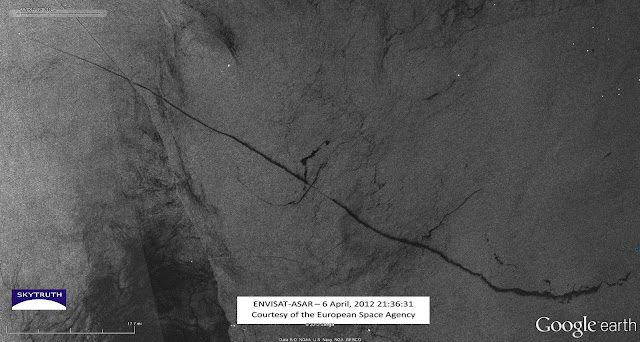
Radar satellite image showing a 92 mile long bilge-dump slick, taken on April 6, 2012. Envisat ASAR image courtesy European Space Agency.
On April 6th, satellite-image-monitoring-environmental group SkyTruth identified a 92-mile slick off Congo and Angola captured in the above photo that was likely the result of a discharge of oily bilge water from a ship. Now, after a thorough investigation worthy of it’s own CSI episode to find the perp, SkyTruth believes it has identified just who is responsible for the release of the oily bilge waste.
Here, SkyTruth tells us just how they cracked the case and scroll all the way down to find out ‘whodunnit’:
In the ASAR satellite radar image, we can determine the exact time and date of the event, the coordinates of the start and end point of the slick, the length of the slick, and the heading of the vessel:
SpaceQuest builds satellites that intercept Automatic Identification System (AIS) data broadcast by vessels at sea. SpaceQuest gave us AIS data for the region spanning a 24-hour period, enabling us to identify vessels that were operating in the area around the same time the radar image was taken. After doing some simple math, we had enough information to pinpoint the likely culprit.
Red dots show the positions of vessels recorded by AIS data. Red dot at upper left marks the position of the suspected perpetrator, 39 miles northwest of observed location of vessel.
AIS data for a vessel 39 miles northwest from the observed location of the ship gave a heading of 293.8° and a speed of 15 knots (17.3 mph). This AIS information was broadcast 2.25 hours after the radar image was taken. If the ship traveled for 2.25 hours at 17.3 mph, then the ship traveled 38.925 miles, very close to the measured distance between the observed location and the AIS position.
The heading of the ship was reported by AIS to be 293.8°, only 1.1° off from the measured heading of 294.9°. I also calculated where the vessel should be, had it been traveling for 2.25 hours at the AIS-recorded heading from the location observed on the satellite imagery. The ship would have ended up only 0.79 miles from the AIS-recorded location. No other vessels appear anywhere near this location on either the radar image, or the AIS data, making the Dona Liberta a likely culprit for this bilge dumping.
Difference between AIS-recorded position of vessel and calculated position based on observed location and AIS-recorded heading and speed.
But a ‘good idea’ of who dumped this material really isn’t good enough. After checking back with SpaceQuest on our findings, they supplemented our data with a compilation of the perp’s AIS data for the previous 24 hours. From that, we were able to determine more about the trajectory of this vessel:
Possible route of the suspected vessel (green line) drawn by simply connecting the red dots (AIS recorded positions). The slick may have drifted southward under the influence of currents and surface wind.
The observed location of the vessel in the radar satellite image was bracketed by two AIS data points, so there was more information available to cross reference with our current suspect. By comparing the time of each AIS point, with the time of the ASAR image, as well as the distance between them, the rate of travel was confirmed:
The distance between the eastern AIS position to the observed location (yellow line) is 16.9 miles, and the vessel’s speed according to AIS was 15.1knots (17.377 mph), giving a travel time of 58.4 minutes. The actual time difference between the radar image and the AIS broadcast is 54 minutes. On the other side, the distance between the western AIS point and the observed location (pink line) is 9.66 miles, with the vessel speed at 15.2 knots (17.49 mph), implying a travel time of 33.1 minutes compared with the actual time difference of 36 minutes. These measurements are not exact but are very close, with no other vessels in the vicinity that could be confused with the suspected vessel.
After this thorough investigation, SkyTruth has revealed the perpetrator as…. the Dona Liberta, a refrigerated cargo ship owned by NaviFruit LTD.
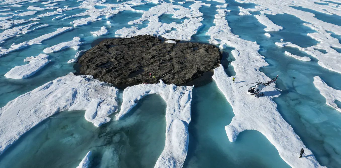
by Kevin Hamilton (University of Hawaii) In 2021, an expedition off the icy northern Greenland coast spotted what appeared to be a previously uncharted island. It was small and gravelly,...
Editor’s Note: This article was originally published by gCaptain in 2016 and is being republished now because it’s lessons are timeless and possibly more relevant in 2022 as today’s ships...
by Salvatore R. Mercogliano, Ph.D. (gCaptain) This Veteran’s Day we remember the thousands of Soldiers, Sailors, Marines, Airmen, and Coast Guardsmen who gave their lives in defense of the United States...
November 11, 2022
Total Views: 1533
Why Join the gCaptain Club?
Access exclusive insights, engage in vibrant discussions, and gain perspectives from our CEO.
This website uses cookies to improve your experience while you navigate through the website. Out of these, the cookies that are categorized as necessary are stored on your browser as they are essential for the working of basic functionalities of the website. We also use third-party cookies that help us analyze and understand how you use this website. These cookies will be stored in your browser only with your consent. You also have the option to opt-out of these cookies. But opting out of some of these cookies may affect your browsing experience.
Necessary cookies are absolutely essential for the website to function properly. This category only includes cookies that ensures basic functionalities and security features of the website. These cookies do not store any personal information.
Any cookies that may not be particularly necessary for the website to function and is used specifically to collect user personal data via analytics, ads, other embedded contents are termed as non-necessary cookies. It is mandatory to procure user consent prior to running these cookies on your website.

 Join The Club